Good morning. Houston’s wet pattern will continue through the work week, although the most organized heavy rainfall should wind down over the course of this morning after a storm system pushes through the area. Please take care if you have cause to be out and about this morning before conditions should improve later today.
Wednesday
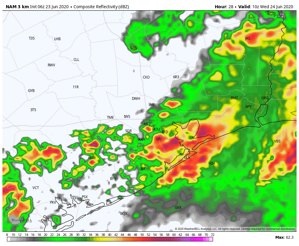
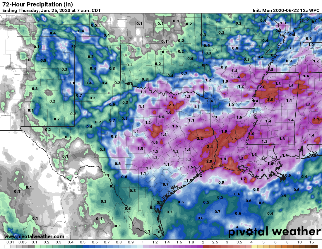
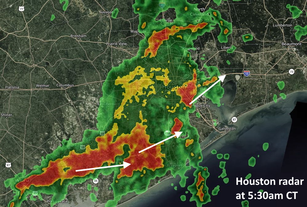
Moisture continues to move in from the Gulf, combining with an upper-level storm system to bring heavy rains to the metro area on Wednesday morning. The heaviest rains are generally to the south of the city now, and this mess should slowly begin to slide generally eastward, exiting the area entirely by 9 a.m. or 10 a.m. In the meantime, these storms should put a manageable 1 to 3 inches of rain down for most of the metro area—with the heaviest rains coming and lingering near the coast.
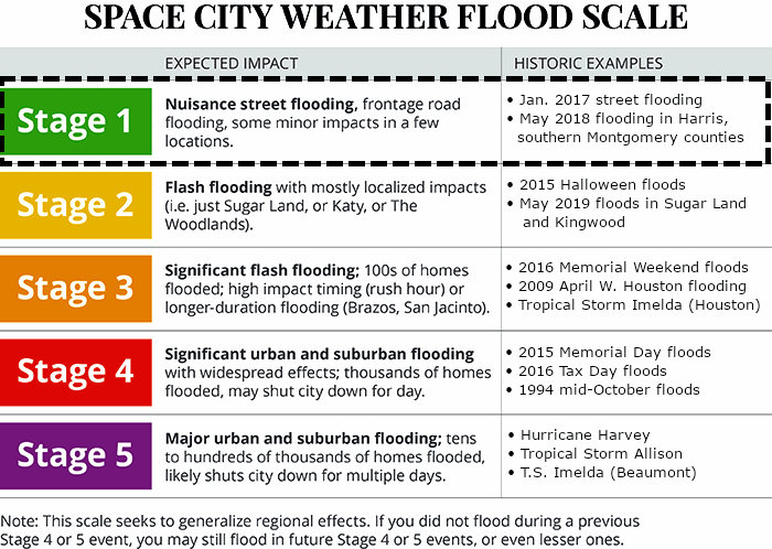
Although this will end our Stage 1 flood event, the rain won’t be over. Even as the storm system rotates away from Houston, additional moisture will be pulled inland and more showers will likely develop this afternoon. We’re not sure about this, because the atmosphere should be somewhat stabilized after this morning. In any case, storms this afternoon should be less organized. Highs today will likely only reach the mid-80s with cloud cover and rain.
Thursday
Healthy rain chances continue on Thursday, with a higher likelihood of moderate-to-heavy rain along the coast where moisture levels should be highest. Accumulations should be less than on Wednesday, however. Temperatures should remain in the upper 80s for most with cloudy skies.