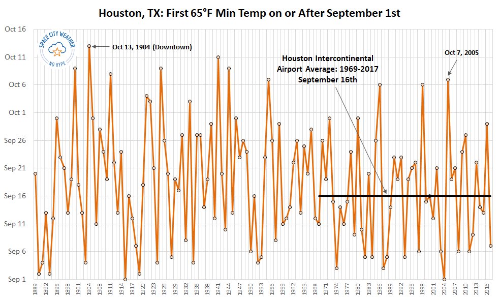
Weather-wise, this past September was pretty terrible. There were the floods of Tropical Storm Imelda, which were especially terrible north and east of the Houston metro area. Then there was the heat: Highs were 98 degrees, or above, for the first eight days above, and overall this was by far Houston’s warmest September on record. Finally, the region saw no cool fronts to bring down overnight temperatures, so it remained hot and muggy throughout the month.
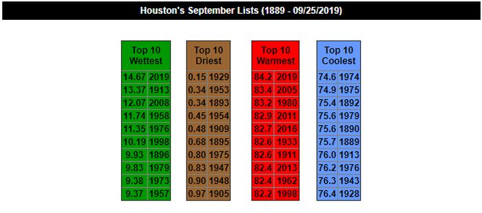
Although this region has had worse extreme weather during past Septembers—such as the landfalls of the Great Storm of 1900 and Hurricane Ike in 2008—I would argue that end-to-end this has been the worst overall September weather in Houston. Good riddance. Fortunately, October promises to be better with a cool front likely in about one week’s time.
Tuesday and Wednesday
The heat continues. With Houston falling under the influence of high pressure the region will continue to see hot and mostly sunny days and warm, humid nights. Expect high temperatures on Tuesday and Wednesday to reach 90 degrees, or warmer, for inland areas. Nights will be extra sticky, with lows for much of the region only falling into the upper 70s. Rain chances remain near zero, except possibly for a few isolated areas near Matagorda Bay.