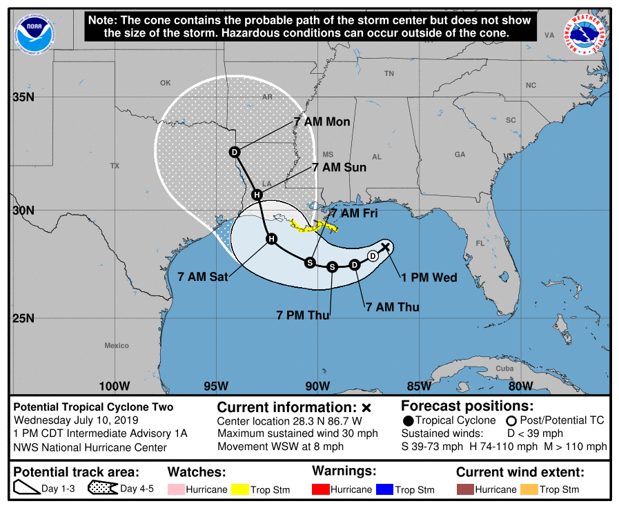
Good morning. As of 4am CT, the system in the Gulf of Mexico has nearly organized into a tropical depression (named Barry), and likely will become one later this morning or early this afternoon. While Texas isn’t entirely out of the woods, as there remains some uncertainty in the track and intensity forecast, this increasingly looks like a threatening situation for Louisiana. Because the state is next to Texas, and we have received so many questions from people living in, or traveling through Louisiana, we will continue to offer comprehensive coverage of Barry as the storm develops. If you’re living in Houston, please continue to pay attention to forecasts for the next couple of days, as tropical weather invariably offers up surprises. However, it’s probably safe to go about your business as usual this weekend.
Track
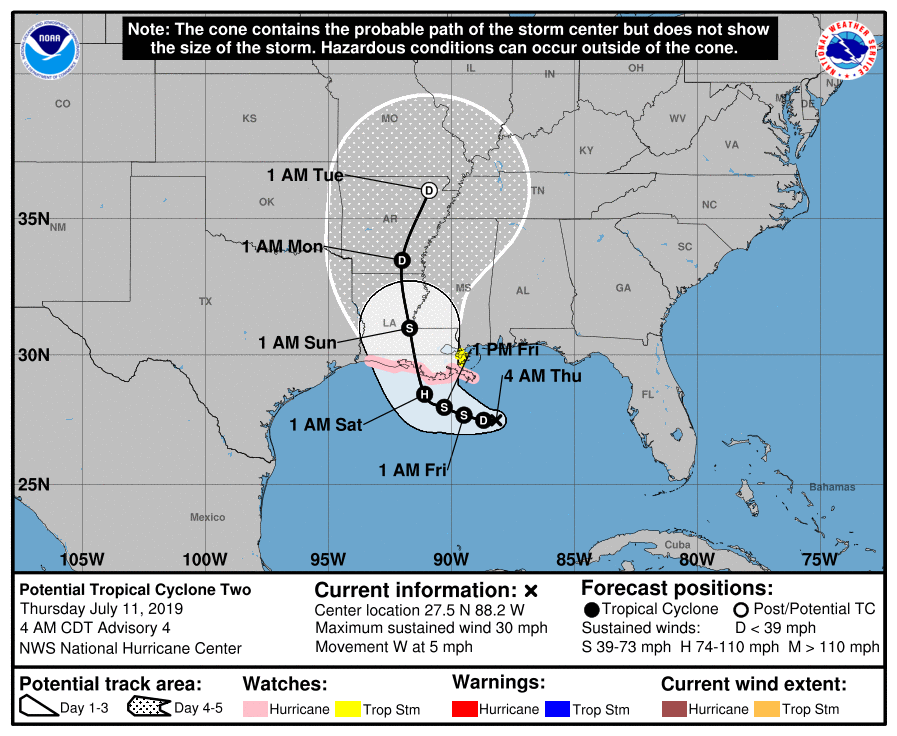
Confidence is increasing in the forecast track for a couple of reasons. First of all, we’re now likely only about 2.5 days away from landfall (likely along the Louisiana coast between Lake Charles and New Orleans), and errors for such a storm are typically less than 100 miles, even given the uncertainty with Barry. Secondly, although Barry has not yet formed a distinct center of circulation, there is nonetheless a decent clustering of ensemble members of the global models around such a solution. So a Louisiana landfall is likely for Barry, but not a certainty.
Intensity
Because Barry has not yet organized into a tropical storm, and perhaps only has a couple of days remaining sufficiently offshore, this should help to set a limit on its intensity. The official forecast still brings Barry to minimal Category 1 hurricane status prior to landfall, but confidence isn’t particularly high.