We’re almost there, Houston. Just one more round of showers and heavy rain today, and then we can put the several five days of intermittent heavy rainfall and storms behind us. Fortunately, in comparison to our recent weather, today’s storms do not look too serious beyond their potential to disrupt outdoor activities—and I know there are plenty planned as we’ve been asked about weddings, baseball games, camp-outs and more.
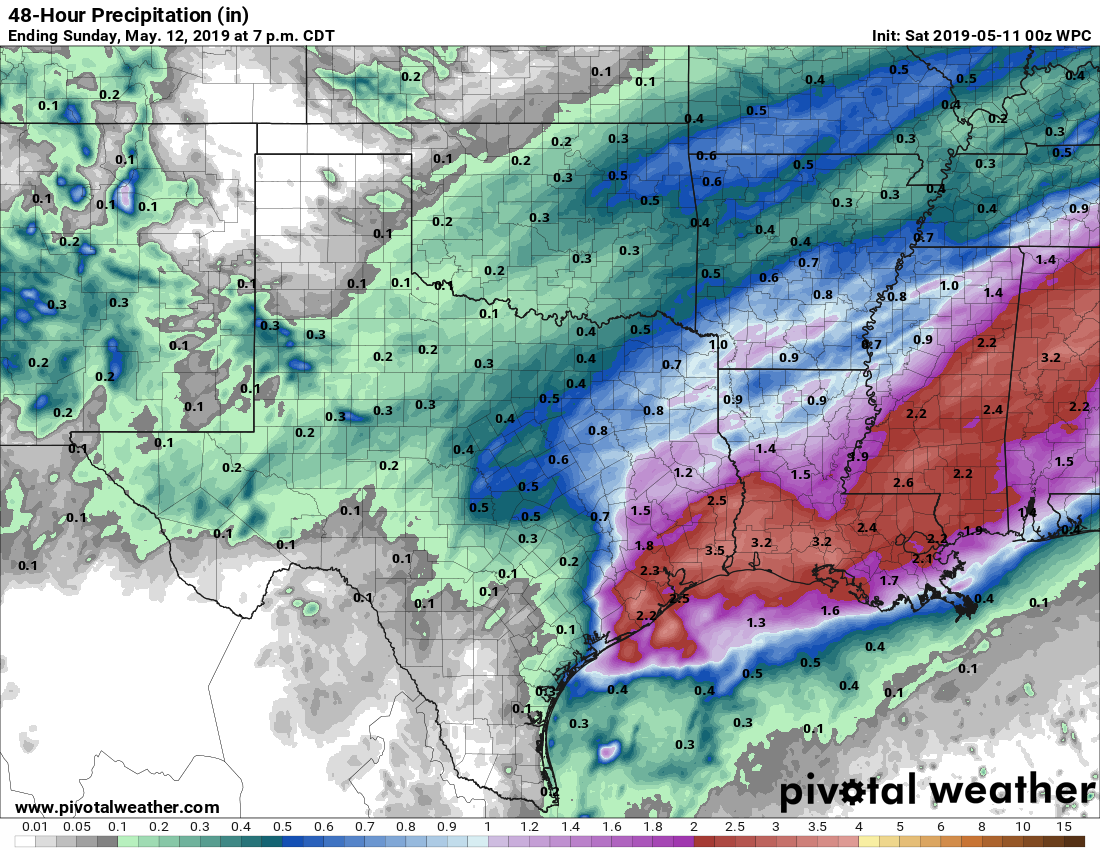
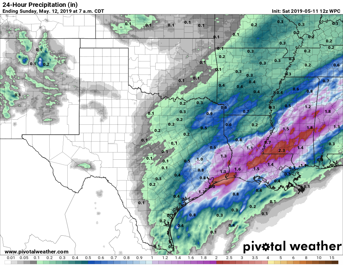
Showers and thunderstorms today will be driven by a disturbance moving up the Texas coast, combined with an extremely moist atmosphere. The best chance for storms today will occur south and east of I-69, near the coast. (Under some scenarios, the heaviest rainfall occurs near Galveston Bay, and under others, it occurs offshore). Generally, I think inland areas—those on the north and west side of I-69 will probably see about 1 inch of rain or less today, while people closer to the coast will see 1-2 inches. Isolated amounts of 3 inches or higher are, unfortunately, possible. The good news is that rainfall rates appear to be more restrained today, so we don’t anticipate any of the crazy 3+ inches per hour we saw over the last four days, which rapidly flooded streets.
Storms will likely develop between 10am and noon across Houston, with a general west to east motion that pushes them out of the metro area between 3pm and 7pm. Good riddance!
After this mess moves out, we should see clearing skies tonight, with rather pleasant weather for Sunday and Monday, with highs in the low 80s and overnight lows in the 60s. It will almost be nice enough for you to forget that June is only a couple of weeks away.