Skies are partly clear across the region this morning, but clouds will increase throughout the day, and I’m afraid we’re looking at mostly cloudy skies for the remainder of the week. We’ll also see healthy rain chances through Friday or Saturday—which means less-than-ideal conditions for the upcoming Houston Rodeo Cook Off, and part of the opening weekend for Mardi Gras in Galveston. We’ll dive into this in greater detail below.
Monday
With Sunday’s cold front well offshore, we’ll see a breezy, cool day today, with highs in the upper 50s and lower 60s. This is probably also the last day with near-zero rain chances until Sunday as conditions turn wetter. Temperatures tonight will drop to around 50 degrees—cooler inland and warmer near the coast. The wetter pattern should begin as soon as this evening, as light rain showers migrate inland.
Tuesday
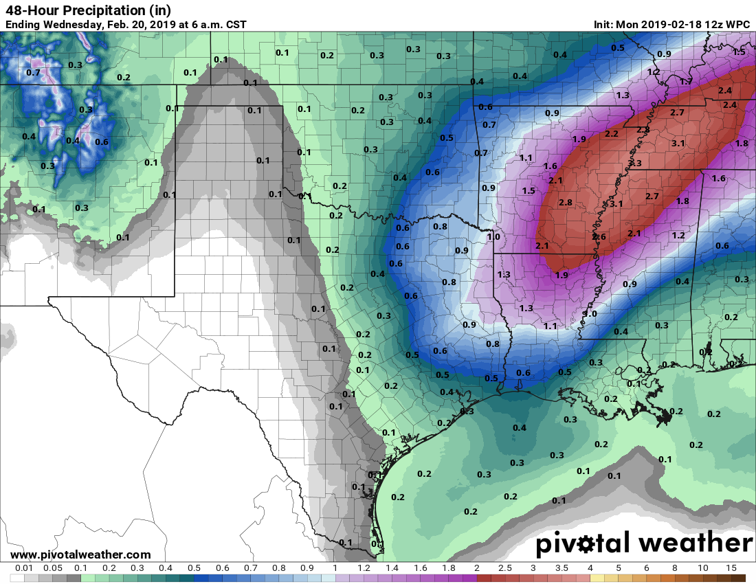
Broadly speaking, our pattern for much of this week will be one of a thin layer of colder air at the surface, and a warmer, moist current of air from the southwest higher up in the atmosphere. Tuesday looks especially wet, with a saturated atmosphere and near 100 percent rain chances. The heavier rain should remain largely to the northeast of Houston, with the metro area generally seeing about one-half inch of rain. All told, this will be a cold (mid-50s), damp day.