Good morning. We’ll remain in a wet, gray pattern for the next couple of days before drier air and lovely weather arrive in time for the weekend. In fact, the weather for the upcoming Friday through Sunday period should make for the region’s nicest weekend since about April. We’ll also take an early look at the Halloween forecast.
Tuesday
Light to moderate showers are moving from west to east across the Houston area this morning, and high resolution models suggest this precipitation should come to an end around noon, or a few hours later. Accumulations should be modest, under 1 inch for most. Skies will remain cloudy after the rains end, and highs for the most part should stay in the 60s today—so cool and gray. Rain chances will be lower tonight, but not zero, with little overnight cooling due to thick cloud cover.
Wednesday
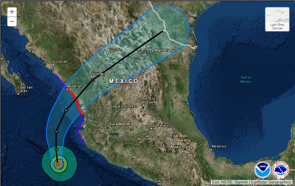
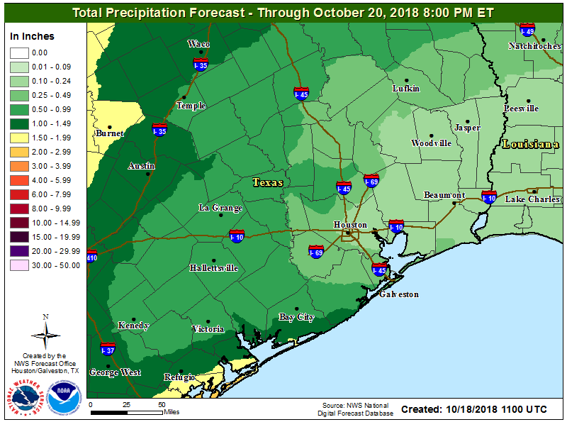
Texas will see some moisture from the remnants of Hurricane Willa on Wednesday, but nothing to be particularly concerned about. A few thunderstorms are possible, but for the most part we expect the region to just see 1 to 2 inches of rainfall from Wednesday morning through Thursday morning. Slightly higher amounts are possible along the coast.
This shouldn’t be enough rain to cause problems for the Houston metro area, but central Texas certainly doesn’t need the additional rainfall. The City of Austin had to issue a boil water notice for residents on Monday due to problems with flooding at its water treatment facilities.