We’re going to have one day, and especially night, of widespread rainfall before the region gets a break from the precipitation. In fact, after early Thursday morning, it would not surprise me to see the region go an entire week without rainfall. So if you’ve been waiting for the region to really dry out, that time now appears to be at hand.
Wednesday
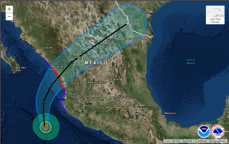
There are a few light showers about this morning, but it looks like the deeper moisture from the remnants of Hurricane Willa won’t push into Houston until later today, or during the overnight hours. Before early afternoon today, we’re likely to see mostly cloudy skies, with scattered light to moderate rain showers, and highs in the upper 60s. Winds will also be breezy, out of the northeast, with gusts up to 20mph.

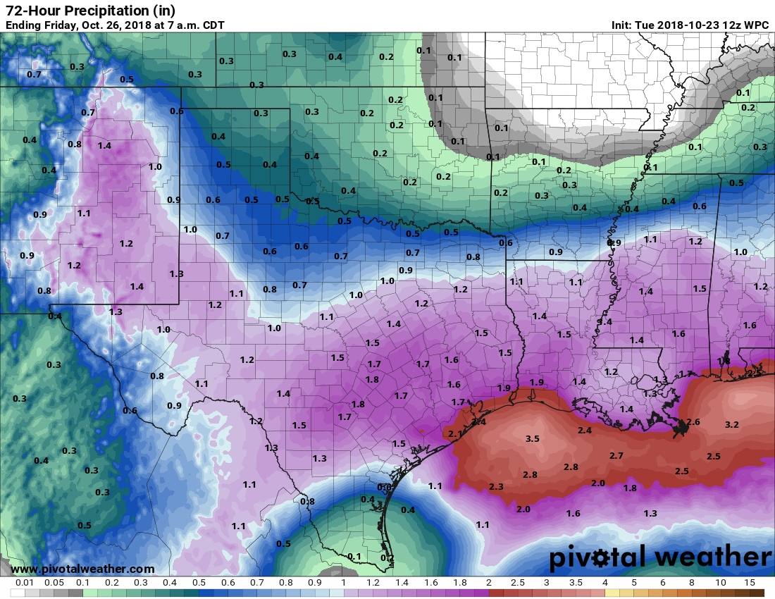
The real action will likely begin this afternoon to our west, or after sunset for eastern Houston. As we’ve been suggesting for a few days now, we don’t expect anything too extreme. Most of the region will likely see 0.5 to 2.0 inches of rain. Some thunderstorms are possible closer to the coast, but most areas will just see rain. Although soils are pretty wet already, these kinds of rainfall amounts should be manageable, and right now we wouldn’t expect anything more than some isolated, brief street flooding—if that.