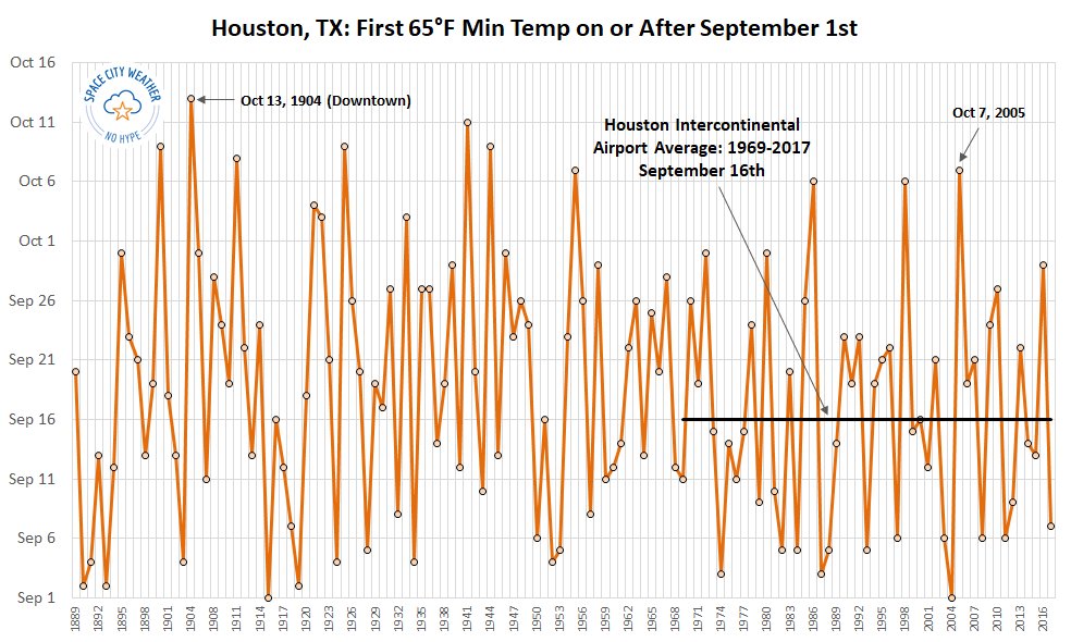
The temperature at Bush Intercontinental Airport fell to 64 degrees this morning, which semi-officially means that “fall” has arrived in Houston. According to our records, this is the second-latest date on which a 65-degree or cooler night has come to Houston in the months of September or October. The only later date came back in 1904, on October 13th.
The first day of “fall” in Houston. (Brian Brettschneider for Space City Weather)
Despite the long wait, we can now look ahead to very fine weather in the coming days, so let’s get right to it.
Thursday and Friday
Hello, fall. We’ll have two sunny days, with high temperatures around 80 degrees. Thursday night into Friday morning should actually be a couple of degrees cooler than this morning, but Friday night will be a smidge warmer as we begin to feel the rumblings of the onshore flow.
It is difficult to take too much pleasure out of Houston’s weather for today, and the foreseeable future—and it will be sublime after our long, muggy summer—with an intensifying hurricane bearing down on the Florida Panhandle. Unfortunately, Michael strengthened overnight into a 145-mph, Category 4 hurricane overnight. Moreover, its central pressure continues to fall this morning, indicating further strengthening is possible before a landfall later today near Panama City.
Zoomed in forecast track map for Hurricane Michael. (National Hurricane Center)
This is the most devastating storm that northwestern Florida has ever seen. Wind damage will be extensive, with even inland areas such as Tallahassee likely seeing sustained hurricane-force winds, and storm surge to the right of Michael’s landfall will be highly significant. Please heed all warnings from the National Hurricane Center.
We’ve talked about the late start to autumn this year in Houston, and we’re going to come very close to the latest start of fall on record. As a quick reminder, we’re defining “fall” as the first temperature of 65 degrees, or below, on or after Sept. 1. If we look at the data for the city, which goes all the way back to 1889, we can see how late we are this year in reaching this temperature, which denotes the arrival of the first decently strong “fall” front.
The first day of “fall” in Houston. (Brian Brettschneider for Space City Weather)
Today is October 9. Note that since the official weather monitoring station was moved to Bush Intercontinental Airport in 1969, the average date of “fall” was September 16th, and this trend line has been flat. The latest beginning of “fall” for this site came in 2005, on Oct. 7. We passed that a couple of days ago. The latest ever start to fall dates all the way back to 1904, when the downtown weather station didn’t measure a 65-degree night, or cooler, until Oct. 13. We’ll come close to that this year. But will be break it? Probably not.
Tuesday
We’re going to have one more sloppy humid day before some drier air arrives. Mostly cloudy skies should keep temperatures in the upper 80s, with some scattered showers and thunderstorms like the region saw Monday. While some of these storms could produce briefly heavy rain, we don’t expect them to persist for too long.
We’ve also seen might higher water levels along the coast during the last day or so; this is due to stronger lunar tides, persistent southerly winds, and waves from the distant Hurricane Michael. The effects of this should ease by Wednesday morning, with the passage of a cool front and wind shift. A coastal flood advisory remains in effect until that time.
It has been a torrid start to October, with six consecutive 90-degree days in Houston. We’ll remain in this steamy, hot, and humid pattern for only a few more days before fall’s first moderately cooler and significantly drier weather finally arrives later on Wednesday, in the wake of a front. Houston’s temperature last fell below 65 degrees on May 15th, nearly five months ago. This has been a long summer, y’all. But now it’s almost time for fall.
Monday
With lows in the mid- to upper-70s it’s incredibly warm across the region for October, and with partly sunny skies we should see high temperatures near or at 90 degrees today. Some scattered showers and thunderstorms are possible, but we shouldn’t see anything too widespread due to the lack of forcing.
Tuesday
Moisture levels will be higher than Monday, and as a result we expect that probably about half the region will see rain on Tuesday. Accumulations should be less than 0.5 to 0.75 inch for the most part in what will otherwise be a hot and steamy day, with high temperatures in the vicinity of 90 degrees. Increasing clouds could keep most western areas in the mid- to upper-80s.
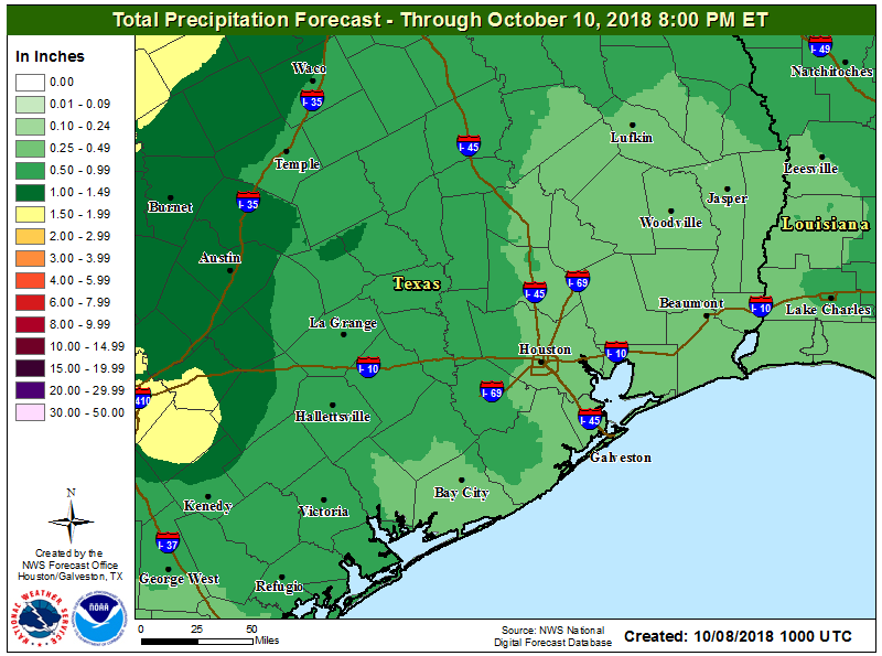
Rain accumulations for now through Wednesday should be greatest for the western half of Houston. (National Weather Service)
Wednesday
The first real front of fall won’t be that strong, but it will bring some drier air and overall relief to the area. This day will still be warmer, with drying air allowing temperatures to push into the upper 80s. But lows Wednesday evening should fall into the 60s for most of the region, except for immediately along the coast, and the drier air will feel immeasurably better as the sun goes down.