In brief: In today’s post we have a lot going on: A little World Cup talk, an official forecast for the Fourth of July holiday, and shockingly some fairly healthy rain chances for today.
America turning 250 years old
Good morning to everyone except Raphael Claus, the Brazilian soccer referee who issued a red card to US starting striker Folarin Balogun on Thursday night. If you’re like me, you’ve been enjoying the World Cup games this year, which have been spread across North American venues, including Houston.
Last night the environment at Pitch 25 near downtown was electric for the US match against Bosnia and Herzegovina. Balogun scored a goal, but then received a questionable red card from Claus and was ejected from the game. The Americans held on, despite being down one player. Exciting!
Anyway, the US men’s team has advanced to the round of 16, playing against Belgium on Monday evening at 7 pm CT. It has been enjoyable to be swept up by the sport, and wonderful to have so many foreign visitors for the games in Houston. We have one final match on Saturday, between Canada and Morocco at Noon.
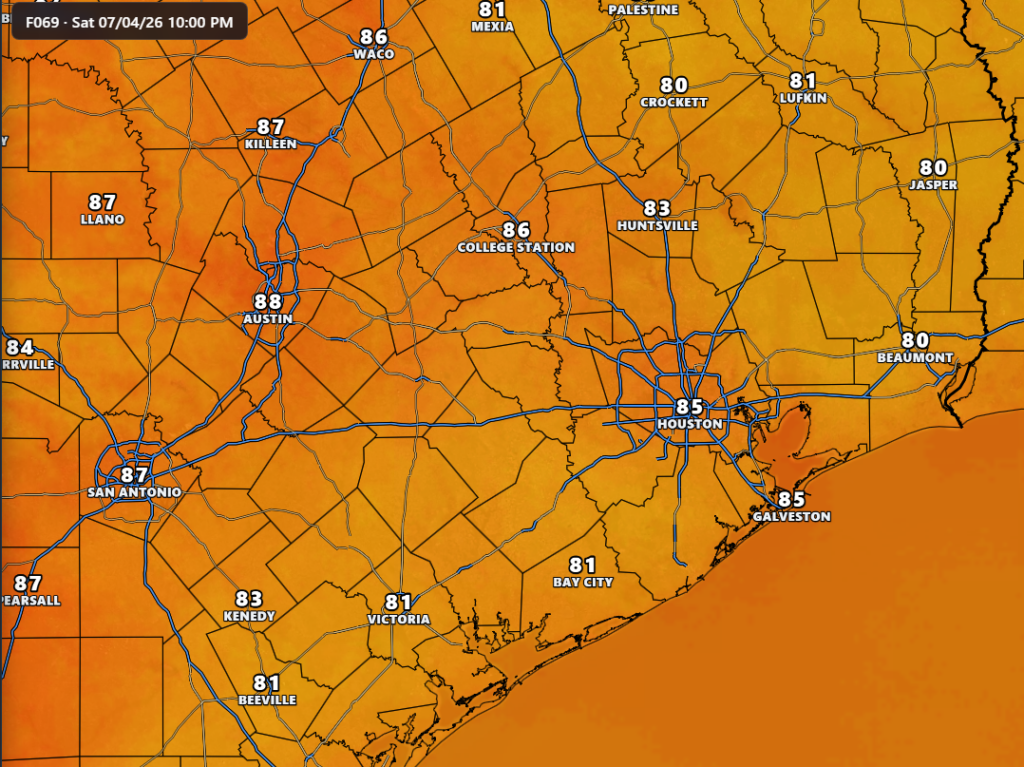
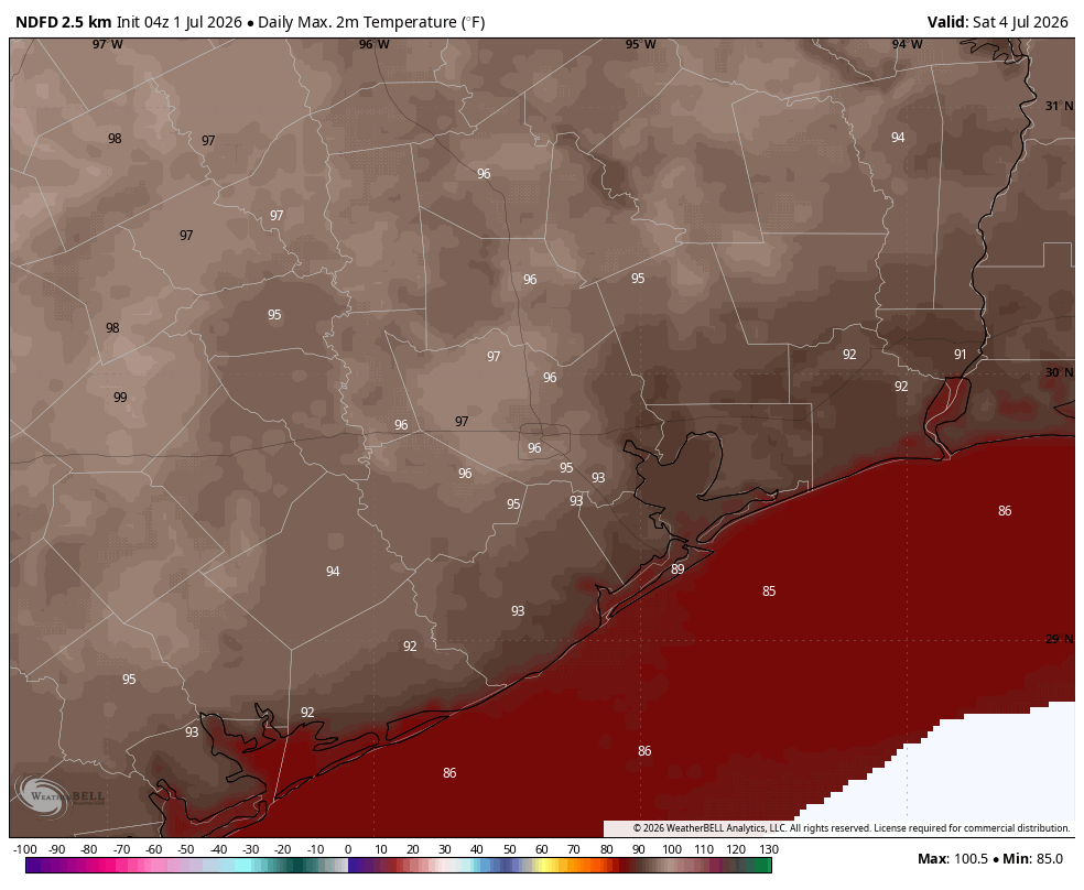
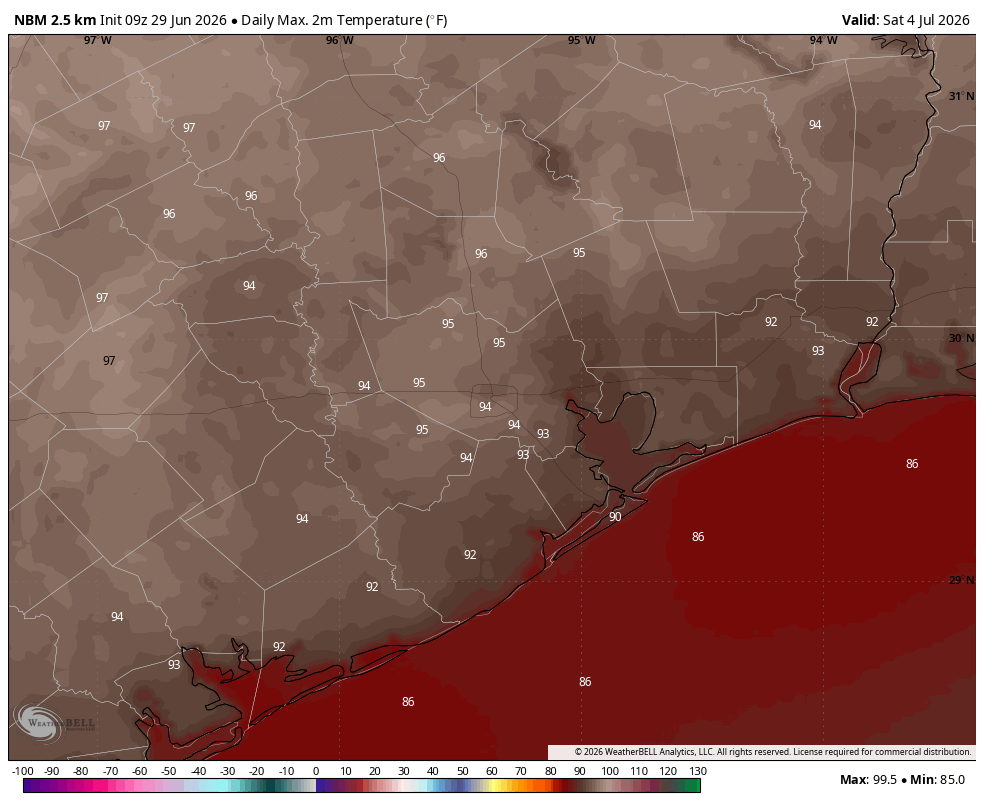
The World Cup comes amid the 250th anniversary of the adoption of the Declaration of Independence. We will celebrate this founding document, which asserts our right to self-governance, and more broadly represents freedom and democracy, on Saturday. Our confidence in the weather forecast for the Fourth of July is high: We are going to see a sunny and hot day, with high temperatures ranging from the mid- to upper-90s across the region, except for the immediate coast. The air will be humid. And conditions optimal for fireworks—as long as you’re willing to sweat a little.
Also be sure to check out a few words from our sponsor, Reliant, at the end of today’s post. As our temperature soars upward for the next couple of months they recognize that energy affordability is a serious issue for many of us. They have some tips to help control electricity costs. Reliant has not been with us since the founding of Space City Weather in October 2015, but they came on board soon after. If we had been founded in 1776 like the United States, it would be like Reliant came aboard in 1810. So they’ve been with us for a long time, helping to keep the lights on here, and we appreciate that.
Thursday
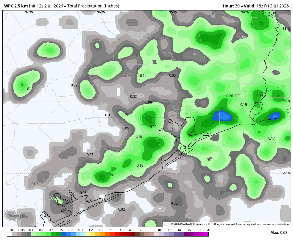
Alright, before we get to sultry and sunny conditions this weekend, we do have a decent chance of some showers and thunderstorms today. Do not set your expectations overly high, but I do think about 40 or 50 percent of the region will see some showers later today with peak heating. Rainfall amounts will vary widely, with some areas seeing a smattering of rain while a few locations may pick up as much as an inch. Some showers may briefly pulse up into thunderstorms. This is our best chance of rain in more than 10 days. Highs likely will reach the low- to mid-90s, depending on local rainfall conditions this afternoon. Winds will generally be light. Lows tonight will drop into the upper 70s.
Friday, Saturday, and Sunday
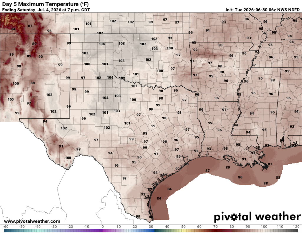
The holiday weekend will bring lots of sunshine into the Houston area, and likely our hottest weather of the year so far. Expect highs in the mid-90s on Friday, likely peaking in the upper 90s on Saturday, and getting close to that on Sunday. Rain chances will be about 10 percent on Friday and Saturday, but may bump up slightly to 20 percent by Sunday. The air will be fairly humid, as is usual for early July. Please remember sunscreen for daytime activities, and you’ll probably want some bug spray for fireworks in all but the most urban of settings.
Next week
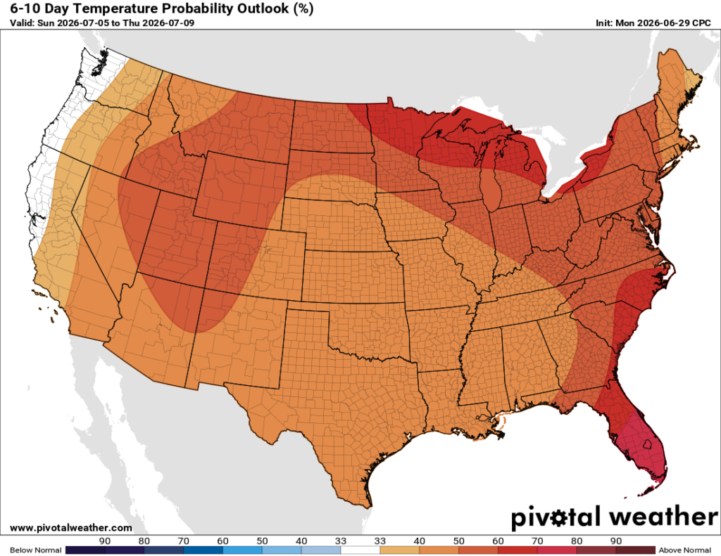
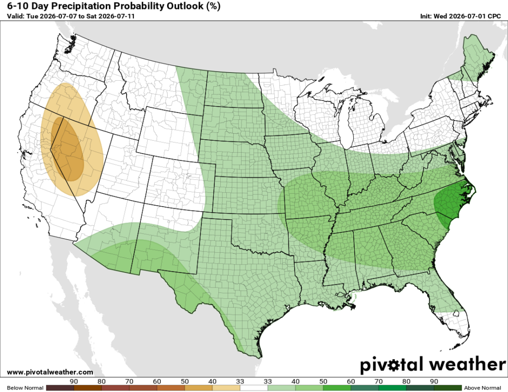
There’s a couple of different paths our weather could go down next week, and I don’t have the highest of confidence about what will happen yet. My best guess is that we’ll see a few more clouds, some better rain chances, and perhaps a slight moderation in temperatures. But there remains the possibility of ongoing sunny, and largely rain-free days. Not helpful, I realize.
A message from our partner, Reliant
Whether Texans are firing up the grill at home or hitting the road for a holiday escape, the long July 4th weekend presents plenty of opportunities to use energy more efficiently. Reliant is sharing simple tips for anyone to save money and cut back on energy use while still staying cool and enjoying the holiday.
Traveling for the holiday weekend:
- Follow the “four-by-four” principle instead of turning off your HVAC system completely. Set your thermostat four degrees higher when you’re away from home for more than four hours to reduce electricity usage while staying efficient upon your return home.
- Leverage smart thermostats and smart home devices, whichare powerful tools to manage energy usage while away. You can adjust settings remotely, as well as pre-cool the house before you return.
- Close blinds and shades to prevent heat buildup and get the most out of the cool air coming from the AC.
- Turn off or remove anything plugged into an outlet that doesn’t need to run while you’re away, like chargers and electronics with lighted displays. Even small appliances draw power in standby mode, which can add up over time.
- Reduce your water heater temperature. For shorter trips, keeping your water heater’s temperature at or above 120-140°F helps prevent bacterial growth while maintaining efficiency.
Enjoying the long weekend from home:
- Grill outdoors. Cooking indoors raises the heat, requiring the AC to use more electricity.
- Use heat-producing appliances like the dryer, dishwasher, or oven after sundown instead of during the hottest times of day.
- Avoid running your pool pump all day by using an automatic timer.
- Set your ceiling fan to rotate counterclockwise to create a wind chill effect. Also turn off fans when you leave the room.
More money-saving tips from Reliant can be found here.