Just wanted to provide an update on conditions for Tuesday, especially because it now appears as though any freezing precipitation may move into the city a little earlier than expected. I know there are a lot of people and organizations out there looking to make decisions, so as of about 12:30pm CT on Monday, here’s what we know: A cold front is still on track to move through Houston between midnight and sunrise on Tuesday. The key questions are how cold it will get, how soon, and the timing of the precipitation. Here’s a look at what may happen at certain times.
Midnight-6am Tuesday
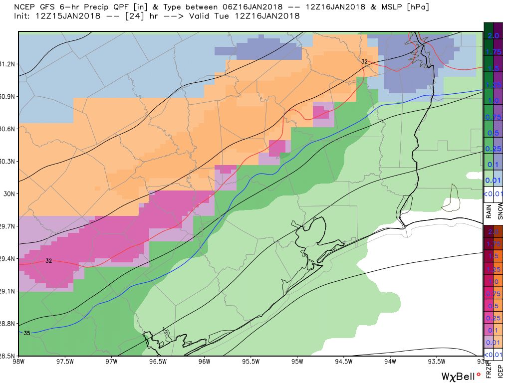
In the map below we see a mix of sleet and freezing rainfall moving from the northwest into the Houston metro area. This forecast from the GFS model shows accumulations for the 6-hour period from midnight to 6am, and they are slight. However when it comes to freezing rain (shown in pink) it doesn’t take much to cause problems on roadways, especially bridges and roadways.
GFS model forecast for midnight-6am accumulations. (Weather Bell)
After a clear and cold weekend, our concerns once again turn to the possibility of a winter storm in Houston—the third time we’ve worried about this kind of thing during the winter of 2017-2018. Fortunately, I’m also pretty confident this is the last time we’ll have to worry about this for this winter.
MLK Day
Fortunately, the inclement weather will hold off for today, allowing for pretty nice conditions across the region for the celebration of MLK Day. We can expect to see high temperatures in the low 60s, with partly sunny skies. Some scattered showers are possible later this afternoon and evening, as temperatures fall to around 50 degrees.
Tuesday
Everything changes on Tuesday as a strong cold front blows into Houston between midnight Monday, and sunrise on Tuesday. Light rain should follow behind this front. We’re not concerned about accumulations, with only a tenth or two of an inch of precipitation for most areas. But we are definitely concerned about the potential for rain turning into a wintry mix north and west of Houston on Tuesday morning (i.e. in the Brazos Valley and the Piney Woods regions), and moving southward into the Houston area later on Tuesday.
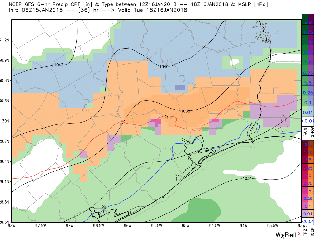
GFS model for precipitation from 6am to noon Tuesday. Rain for southern half of Houston, with mostly sleet (ice pellets) to the north. (Weather Bell)
Expect temperatures to fall throughout the day on Tuesday as very cold air advects into the region behind the front. For Houston, we’re primarily concerned about precipitation that lingers into the afternoon and evening on Tuesday, when temperatures fall below freezing. Although the precipitation (rain, sleet, snow?) will be light, you’re going to want to check the weather and road conditions before venturing out on Tuesday evening or Wednesday morning. Overall I’m not too concerned as something like light sleet shouldn’t cause major problems. But we’re nonetheless watching this closely because of its trouble-making potential, and we’ll keep you updated. A winter weather advisory is in effect from 3am Tuesday until 6am Wednesday for the entire metro area.
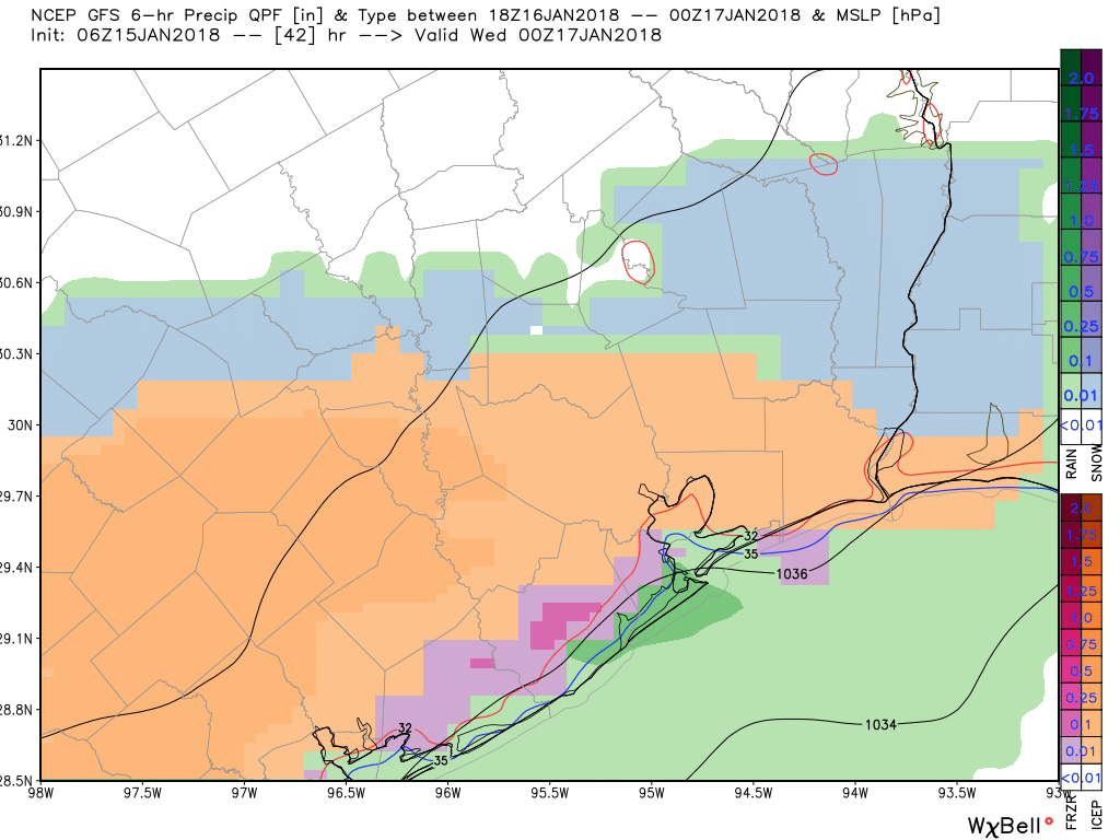
GFS model for precipitation from noon to 6pm Tuesday shows sleet over most of Houston, with snow up north. (Weather Bell)
The other big story for Tuesday night is low temperatures. Right now I expect we’ll see low 20s for inland areas, mid-20s for central parts of the Houston area, and upper-20s for the coast. Obviously you should take similar precautions as to what you did for the cold snap right at the beginning of the new year.
Last night at about 10:30pm, as the winds roared outside and you could just feel the cold moving in to Houston, my wife turned to me and said, “I’m so tired of winter. When is it going to warm up?” I’ll have some more words on this later in the post, but the short answer is that the second half of this month does appear likely to be noticeably warmer than our cold start to 2018.
Friday
Cold air will continue to blow into Houston today, but the winds won’t be quite so fierce as they were Thursday evening. Intercontinental Airport reported gusts of 38mph, with Galveston reaching 41mph, and College Station recording a gust of 45mph. Today wind gusts should remain in the 20s. Even so, it will be cold, with high temperatures struggling to reach 50 degrees under sunny skies. Lows tonight will be at or just above freezing in Houston, with a light freeze north of the city.
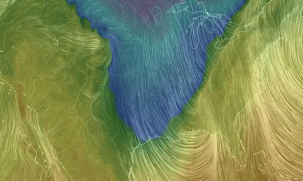
We we talk about cold air advection, this is what we mean. Notice the winds drawing cold, Canadian air all the way down across the United States and into Texas. (earth.nullschool.net)
Saturday and Sunday
After the winds finally die down later on Friday, we’re going to be left with just cold, sunny weather. High temperatures on both Saturday and Sunday will only reach about 50 degrees, and Saturday night should see a freeze over the northern half of the region, with temperatures in the mid-20s over some places like Montgomery County.
It’s quite warm this morning across Houston, with low temperatures only falling into the mid-60s for most of the area. But don’t let that fool you—a strong cold front will blow through the area today and change our weather through the weekend.
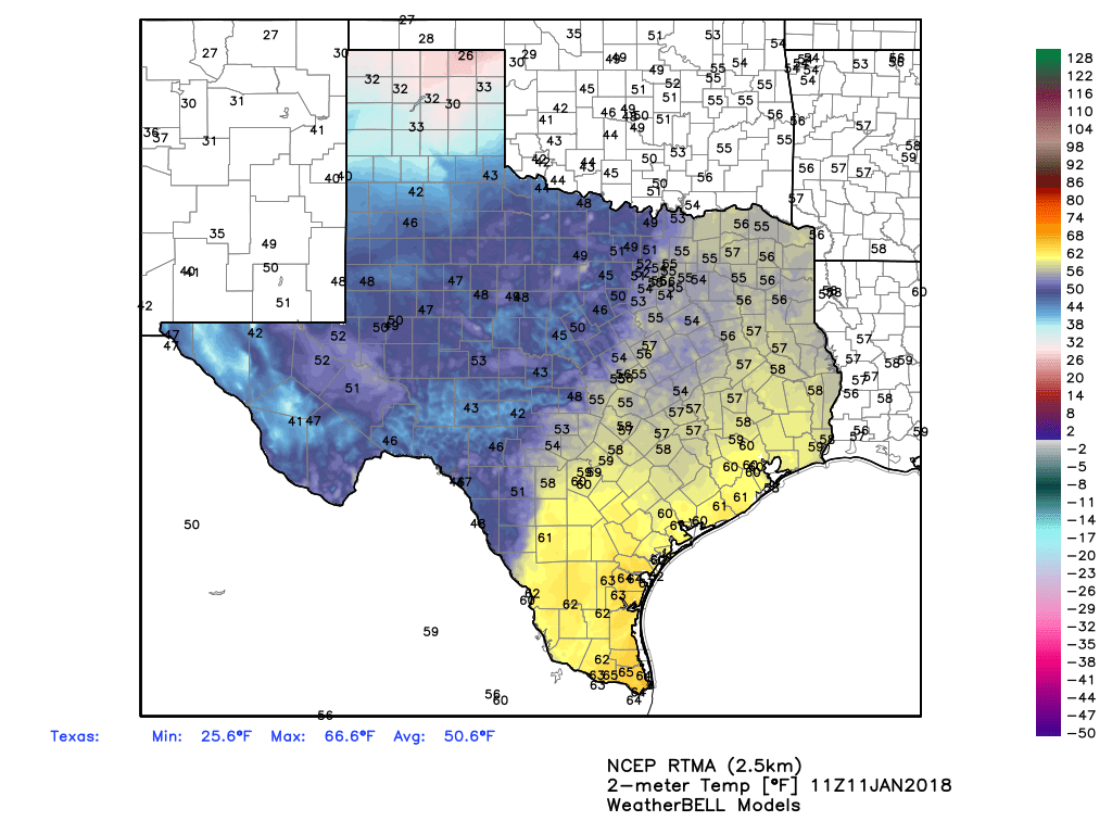
It’s moderate along the coast this morning, but much colder air is coming. (Weather Bell)
Thursday
Our muggy (for winter) conditions will prevail this morning, allowing high temperatures to likely rise into the low 70s for much of Houston. However, a line of showers will develop later this morning, and move through the region between about 10am and 2pm, with the cold front at the back end of these showers. Most areas shouldn’t see more than a tenth or two of an inch of rain as the storms move through fairly quickly. In their wake we’ll be left will very blustery conditions, as gusts may rise to about 30mph this afternoon and evening. (A Gale Warning is in effect for offshore, where seas will be rough. This afternoon and this evening would be a very bad time to take the boat out.) All of this should lead to a chilly night, with a light freeze for the northern half of Houston, and wind chills down in the 20s.