We are now just one week away from the Houston marathon. And as the event comes closer, the forecast continues to become clearer. At this time we can have relatively high confidence in a cold and probably dry day for the run, which we’ve been suggesting for some time would be most likely. But how cold?
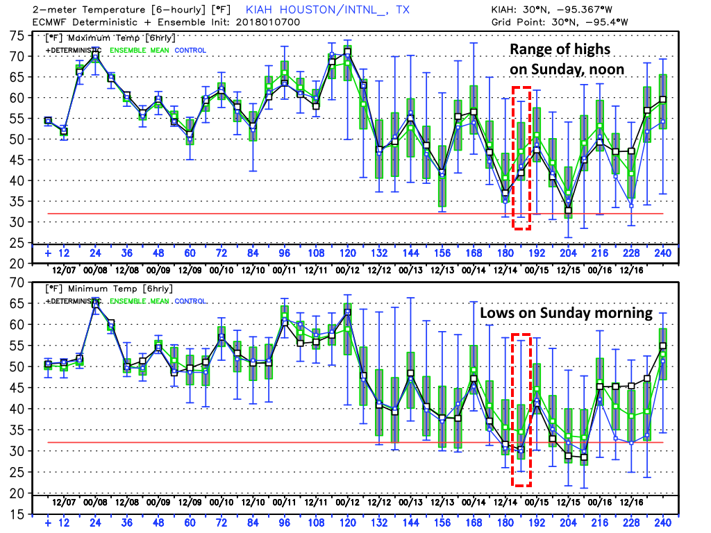
Ensemble forecasting (looking at the various ensemble members of the global models) remains a better practice until about five days out, so it still makes sense to look at the range of possibilities rather than a specific, point forecast. And generally, the global models are in agreement that a cold front will move through the region next Friday, with some reinforcing colder air on Saturday at some point. Because the timing of this colder air remains uncertain, we still cannot have total confidence in the forecast. But I think it’s safe to say the temperature will fall within the following ranges:
Run start, 7am CT
European model forecast: 25 to 45 degrees
GFS model forecast: 27 to 42 degrees
Run finish, noon CT
European model forecast: 40 to 60 degrees
GFS model forecast: 40 to 55 degrees
As for precipitation, rain chances appear low if non-existent. Most likely we’ll have clear skies, which would lead to quite cold temperatures to start the day.