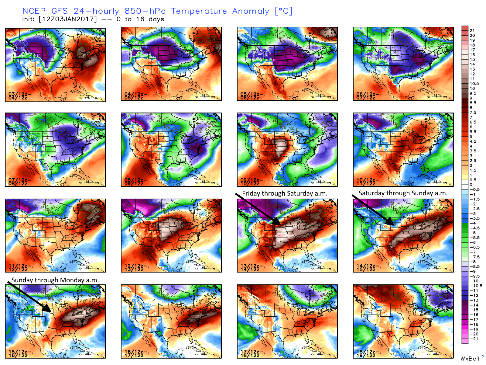
Good morning. It’s in the 40s across Houston this morning, and we’re now going to remain in a cooler pattern through the weekend, with a light freeze possible on both Saturday and Sunday mornings.
Today
Northerly winds will keep conditions across the area winter-like today, with highs likely rising only into the mid-50s under partly sunny skies. Look for another cool night tonight in the mid-40s.
Thursday and Friday
Winds should veer back out of the south on Thursday during the daytime hours, and with some moisture in the air we can’t rule out a few scattered showers along with highs in the low 60s. Accumulations will be slight, however. A cool front will move into Houston later on Thursday to reinforce the colder air mass already in place.
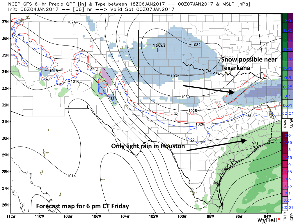
The big question is rainfall later on Thursday night, Friday, and Friday night. An atmospheric disturbance will move into the area Friday morning, but there’s not going to be an overly amount of moisture to work with. At a minimum Friday looks to be cloudy and cold with highs in the mid-40s, and with northerly winds it will feel colder. Any light rain on top of this will make for a pretty grim winter day. If this precipitation persists into Friday night across northern Houston and counties such as Montgomery and Walker, some sleet is possible. We’ll continue to track that possibility.
(Space City Weather is sponsored by Westbury Christian School for this month)