As one might expect at the end of August, the tropics are very active today. Here’s a Sunday roundup of everything that’s going on, with an emphasis on what might affect the Gulf of Mexico.
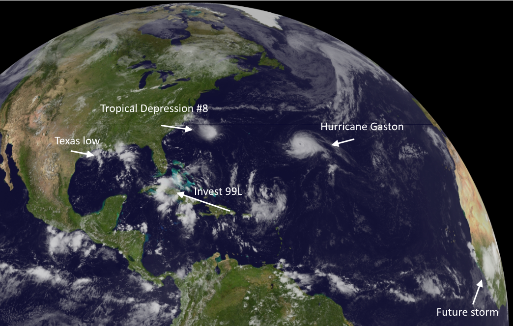
Hurricane Gaston
Gaston may be a beast, but we can only admire his eye and 105-mph sustained winds beauty from afar. A quick summary:
No one stays away from land like Gaston!
No storm is worth ignoring like Gaston!
Tropical Depression 8
This storm developed quickly on Saturday night and Sunday morning, and may become Tropical Storm Hermine during the next day or so. This system is going to move toward the North Carolina coast by Tuesday or so, but shouldn’t strengthen much further due to increasing amounts of wind shear. Should still be a rainmaker for the Carolinas and possibly Virginia this week before it moves back out to sea.
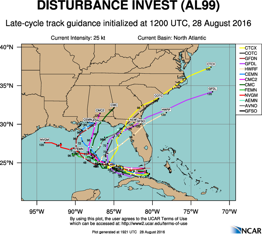
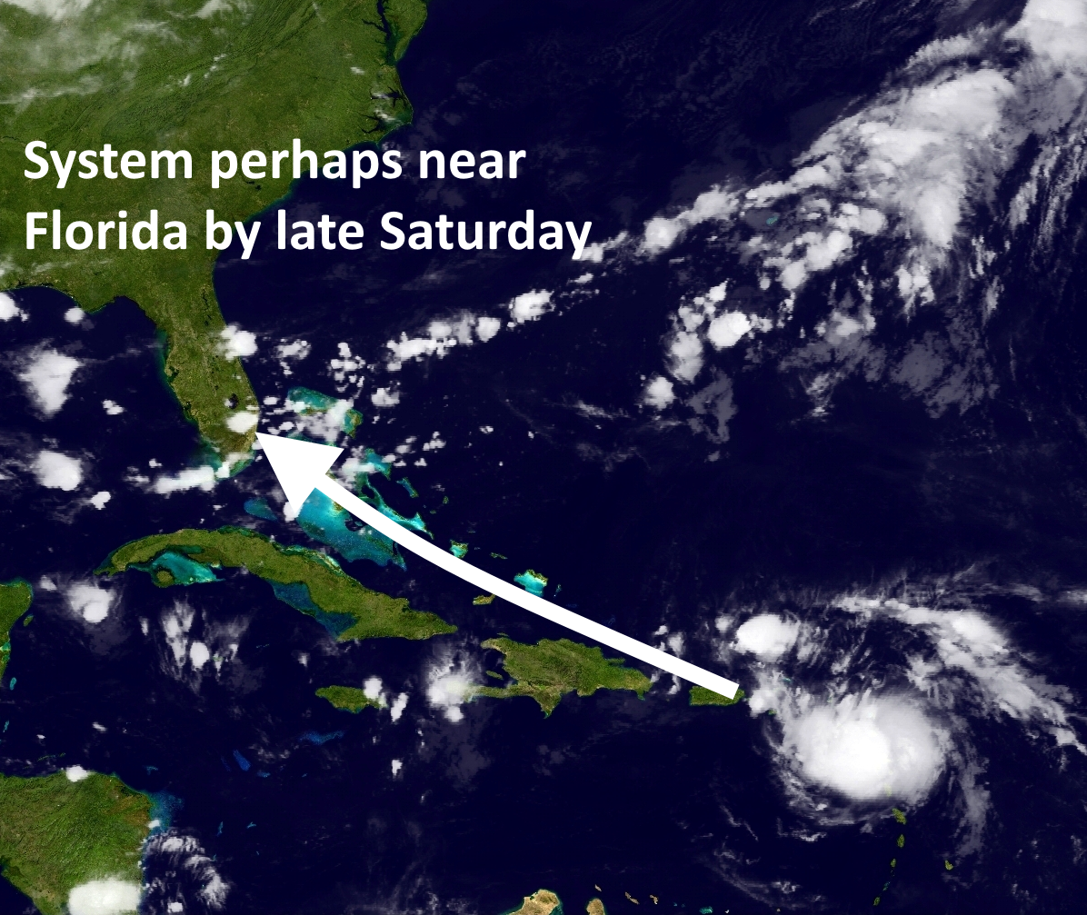
Invest 99L-Now Tropical Depression #9
Ahh, our old friend Invest 99L. It seems like we’ve been tracking this undeveloped tropical wave since about 2013. Matt joked that it might be the first Invest to ever get “retired” by the National Hurricane Center. With that said the system does look a little bit better on satellite today, and the hurricane center just upgraded it to a tropical depression. Here’s a look at the track models: