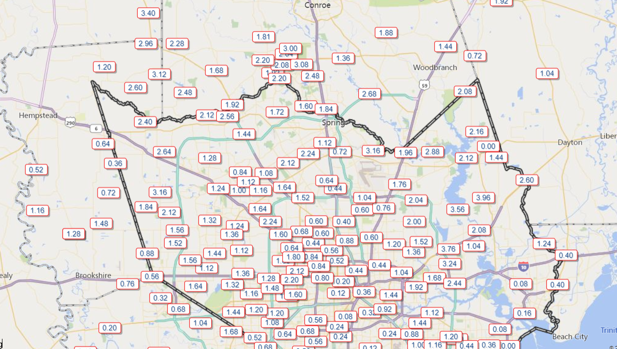
More storms impacted the region yesterday, mostly on the south and east sides of Houston. Thursday’s star of the show was a supercell over Galveston Bay that produced nearly 70 mph winds on the Texas City levee and multiple waterspouts in the bay.
Galveston Bay @NWSHouston pic.twitter.com/SzGfNBT8XT
— 🇺🇸madstork🦅 (@baldbear87) May 28, 2020
Wow!
Friend sent this photo from La Porte, TX around 2:30. pic.twitter.com/fPfu90MLk5
— Michael Schwab (@michaelschwab13) May 28, 2020
We see waterspouts fairly regularly around here, but this was one or two levels above a typical one. Really impressive structure and intensity with that storm. Thankfully, this remained over water, though it did come very close to producing a tornado on Galveston Island.
We also do think that this pattern of nasty, over-productive daily thunderstorms has begun to wind down. Houston starts the transition to something very summer-like heading into the weekend.
Today
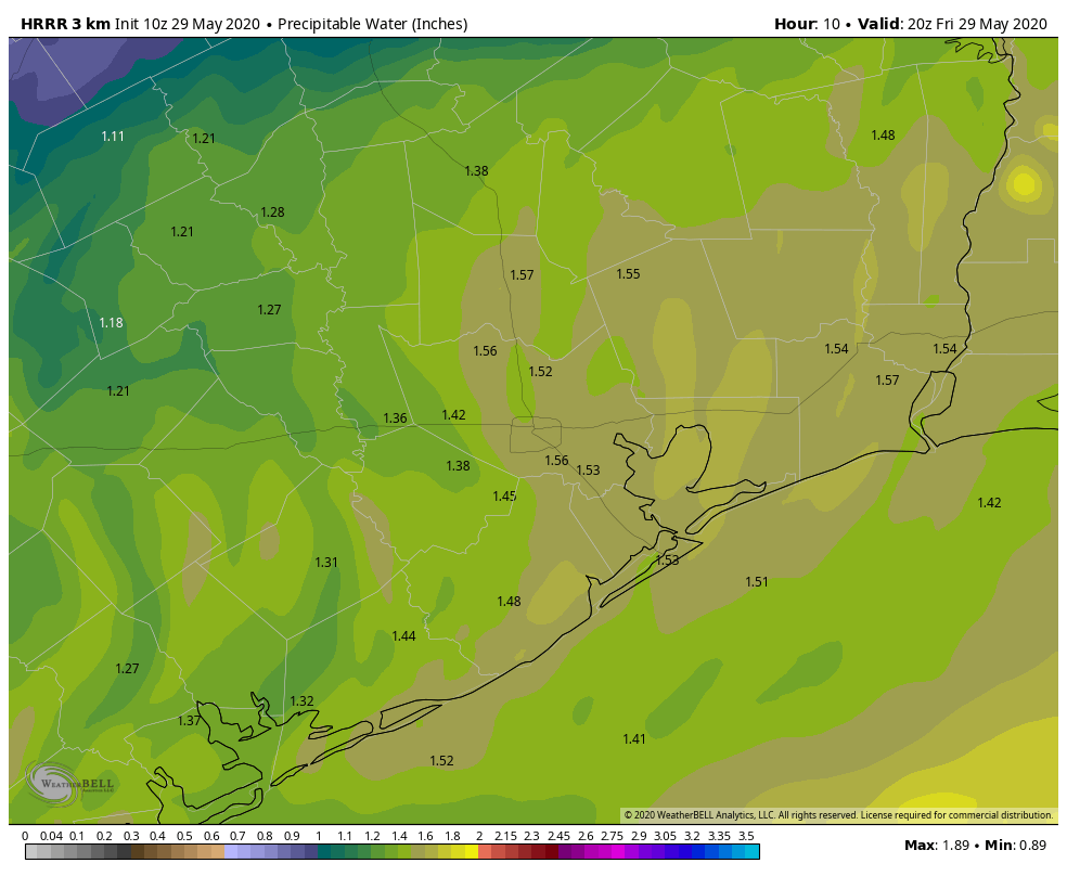
With the upper level storm that’s been sitting off to our northeast, we’ve been stuck in a pattern with winds aloft out of the northwest, bringing disturbances our way each day that have helped to invigorate our daily storms. That upper level system rockets off to the north and east today, integrated into a passing disturbance over the Great Lakes. Along with that, the amount of atmospheric moisture available is a little lower today, and the forecast of instability on the models is also substantially lower. I think that should be enough to limit just how widespread and strong showers and storms can get this afternoon.
So what does it mean? It does mean another chance for showers or a thunderstorm today, however they should be somewhat kinder and gentler than those of the last few days. The highest chances today will be close to the coast or off to our east. That doesn’t mean a shower or storm can’t happen elsewhere; it’s just more likely closer to the sea breeze. We will see a mix of clouds and sun otherwise. Humidity will be low for this time of year, which should allow high temperatures to get to near 90 degrees this afternoon without much trouble.
Saturday & Sunday
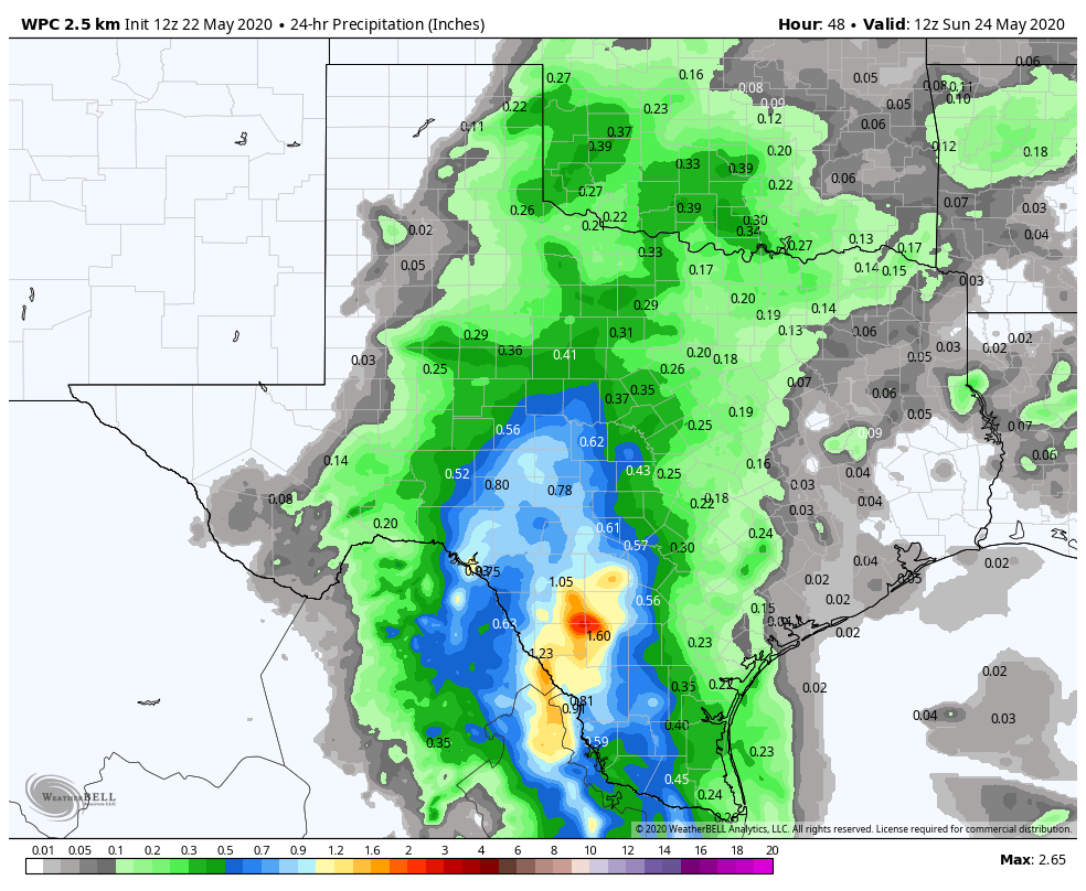
We should settle back into a typical summer type pattern of sun, clouds, hot weather, and perhaps a brief passing shower. High pressure starts to flex, which will really drop the rain risks. The best odds look to be mostly toward Matagorda County, Wharton County, or southern Brazoria County. Unlike the last few days where we’ve seen storms blow up, anything this weekend would probably be slow to develop and max out maybe as a brief downpour and likely nothing worse. Humidity will increase a bit further, and we’ll see highs again around 90 degrees, give or take. Saturday and Sunday morning’s lows will be around 70 degrees, a little warmer at the coast and a little cooler farther inland.