After an on-again/off-again dry summer in the Houston area, the last 10 days have felt like we’ve been dodging a continuous faucet. We will continue to deal with this into later this week and weekend.
Quick situational awareness for you:
- A Flash Flood Watch is in effect generally along and southeast of US-59, so primarily for the coastal counties in our area until later today. A watch means flooding, especially street flooding, is possible.
- We’re expecting periods of rain, possibly heavy at times, through tomorrow, with a bit more possible Wednesday and Thursday.
- Our Caribbean/Yucatan tropical disturbance (Invest 95L) remains disorganized this morning. The National Hurricane Center (NHC) gives it a 60% chance of development as it comes across the Gulf later this week. We think the ceiling on intensity is low, but this system does bring more locally heavy rain risk to parts of Texas.
Through Thursday
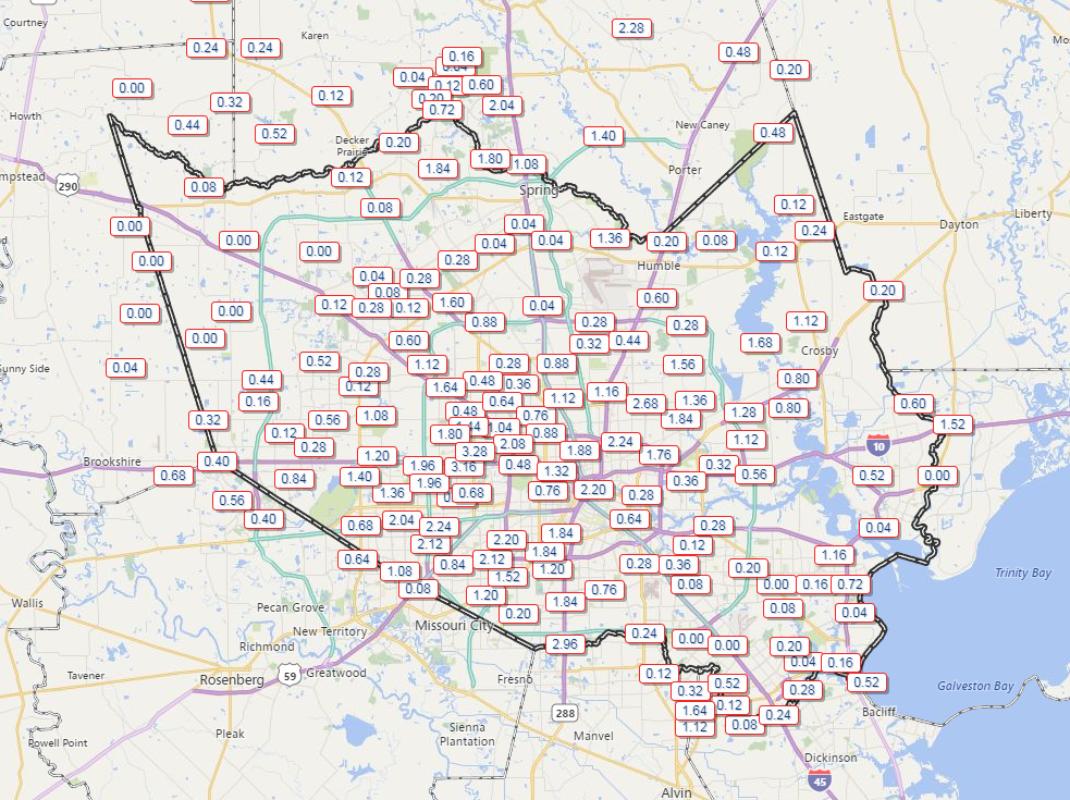
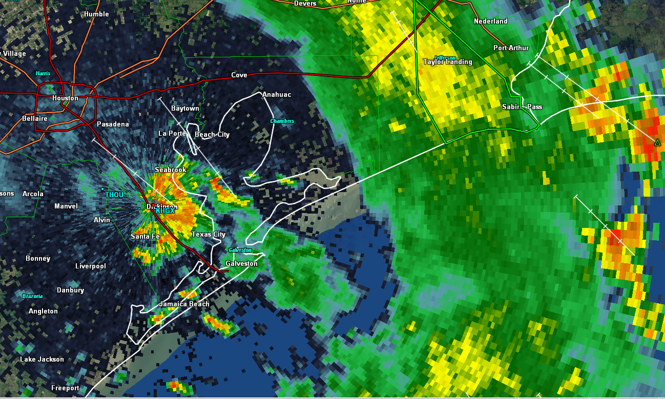
As I write this morning, heavy rain is south and east US-59, mainly impacting coastal Brazoria County and much of Galveston, and Chambers Counties.
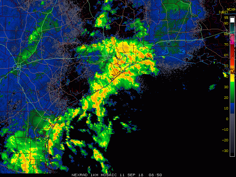
A Flash Flood Warning is posted for the west shore of Galveston Bay through Texas City back into western Galveston County. That goes until 7 AM, as they’ve seen healthy amounts of rain in that area overnight.
Look for rain to continue this morning, though with perhaps a gradual focus more to the east or offshore. It’s possible areas north and west of Houston stay quiet much of this morning before some scattered downpours this afternoon. The most likely area to see rain continue at a healthy pace at times will be along the coastline or near Galveston Bay.
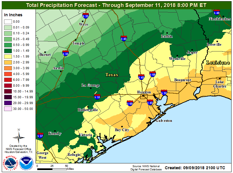
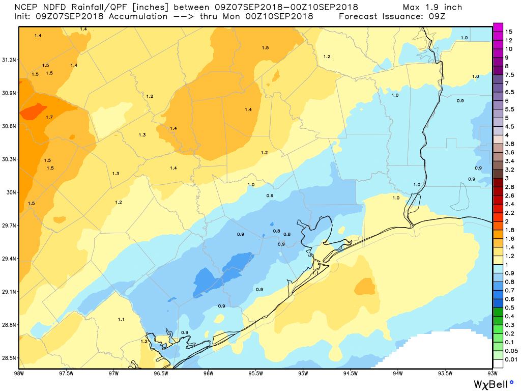
Additional rain of one to three inches is possible along the coast and just inland. If rain hugs the coast longer than expected this morning and afternoon, totals could be higher in Galveston through Freeport. Areas north and west of Houston will see more sporadic, scattered amounts of less than an inch in most cases.
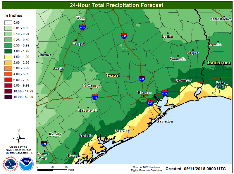
More rain will be possible tonight, once again along the coast, however we expect the heaviest rain tonight to stay south and east of Houston and mostly offshore. Flash Flood Watches are expected to expire as long as that remains the case We’ll re-evaluate that later today and probably have a brief update for you this evening and let you know if NWS extends the Flash Flood Watch through tonight for the coast.
From this vantage point, the forecast for Wednesday and Thursday is pretty straightforward: Scattered showers and thunderstorms are likely on both days. We still need to iron out specifics and details, but expect more pockets of locally heavy rain, though they aren’t expected to be widespread at this point. Just a generic, “It’s probably going to rain at a few points between both days” will have to suffice for now.
Clouds and rain are at least holding down temperatures. Look for temperatures to range from the upper-70s to around 80° if it stays cloudy and dreary all day to the mid-80s if we see some occasional sunshine.