Recent brilliant weather has side benefits too

Let’s face it. We’ve gotten off very, very easy this spring in most of Southeast Texas. It’s been pleasant very often lately, despite a couple days of heat and humidity mixed in. So as we continue on another nice, lengthy stretch of fair weather, let’s quickly review where we are right now.

A Texas Spring Fling

Rainfall amounts haven’t been at all like the last two springs. It also hasn’t been terribly dry either. In fact, precipitation over the last 60 days is averaging just a little above normal in most of the Houston area.

Percent of normal precipitation for the 60 day period ending yesterday shows most of the region in pretty good shape. (NWS/NOAA)


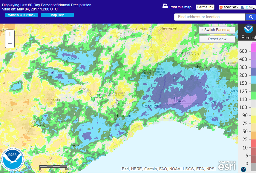
It’s a bit drier than normal in patches around the area also, but we’re by no means in drought. Even despite recent dryness near and west of San Antonio, those areas aren’t really in drought either.

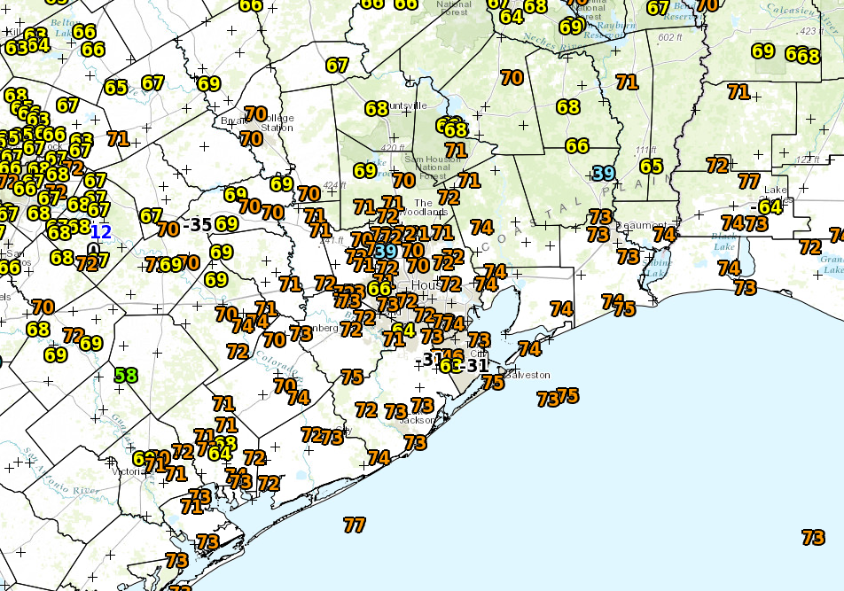
And on top of this, temperatures have been sublime at times. Yes, we’ve already hit 90° twice, but let’s be frank: We’ve had multiple days like yesterday and today, and they’ve been amazing. The last two weeks have been especially lovely.

Average temperatures the last couple weeks have not been too far off normal, despite a couple days in the 90s. (High Plains Regional Climate Center)


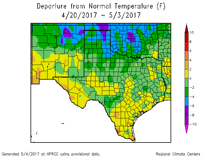
So for most of late April and now early May, rather than drifting into our miserable, stable summer of high humidity and plenty of heat, we’ve only had tastes of it.

(Space City Weather is sponsored this month by Jetco Delivery)

See full post

Another chance for 90° today, then an unsettled weekend

Unsettled weather is going to be the main story this weekend, as we continue to bounce around in a weather pattern that resembles something more like a roller coaster ride than anything. Here are the details.

Friday

A change is afoot this morning. Overnight, winds shifted solidly onshore, and as you step outside this morning, you may not like how it feels.

Dewpoints that were in the 40s just 24 hours ago are now around 70°. It feels like summer. (NWS)


Onshore winds mean higher dewpoints which means more humidity. It’s back, and it’s staying through tomorrow. Outside of the high humidity and temperatures, expect an otherwise nice day today. We’ll see a mix of clouds and some sun. We have a good shot at making another run at 90° this afternoon if we can get enough sunshine. Combined with humidity, it will feel like closer to 100° outside. Unpleasant. With strengthening southerly winds, there is also the potential for some minor coastal flooding starting late tonight and continuing into tomorrow night.

(Space City Weather is sponsored this month by The Mole, a Jonathon Price novel.)

See full post

How Houston could hit 90° Wednesday

We’ve been talking since last week about how the end of this week and/or the weekend look like hot days in Houston, giving us our first shot at 90° in 2017. However, after looking at weather data today, I think there’s a legitimate chance Houston could officially touch 90° for the first time tomorrow. Not a guarantee by any means, but there’s a chance. And the meteorology around it is sort of interesting, so let’s lay it out for you.

Step 1: Have a warm air mass in place

The recipe for Houston to hit 90° in late April involves a few factors. And this may seem like a “duh” statement, but it’s important to touch on. You need to have a warm enough air mass overhead.

The GFS forecast for 850 mb temperatures tomorrow afternoon is for them to be around +18°C. (Weather Bell)


The GFS forecast for tomorrow afternoon has temperatures borderline, but close enough to historically be capable of producing a 90 degree day in Houston. The map of 850mb temperatures above shows how warm it is about 5,000 feet up in the atmosphere. There’s an old school meteorology trick you can use to forecast high temperatures using the 850 mb temperature in the morning. It involves using a sounding (as explained here) and taking the 850 mb temperature down what we call the dry adiabat to the surface. One of the problems tomorrow is that with a front coming through, it creates volatility, which makes using that method difficult. But if you look at forecast soundings for 4 PM tomorrow afternoon, they look healthy for at least an 87-89° sort of day.

The forecasted sounding tomorrow afternoon over Houston is favorable for at least the upper 80s. (BUFKIT, NWS)


So on Wednesday, we have just a barely warm enough atmosphere to work with.

(Space City Weather is sponsored this month by The Mole, a Jonathon Price novel.)

See full post

One final hurrah at comfortable weather before summer sets in?

Houston: Get ready for one, potentially final splash of beautiful weather. Never say never, but it’s getting deep into spring now, and any opportunities at comfortable weather can be fleeting around here. But what we have coming this weekend will be absolutely sublime. Let’s get into details.

Today

No real issues are expected today. Yes, an isolated shower could occur, but it looks like a very slim chance. Temperatures will be similar to yesterday, with slowly increasing humidity. Expect mid to perhaps upper 80s this afternoon.

Saturday’s front

Let’s talk cold front. Expect the front to traverse the region from northwest to southeast through the day, arriving in Conroe around mid-morning, Bush Airport and Katy mid to late morning, South Houston around midday, and Galveston through Lake Jackson around early to mid-afternoon.

Dewpoint forecast for Saturday shows extremely refreshing air arriving from northwest to southeast through the day, lagging the front by just a few hours. (Weather Bell)

For those participating in the Ironman North American Championship Texas in The Woodlands Saturday, I wish we could speed the front up six hours, but alas it waits until Saturday morning. It will be a bit challenging, with temperatures starting the event in the mid to upper 60s, warming into the upper 70s by early afternoon. The precipitous drop in humidity expected behind the front probably won’t begin until early Saturday afternoon. Not the worst we’ve seen around here in spring, but probably not ideal either.

Best of luck to anyone participating in the Ironman in The Woodlands Saturday!

In terms of rainfall, I don’t expect much. A narrow, broken line of showers and maybe a rogue rumble of thunder will be possible as the front moves through. This means some of you may get briefly rained on, others may not. No severe weather is expected. Temperatures will still peak around 80° or so in Houston on Saturday afternoon (cooler north, warmer south). You won’t notice much of a big change until mid to late Saturday afternoon when the refreshing air begins to pour in.

(Space City Weather is sponsored this month by The Mole, a Jonathon Price novel.)

See full post