Many of our complaints about lack of sunshine were lodged and received. We’ve had a couple nice, albeit steamy afternoons this week, officially hitting 80 and 81 degrees on back to back days for the first time since November 17-18 of last autumn. For some that may be too much, too fast, but alas, here we are.
Today through Tonight
We’ll attempt to make another run toward 80 today, but added cloud cover and a few shower chances should limit how warm we can get. But, after a mild start this morning, we should still easily make the upper 70s this afternoon. There’s not much happening in the atmosphere to favor any significant showers today, but some lighter showers will be possible later as our next cold front approaches.
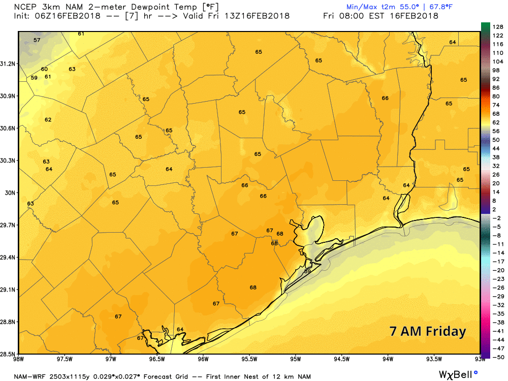
The front should make it to the northwest suburbs of Houston around 3-6 PM or so. Behind it, temperatures will ease back into the 60s and humidity should lower some. As the front moves through Houston, it will begin to grind to a halt. As of now, it looks like forward progress stops somewhere around Clear Lake to Dickinson. You can see this clearly while looking at an animation of dewpoints today.
So most of us will cool down into the mid or upper 50s tonight, but it will stay mild and humid southeast of the front, including Galveston east to Beaumont, where you probably won’t drop below 60-65 degrees. We’ll have low clouds and light showers behind the front and low clouds, drizzle, and fog probably ahead of it tonight. Fog may continue to linger in Galveston through the night.

Weekend
The front essentially dies out southeast of town tonight and Saturday morning. During the day Saturday, onshore flow begins to resume while humidity creeps back up. That turns to a warm front on Sunday, and we’ll see a stronger surge in onshore flow and humidity. Both Saturday and Sunday will probably see more clouds than sun, along with a chance of showers both days. We shouldn’t be looking at a washout this weekend, but it will probably be a bit dreary, which has been par for the course here this month.
Temperatures will be a little tricky, but we should manage the upper 60s to low 70s on both Saturday and Sunday. Overnight lows Saturday night will probably ease back into the 50s in Houston proper, but they could be a bit warmer depending on how strong onshore flow is.
Next week
We’ll continue warming next week, with temps in the 70s during the day and 60s at night. Another front, this one backed by better moisture and instability, will approach later Tuesday into Wednesday. Monday might be the best chance at a drier day. Later Tuesday into much of Wednesday will see scattered to numerous showers and storms in the area.
Heavy rain is possible, but the best support for more serious rains likely stays well off to our northeast. Still, we’ll continue to monitor this through the weekend and update you on Monday.
Yippay!! Hawt weather comin’ back, y’all!! Still don’t care if I never see another snowflake-Clay