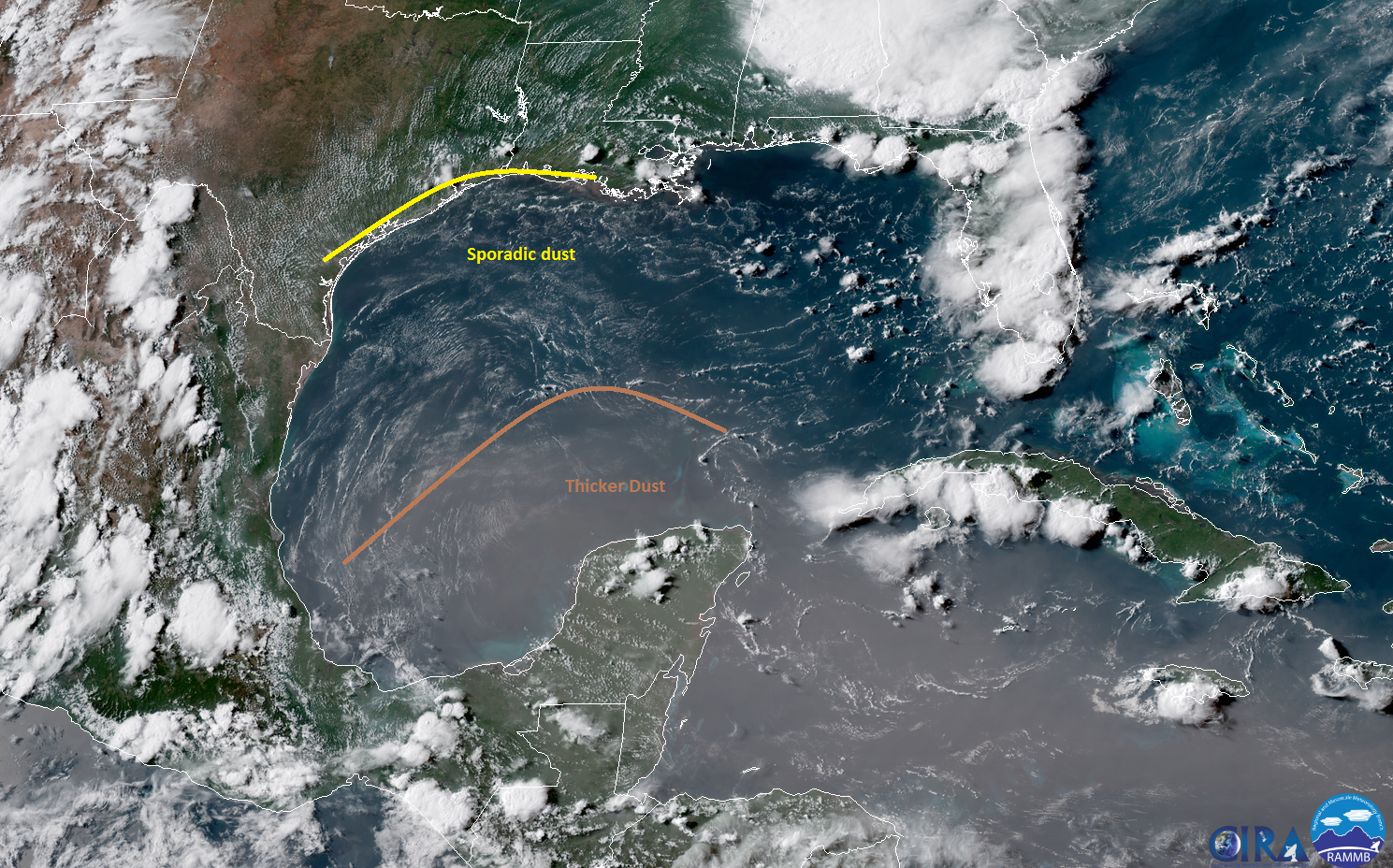
I hope everyone got through the weekend of Saharan dust without too much trouble. We saw a bit of improvement to air quality on Sunday, and we will see further improvement today and tomorrow. It may be unnoticeable by Tuesday. Then we’ll talk rain.
Today & Tuesday
Other than the lingering dust, today will just be another hot one. Look for highs to top off in the mid-90s in Houston, a bit cooler near the coast and hotter inland. It will be mainly sunny. Tuesday will start off similarly. Expect a few more clouds to roll in during the afternoon however. There may be a shower or storm around east of I-45 later in the day. But for the most part, I think Tuesday during the daytime looks good. Any organized storms on Tuesday will be in Louisiana or near Beaumont/Port Arthur. If you’re traveling I-10 east toward Lafayette or Baton Rouge Tuesday afternoon or evening, leave yourself a little extra time.
Fourth of July
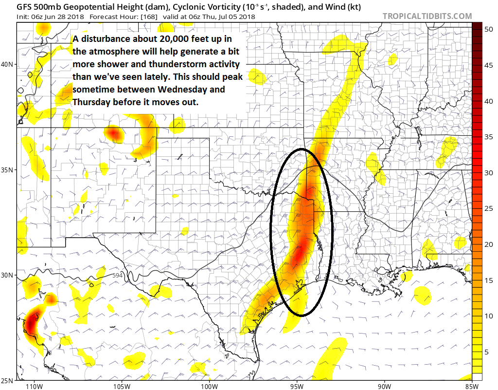
Here’s where things get slightly more complicated. We’ve been discussing this since last week, and we have slightly more confidence in how things should go today. A vigorous upper level disturbance will swing across the Gulf Coast Tuesday and into Texas from east to west Wednesday and deliver showers and thunderstorms. Let’s roll through what we expect.
Timing: The start time in the Houston area will vary, but I expect an increasing chance of thunderstorms or showers from east to west on Tuesday night, sometime around and after Midnight, lingering into early afternoon on Wednesday. I think our odds of improving weather go up after 12-4 PM on Wednesday (again from east to west).
Do I need to cancel my plans? If you have July 4th evening plans, I would keep them, as the timing may work out well for fireworks and evening events. The morning and early afternoon will be dicier, so for some area parades, that could dampen things. If you have morning or early afternoon outdoor plans, you may want to have an indoor backup ready to be safe.
How much rain will fall? I believe we should see, on average, one to two inches of rainfall on Tuesday night and Wednesday. There could be a few places that see up to three or four inches of rain, or even a little more.
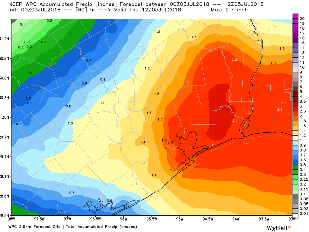
Flooding? Major, widespread flooding is unlikely from an event like this. As is often the case in Houston in summer, however, street flooding could be an issue in the morning or afternoon, depending on where the heaviest rains occur. Right now I think the most likely window for heavier rain from this system will be from 6 AM through 2 PM Wednesday. That may shift a bit between now and then, however.