A dreary start to the week will continue today with a number of things to watch for in the region. Let’s get to it.
Today & tonight
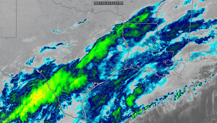
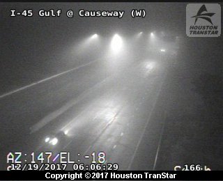
Two issues this morning: Fog and rain. Starting with visibility, we’ve got Dense Fog Advisories up for the entire region. Visibility is restricted just about everywhere in Southeast Texas, so give yourself a few extra minutes this morning. Fog will be most persistent near the coast, so if you’re traveling south on I-45 or east on I-10 this morning, you should expect a much slower than usual go of things.
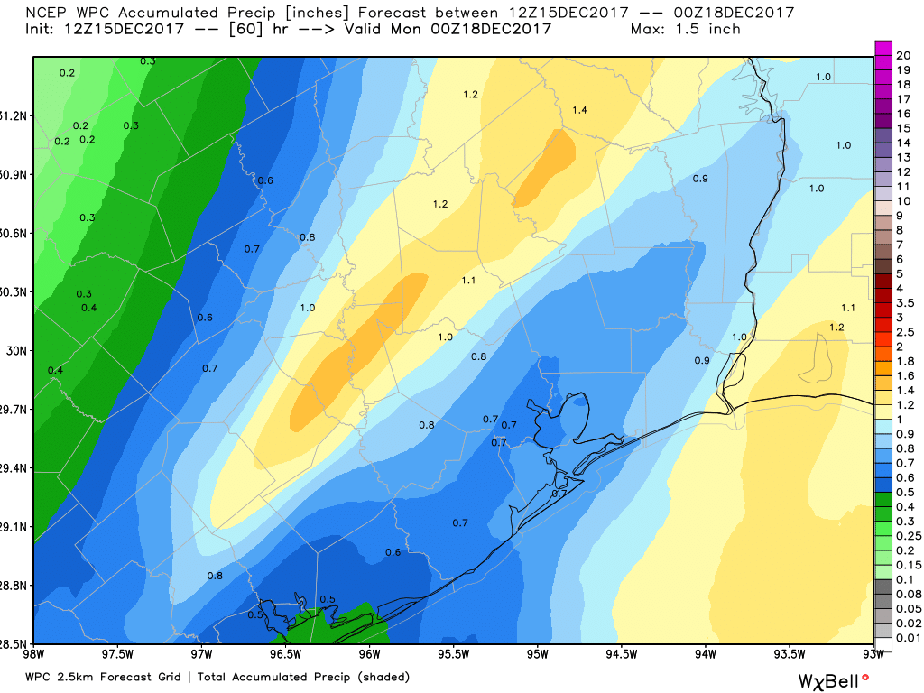
In addition to the fog, we’re also watching rain. Most of the heavier and steadier rain is well north of Houston this morning. If you live in The Woodlands or Conroe or north and west of Houston toward Sealy or Hempstead, you’re seeing occasional rains this morning. Those will probably lift off to the north through the morning.
The rest of today will feature steady to perhaps heavy rainfall almost totally out of the Houston area. This would be most likely north of a Brenham-Huntsville-Lufkin line. In and around Houston itself, we could see a sporadic shower or a thunderstorm. After the fog slowly dissipates this morning (and in places, it may linger into early afternoon), it should be mostly dry. Expect temperatures to reach the mid-70s this afternoon.
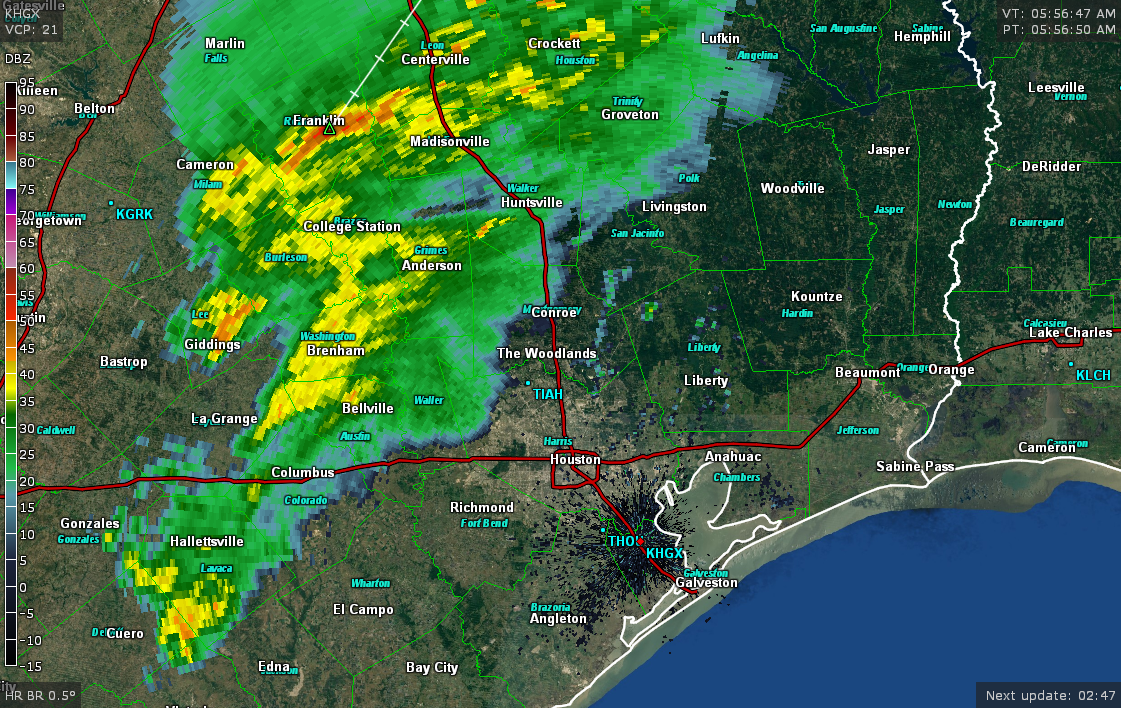
Tonight is when we’ll need to pay attention for some quick moving thunderstorms. A cold front should sweep through between roughly 9 PM and 2 AM. It will bring a broken, thin line of storms, which means it’s possible that not everyone sees rain or thunder. That said, parameters over Southeast Texas will be favorable for some of the storms embedded in that line to be strong to severe. A few places may see some gusty winds, and while we can’t entirely rule out a stray storm capable of producing a tornado, that would be most likely well northeast of Houston into the Piney Woods I think.
Behind the front, westerly winds take control, and much drier and slightly cooler air will arrive overnight.
Wednesday
This is the pick of the week. Perhaps it’s the pick of the next few weeks, actually. I mean, it looks stunning. Wednesday should be partly to mostly sunny, not too humid, and quite warm. Expect temperatures to max out in the middle or upper-70s. This is less of a Christmas spirit type day and more of a “this is why we live in Houston” type day. Hope you’re able to enjoy it a bit.
(Space City Weather is brought to you this month by the Law Office of Murray Newman)