Unsettled weather is going to be the main story this weekend, as we continue to bounce around in a weather pattern that resembles something more like a roller coaster ride than anything. Here are the details.
Friday
A change is afoot this morning. Overnight, winds shifted solidly onshore, and as you step outside this morning, you may not like how it feels.
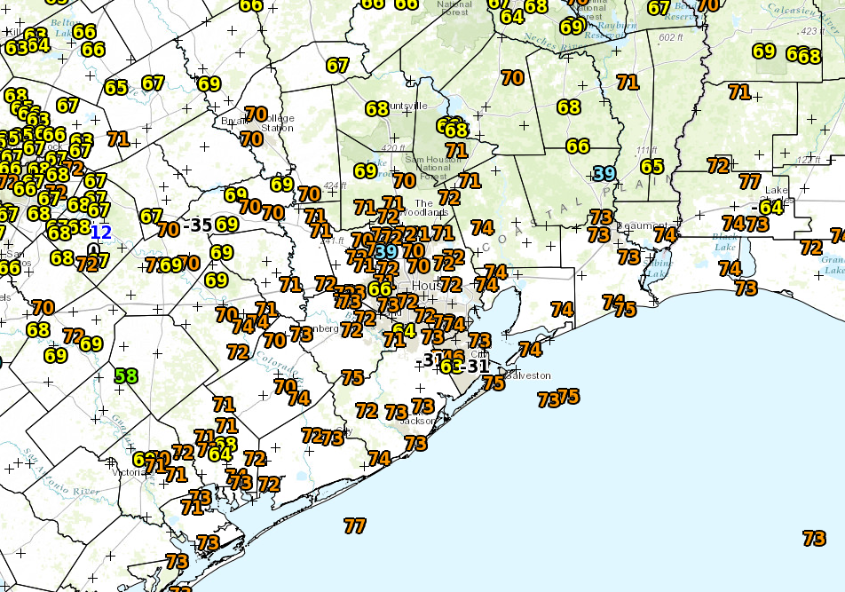
Dewpoints that were in the 40s just 24 hours ago are now around 70°. It feels like summer. (NWS)
Onshore winds mean higher dewpoints which means more humidity. It’s back, and it’s staying through tomorrow. Outside of the high humidity and temperatures, expect an otherwise nice day today. We’ll see a mix of clouds and some sun. We have a good shot at making another run at 90° this afternoon if we can get enough sunshine. Combined with humidity, it will feel like closer to 100° outside. Unpleasant. With strengthening southerly winds, there is also the potential for some minor coastal flooding starting late tonight and continuing into tomorrow night.
We’ve been talking since last week about how the end of this week and/or the weekend look like hot days in Houston, giving us our first shot at 90° in 2017. However, after looking at weather data today, I think there’s a legitimate chance Houston could officially touch 90° for the first time tomorrow. Not a guarantee by any means, but there’s a chance. And the meteorology around it is sort of interesting, so let’s lay it out for you.
Step 1: Have a warm air mass in place
The recipe for Houston to hit 90° in late April involves a few factors. And this may seem like a “duh” statement, but it’s important to touch on. You need to have a warm enough air mass overhead.
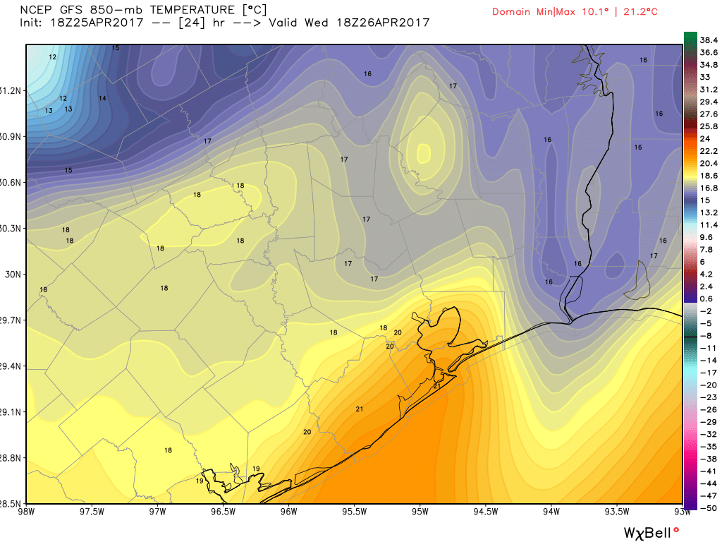
The GFS forecast for 850 mb temperatures tomorrow afternoon is for them to be around +18°C. (Weather Bell)
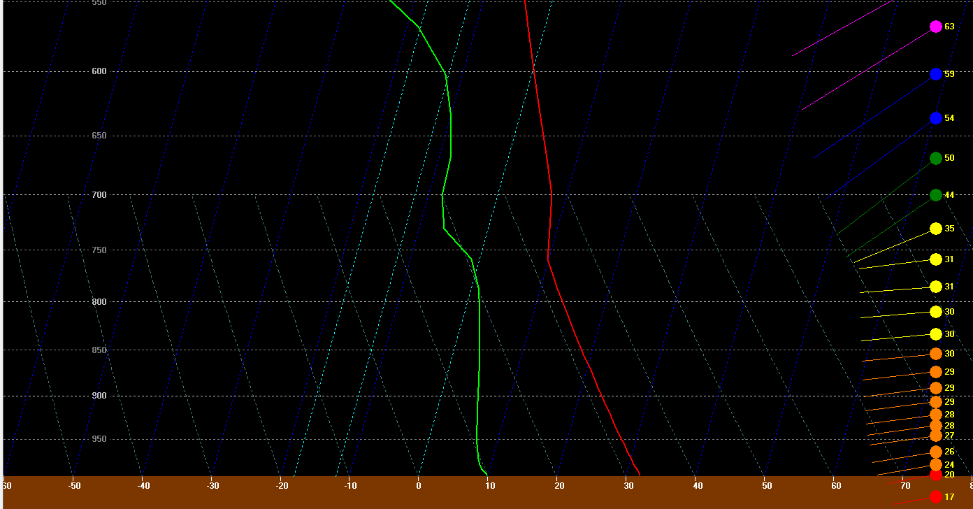
The GFS forecast for tomorrow afternoon has temperatures borderline, but close enough to historically be capable of producing a 90 degree day in Houston. The map of 850mb temperatures above shows how warm it is about 5,000 feet up in the atmosphere. There’s an old school meteorology trick you can use to forecast high temperatures using the 850 mb temperature in the morning. It involves using a sounding (as explained here) and taking the 850 mb temperature down what we call the dry adiabat to the surface. One of the problems tomorrow is that with a front coming through, it creates volatility, which makes using that method difficult. But if you look at forecast soundings for 4 PM tomorrow afternoon, they look healthy for at least an 87-89° sort of day.
The forecasted sounding tomorrow afternoon over Houston is favorable for at least the upper 80s. (BUFKIT, NWS)
So on Wednesday, we have just a barely warm enough atmosphere to work with.
Houston: Get ready for one, potentially final splash of beautiful weather. Never say never, but it’s getting deep into spring now, and any opportunities at comfortable weather can be fleeting around here. But what we have coming this weekend will be absolutely sublime. Let’s get into details.
Today
No real issues are expected today. Yes, an isolated shower could occur, but it looks like a very slim chance. Temperatures will be similar to yesterday, with slowly increasing humidity. Expect mid to perhaps upper 80s this afternoon.
Saturday’s front
Let’s talk cold front. Expect the front to traverse the region from northwest to southeast through the day, arriving in Conroe around mid-morning, Bush Airport and Katy mid to late morning, South Houston around midday, and Galveston through Lake Jackson around early to mid-afternoon.
Dewpoint forecast for Saturday shows extremely refreshing air arriving from northwest to southeast through the day, lagging the front by just a few hours. (Weather Bell)
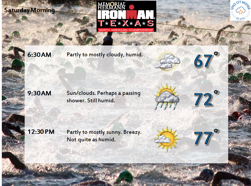
For those participating in the Ironman North American Championship Texas in The Woodlands Saturday, I wish we could speed the front up six hours, but alas it waits until Saturday morning. It will be a bit challenging, with temperatures starting the event in the mid to upper 60s, warming into the upper 70s by early afternoon. The precipitous drop in humidity expected behind the front probably won’t begin until early Saturday afternoon. Not the worst we’ve seen around here in spring, but probably not ideal either.
Best of luck to anyone participating in the Ironman in The Woodlands Saturday!
In terms of rainfall, I don’t expect much. A narrow, broken line of showers and maybe a rogue rumble of thunder will be possible as the front moves through. This means some of you may get briefly rained on, others may not. No severe weather is expected. Temperatures will still peak around 80° or so in Houston on Saturday afternoon (cooler north, warmer south). You won’t notice much of a big change until mid to late Saturday afternoon when the refreshing air begins to pour in.
After a pretty nice and quiet Thursday, we head into Friday with similarly decent weather. We have a couple question marks this weekend, but I don’t think it will be anything to really mar the Easter weekend. But let’s hop to it.
Today
Again, no issues today. I expect it will be partly to mostly sunny and warm. Probably a lot of similarities to Thursday! High pressure is in control, but it is moving away, so onshore flow may get a little steadier late, which could lead to a shower or two in just a couple spots. More subtly, this will mean an increase in humidity very late today or tonight. But the bulk of Friday looks alright.
Saturday
The forecast gets a touch more challenging Saturday. A weak disturbance a few thousand feet up will pivot across the region, probably just east of Houston. This should be enough to set off scattered showers and storms, but also probably just east of Houston.
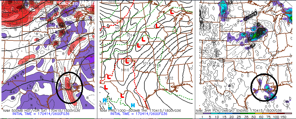
NAM model forecast shows a weak disturbance in Louisiana tomorrow that should keep most showers away from the Houston area. (Penn State)
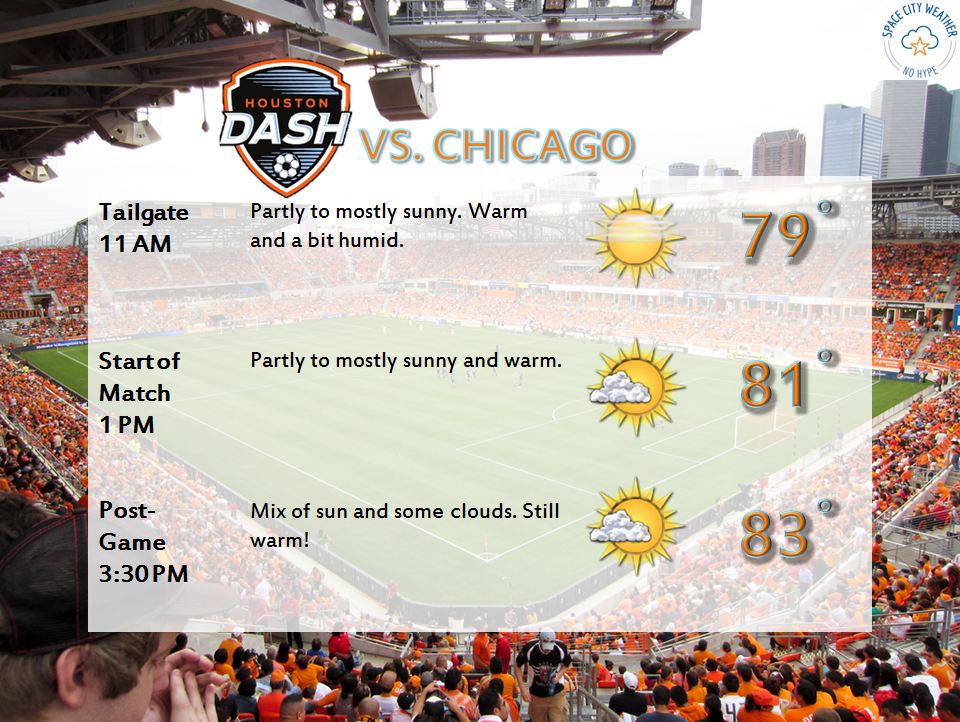
So the bottom line on Saturday: It’ll be a bit more humid. It will also be a couple degrees warmer. While I can’t entirely rule out a shower or two in the area, odds favor most of us staying dry. The best chance for a scattered shower will be east of I-45 and probably as far east as Beaumont or Lake Charles. So if you’re headed to Hobbyfest or Buzzfest, it looks pretty good. The Houston Dash also kick off the season at BBVA Saturday afternoon. It looks great.
The weather for both the afternoon Dash match and the evening Dynamo match looks excellent!