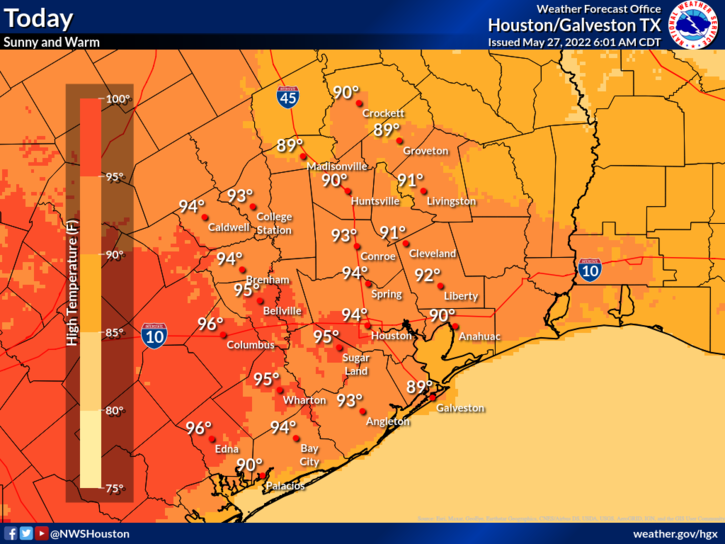
We managed 99 degrees officially again on Monday in Houston, but you may have noticed at least a little less humidity around that peak heating. It’s not much but it does help. So does air conditioning. Your author got his back before Monday afternoon, so we’ll call that a win.
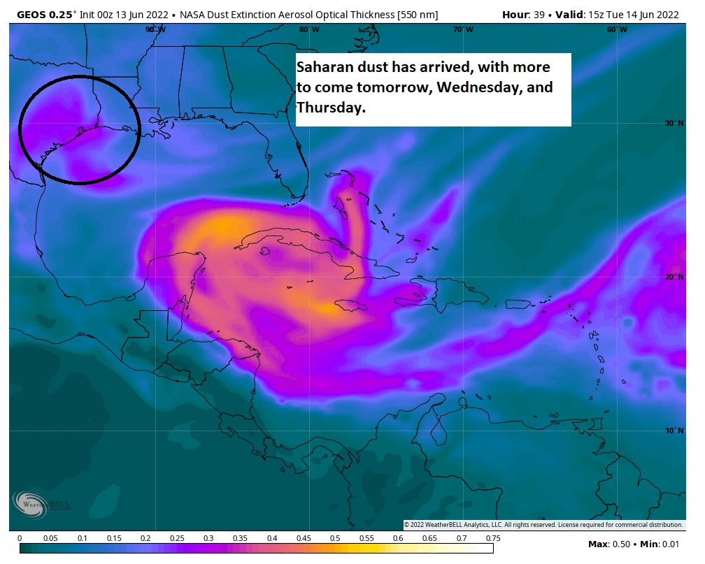
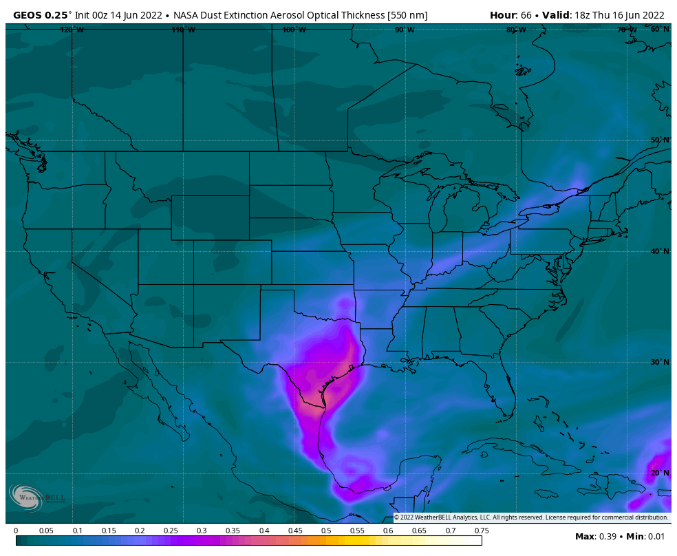
Anyway, the hot weather will continue and so will the dust.
Today
Look for another day with clouds, haze, and sun. We should be able to shave a degree or two off yesterday’s 99 degrees, so look for something more in the mid to upper-90s. Another burst of Saharan dust arriving today should help us double down on the hazy conditions and poor air quality. If you are asthmatic or are sensitive to poor air quality, it would be a good idea to limit outdoor time as much as possible the next few days.
Wednesday through Friday
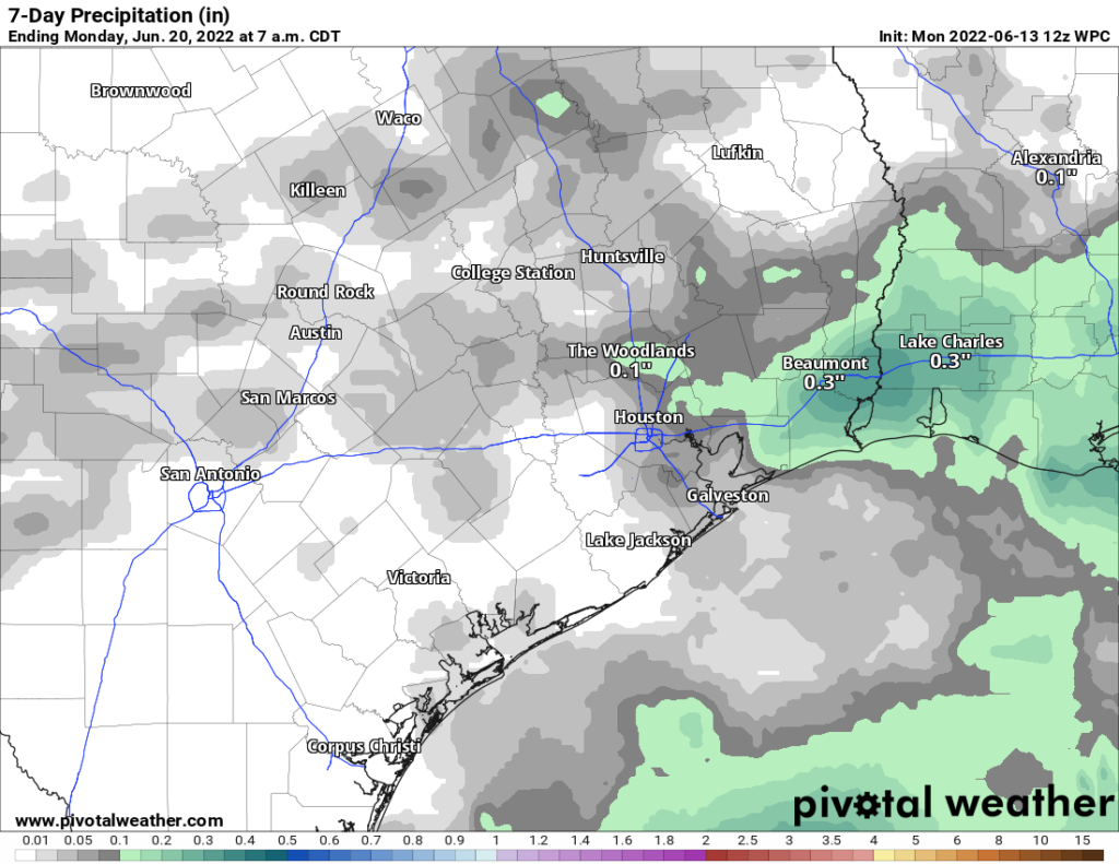
Of the next few days, only Friday carries something above a 10 percent chance of a shower. Look for sun, clouds, and continued Saharan dust, likely at its worst on Thursday.
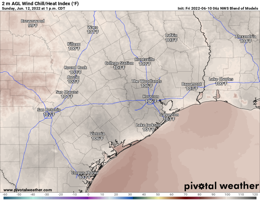
High temperatures will continue in the mid to upper-90s, with lows in the 70s and 80s. Those Friday rain chances stand at around 20 percent, so a few locations could see a welcome shower or downpour but most will not.
The Saharan dust event should end on Friday, with better air quality and less haze for the upcoming weekend.
Weekend into next week
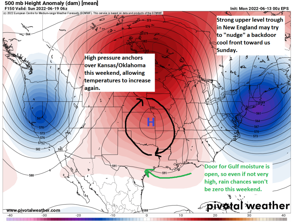
More of the same. The weak backdoor cold front (a front that comes out of the northeast…from Louisiana) that we were looking at on Sunday looks to get held up to our east. Truthfully, I just don’t see anything better than 20 percent rain chances on any given day into the middle of next week. Highs will be well into the 90s each day.
Tropics
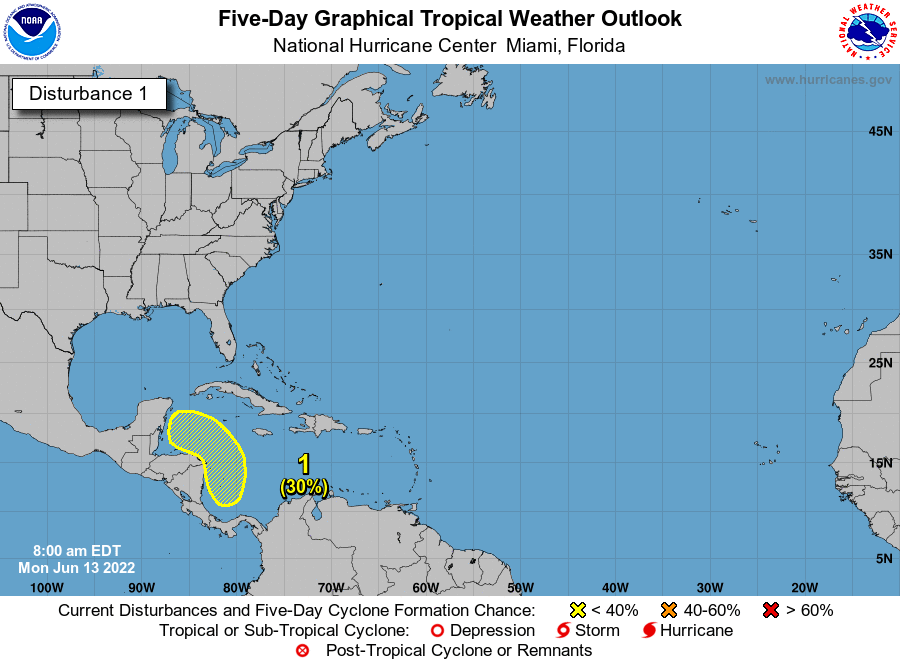
The National Hurricane Center continues to outline this area in the Caribbean for a chance at development over the next 5 days.
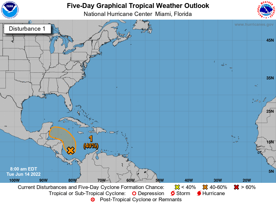
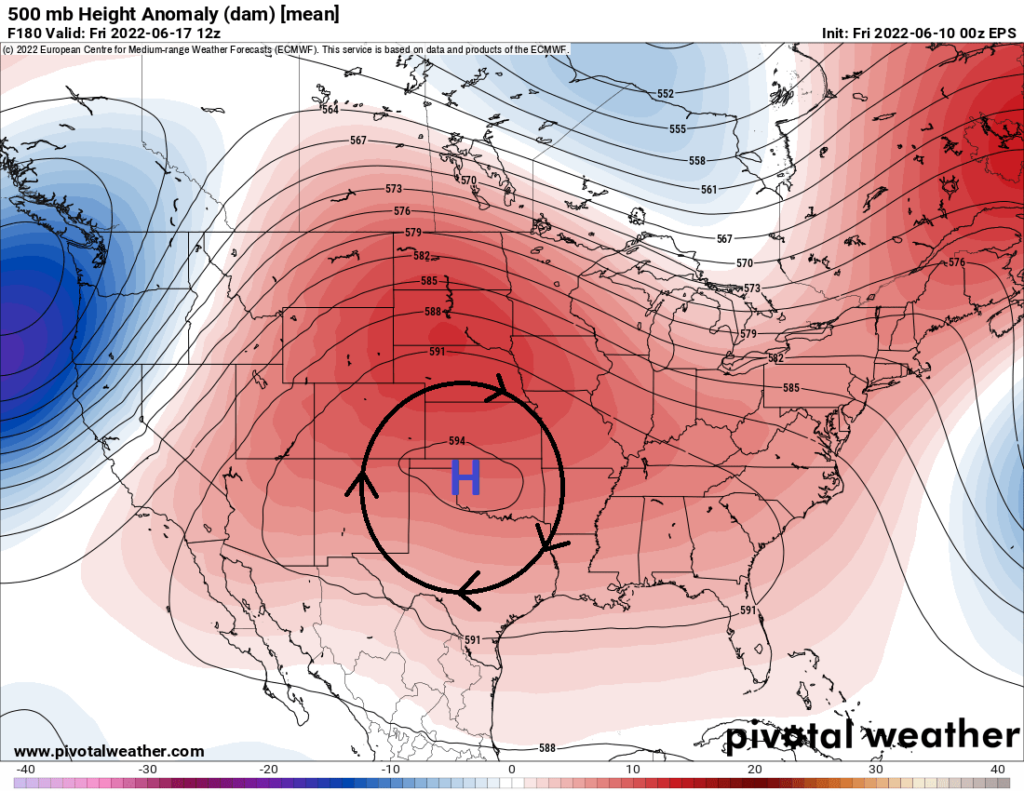
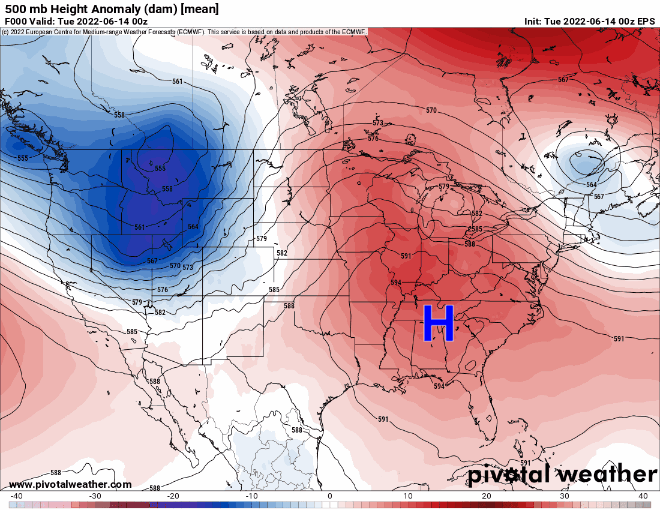
This is not a concern for Texas, and it’s rather easy to explain why. Our weather pattern over the next week (and beyond) will continue to be dominated by this fluctuating ridge of high pressure in the upper atmosphere over the Central U.S. As this system waxes, wanes, waxes, and moves around, one thing stays true: It stays in a position to basically shield Texas from any tropical nonsense right now.
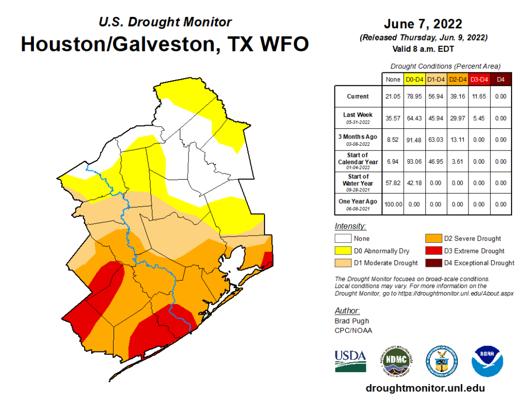
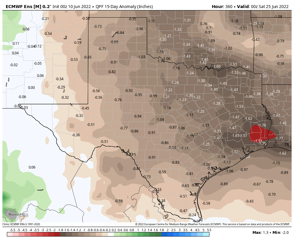
This is both good and bad. It’s good because we could use a year off from hurricane risks. It’s bad, however, because it is likely going to cause the drought across much of Texas to expand and intensify. We could use a little surge of tropical moisture for a couple days. It appears we’re not going to line things up correctly.
Will this heat ever end?
This brings me to the last point today: Many of you are asking when this abnormally hot weather will end. Texas is always hot in summer, but we’re running consistently above average right now, more like July than June. The honest answer is that I have absolutely no idea when this will end.
We’re getting ourselves into a bit of a pickle right now, with a stubborn weather pattern that keeps reinforcing itself over the Plains. Just look at that loop above and you’ll see this. There’s a saying in meteorology that “drought begets drought,” as patterns can occasionally start acting on feedback loops. More dry air, more dry soil, more dry air, more heat, more dry air, etc. I see absolutely nothing right now that would act as a catalyst for change, so we may be stuck in this morass for the rest of June at least, if not longer. We’ve been telegraphing this for a couple months now, but prepare to hear more about drought, burn bans, and maybe more in the weeks ahead. Things can always change, of course, but we’ve got little data to predict change right now.