About nine weeks have now passed since the brutal winter storm that crippled the state of Texas’ electricity generation system. Since that time, however, Houston has enjoyed mostly spectacular weather. It’s difficult to quantify things, but the large majority of weekends have seen mostly sunny skies, dry air, and mild temperatures. This most recent weekend brought more of the same weather and the (very) early outlook for next weekend is not bad. I hope you’ve enjoyed it, because March and April typically offer some of this region’s nicest weather, and this year both months delivered.
Monday
Temperatures this morning are in the mid-60s, and they will climb into the low 80s this afternoon with partly sunny skies. Winds will blow from the southeast at about 10 mph, with higher gusts, and this will signal the return of the onshore flow. With this influx of more moist air humidity levels will rise, and overnight temperatures will likely not fall below 70 degrees for much of the metro area tonight.
Tuesday
Skies will be mostly cloudy, and this likely will help to limit temperatures in the low 80s. Winds will continue to blow from the southeast at 10 to 15 mph, and this will pump up moisture levels for rain chances later this week, but for now Tuesday should remain free from precipitation. Lows Tuesday night will only drop into the low 70s.
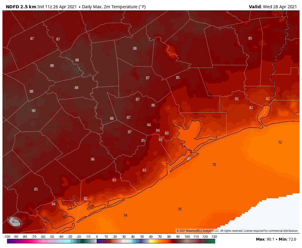
Wednesday
Another day with a breezy flow off the Gulf of the Mexico. It’s possible there will be some breaks in the clouds on Wednesday, and if so this will allow temperatures to climb into the mid- to upper-80s. This likely will be the warmest day of the week, and for now at least rain chances should remain about 10 percent or less. Lows will again be warm.
Thursday and Friday
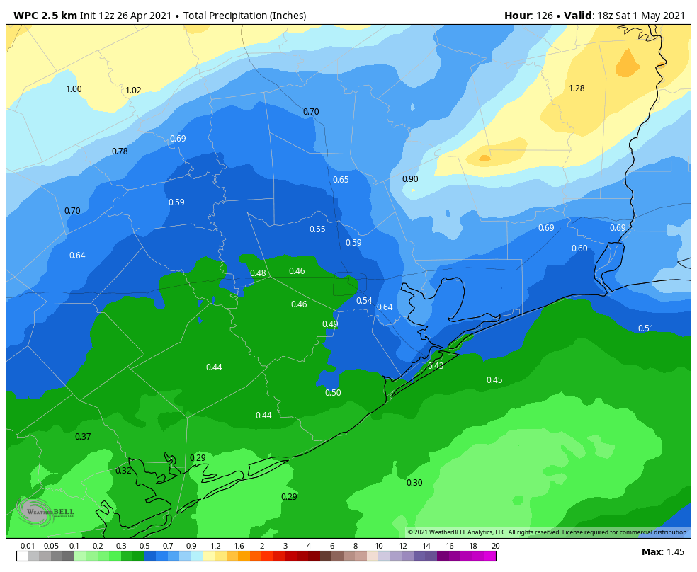
A front will approach the region on Thursday and should cross the area by Thursday evening. This front will bring a healthy chance of showers to the region. Right now accumulations for most areas will probably be in the one-tenth to one-half inch range, with most rain during the daytime on Thursday. Highs on Thursday should be in the low 80s. Some rain chances will linger on Friday, but any accumulations should be very slight. Friday will see partly sunny skies and highs in the upper 70s.
Saturday and Sunday
For now, we think Houston will see a drier pattern this weekend, with at least partly sunny skies. As we enter May, it’s difficult to beat highs in the low 80s with moderate dewpoints. We can’t entirely rule out some rain chances, at least not yet, but overall the weekend forecast looks promising at this point.
All of us MS-150 riders on Saturday would appreciate it if you could work some magic for a nice S/SSE breeze on Saturday morning. Please – nothing from the north. Thanks. 😂
Would love an Ms150 forecast if at all possible.. Multiple starting locations with Katy, Waller, Todd Mission, La Grange all flowing to College Station. Wind very important 🙂