Good morning. Houston should remain in a drier pattern through the first half of the weekend—Friday evening through Saturday morning looks especially pleasant—before much wetter weather arrives by Sunday. As tropical moisture increases, so will rain chances, and we’re tracking the potential for heavy rainfall from Sunday night through the early part of next week.
Thursday
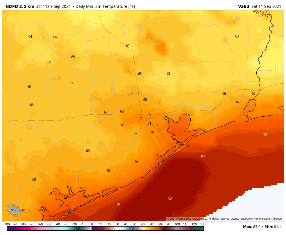
The next weak front is located north of the metro area, but should slide into the region today. There will be a subtle shift in winds from the northwest to the northeast, but skies should remain sunny regardless. Accordingly highs will be toasty today, likely reaching the mid-90s, with the possibility of a few locations seeing the upper 90s. Lows tonight will drop into the low 70s in Houston, with the potential for upper 60s further inland.
Friday and Saturday
This looks like a pretty stunning period, at least as September goes, through about Saturday evening. The driest air should push into the region on Friday, with the potential for dewpoints to drop into the 50s. Expect daytime highs around 90 degrees, with sunny skies, and lows Friday night in the upper 60s across much of Houston.
Saturday night through Monday
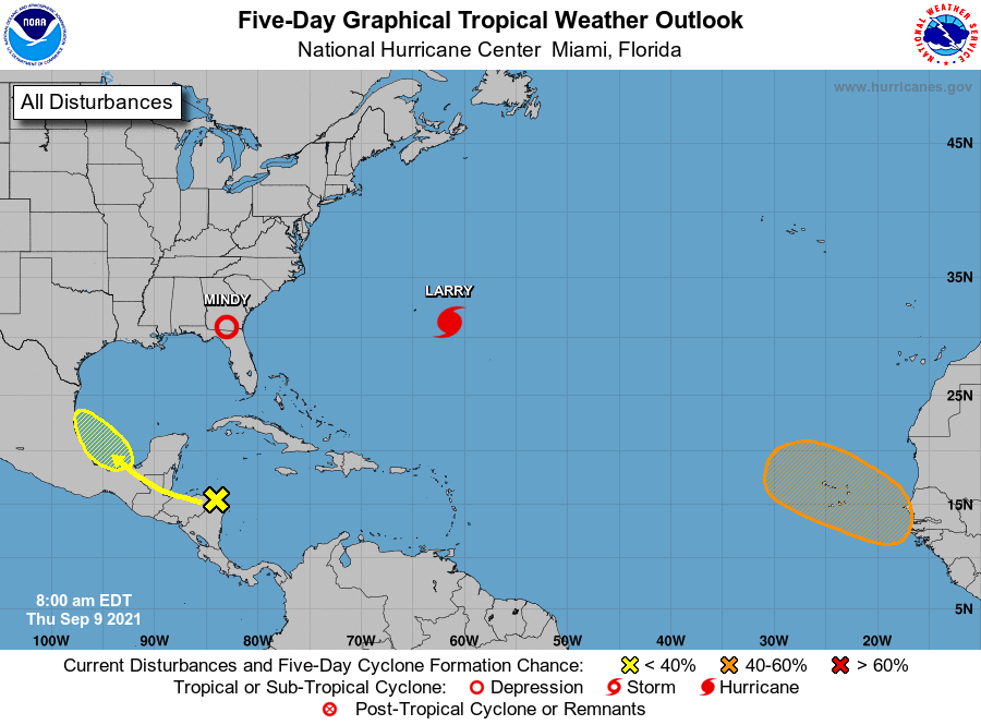
The period turns sharply wetter with the arrival of tropical moisture beginning Saturday night or Sunday morning. The overall threat is still not particularly well defined, but a tropical wave should move into the southern Gulf of Mexico this weekend, and associated moisture will push into the Texas coast. The forecast models are hinting at some significant rainfall totals from this, especially for locations closer to the Gulf of Mexico. For now, as a guess, we’re probably looking at rain totals of 3 to 5 inches south of Interstate 10, with lesser amounts inland through early next week. Our main concern is the potential for higher localized rain totals. It’s impossible to say where that will happen, but the potential is there.
After Monday
A fairly wet period should persist into the middle of the week, with sunnier weather potentially returning by Thursday or so. Until that time highs will only be around 90 degrees, with muggy nights in the upper 70s. Those deliciously low dewpoints will be long gone.
Tropics
It’s September 9, so as usual there is a lot of activity in the tropics. But for the western Gulf of Mexico we need only concern ourselves with the aforementioned tropical wave. This feature, which we’ve mentioned several times this week, is now given a 30 percent chance to develop into a tropical depression or storm by the National Hurricane Center. The most likely outcome is that the system will move into the Mexico coast, or possibly south Texas, but we can’t entirely be sure of that yet. In terms of the overall rainfall threat early next week, it probably won’t matter too much.
I’m enjoying the drier air while it lasts – having this in early September is like having an early Christmas gift. Sir, may I have another?
Happen to be in Hempstead this morning. What a nice morning–almost cool at around 8:30AM.
This has been some nice late summer weather, I have been trying to get outside as much as possible. Hoping that there won’t be too much rain next week. That’s the last thing that we need. Trees have been toppling quite a bit.
Thanks for always being Pro’s at what you do. One question I have, is could you add a daily comment on air quality. As you know I am disabled with pulmonary hypertension, which highly restricts my ability to breath, even with supplemental oxygen. I enjoy reading your reports as do others with pulmonary problems. By doing this, you would be greatly appreciated.
With great respect,
Lew