Matt here with a special Friday evening update for you, Houston. Yes, the late afternoon run of the GFS operational model showed a significant tropical system crashing into the Texas coast. Some of us in meteorology refer to this as the “happy hour” run of the GFS. I’m going to walk through a pretty basic forecasting approach to whether or not I would put much (any?) stock into the GFS operational model.
The model run
If you’re curious, here it is:
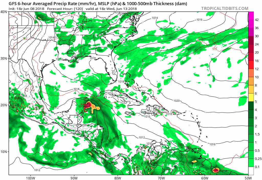
No, you should not worry about it.
The trends
Why am I saying that? If you look at the last 10 runs of the forecast from this very same model valid for next Saturday night, today’s is the first to show a storm in Texas.
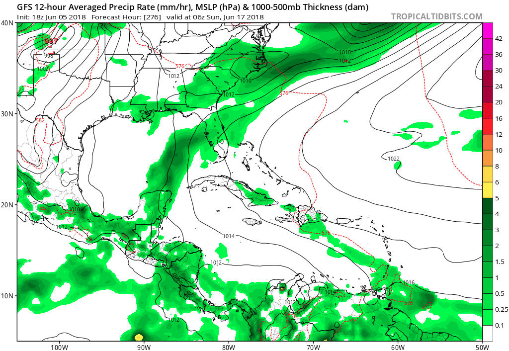
Sure, the last couple runs have trended closer to Texas, but this model is volatile. It’s going to bounce around a lot. I’ve been watching this model for 15 years now. This isn’t an abnormal thing it does.
The ensemble
On top of all this, let’s look at what the GFS Ensemble shows for this same exact timeframe. The ensemble is still basically the GFS model, but it’s run multiple times with some tweaks to the model each time. The intent is to offer you more of a “spread” of possibilities in the forecast. Good forecasters use ensemble based forecasting techniques to help them craft forecasts. I’m focusing on one particular variable here: What each ensemble member shows for sea level pressure centers. Each circle I’ve added to this map is where an ensemble member places the center of something (tropical storm, hurricane, plain old tropical disturbance) next Saturday night.
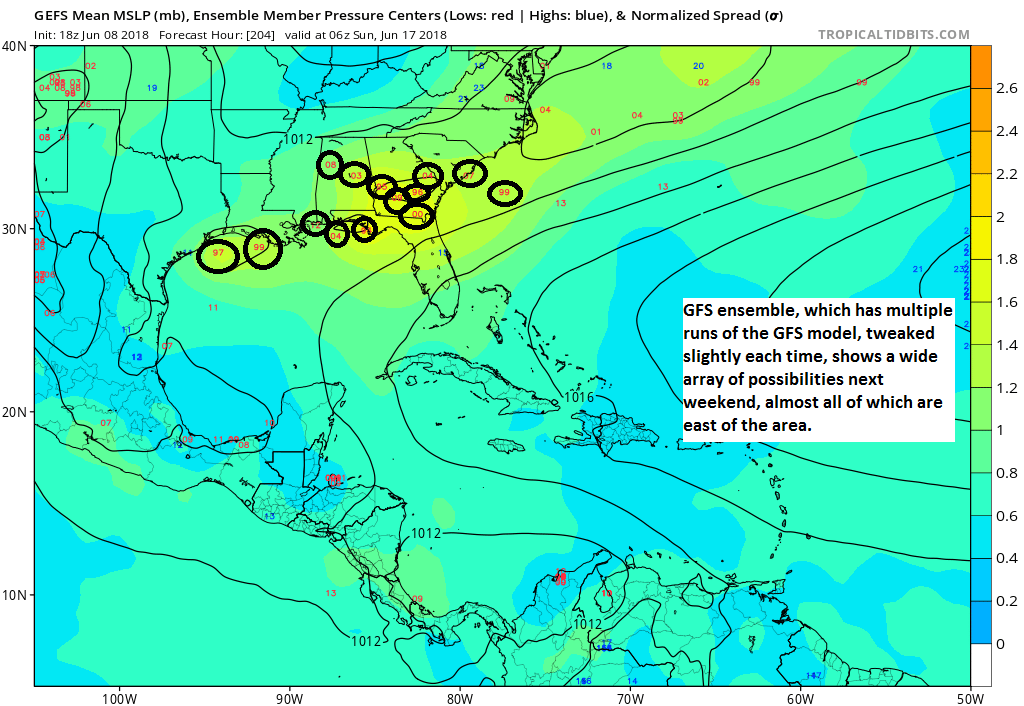
So even the GFS model’s ensemble is saying that the operational model is probably a.) much too strong and b.) too far to the west.
Sidebar, the maps above are from Tropical Tidbits, which is a great site I use. If you’re into veering into the weather weeds, it’s worth perusing. By the way, the owner of that site is a hurricane researcher at Florida State University. He had this to say about that GFS model run:
While an upper trough may generate a surface trough near Central America next week, the Day 6-7 GFS in the Gulf of Mexico is not worth paying attention to, unless more reliable guidance moves that direction over the next few days.
— Levi Cowan (@TropicalTidbits) June 8, 2018
The other models
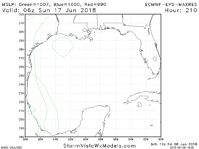
Everyone loves the Euro, so I’ll just tell you, it doesn’t show this solution. What about the European ensemble. That ensemble contains 51 different members. All of one of them, shown below via another good weather model site, StormVista, has a closed off low pressure under 1007 mb (weak) next Saturday night.
There are other models we can look at, but truthfully, none is really reliable enough at this point to utilize with any confidence.
So what should I expect, then?
Here’s what we *do* know.
Based on forecaster experience, the GFS tends to grossly overdo tropical development, while the European model tends to underdo it. So I think the Euro probably isn’t giving enough credit to potential tropical development in the Gulf late next week, but the GFS is probably way too enthusiastic about it.
In my post this morning, I talked a little about what could happen:
Weather modeling indicates that rain chances should increase a little bit later next week as a tropical wave finds itself in the Gulf. Weather modeling indicates two real possibilities at this point. One is a disorganized, weak system heading toward the Florida Panhandle again. The other is just an increased slew of moisture heading toward deep south Texas (Corpus Christi and the Rio Grande). This could be what’s needed to kick start rain chances a bit more in Texas. With that said however, I am a little concerned it may get directed just a little too far south to really offer the Houston area much relief.
So, my thoughts have not changed at all today, truthfully. Why? I’ve been watching this pattern all week. At my day job, I’ve actually been discussing this setup since last week with my summer intern. If you look about 20,000 feet up in the atmosphere, you see high pressure extending across the Gulf into Texas next weekend.
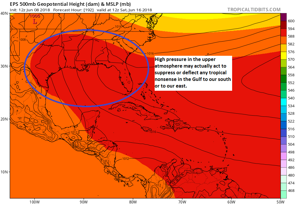
My current thinking is that if this holds up, strengthens further, or a portion of it closes off over Texas and Louisiana, that would likely suppress any developing tropical system near the Yucatan to our south toward the Rio Grande or allow it to move north-northeast within a weakness in the ridge toward Florida. Should this high pressure weaken overall, yes, then maybe we might have to watch the Gulf a little closer. Or it could just be a stream of tropical moisture that finds its way up here and allows us to have daily afternoon showers and storms at a greater frequency next weekend.
I’m not just saying this to dampen hype. I truly believe this meteorologically: I don’t believe that whatever does develop in the Gulf will be anywhere near the scare-icane shown on today’s happy hour GFS model. But as always, we will continue monitoring.
We have plenty of time to watch, should things change. But I’m going to sleep easy tonight, and you should too. Meanwhile, if the gloom and doom posts scare you, it’s a good time to brush up on hurricane season preparations.

Thanks for the update. This is why I’m a faithful follower of you & Eric. Thank you for your no hype honesty!
Thank you for your rational and fact-based analysis, instead of a headline- grabbing spew.
We appreciate the update.
All of us lucky enough to follow you breathe better knowing you’re on watch. Feel bad for the rest still reading the hype. Thanks for all you do.
What a gift you are! I saw the report from earlier and have been checking back all evening, just hoping that one of you was willing to sacrifice your time off for the night to offer us a little peace of mind!
But just to be safe, should I evacuate? I love in Katy.
This is why I wear my Space City T-shirt proudly. Thank you, Matt!
Thank you.
Thank you “scare-icane”…a wonderful addition to the season’s vocabulary!
I applaud your meterlogical lack of hype. I will continue to give you high ratings for that rather than working your readers into a frenzy.
Thank you, thank you and Thank you, we are so very fortunate to have you and Matt!
Thank you, thank you and Thank you, we are so very fortunate to have Eric and Matt! Your intern is learning from the best there is.
About the scaricane. I distinct remember when Rita was heading for the Houston Region; I watched a “Big 4” TV weather person giving a landfall/ track update. She gave the different predicted models and said (this is near perfect quote) “This my favorite track” and rammed a direct line straight through Galveston City to downtown.