After a stunning weekend, Houston will see varied conditions as fronts move back and forth across the area this week. By and large, temperatures will be warmer than the last several days, but not overly so. We’ll also see a reasonable number of rain chances, although we’re not expecting anything at all threatening.
Monday
The story today will be winds starting to blow more forcefully from the south, with gusts up to 20 mph, and this onshore flow will yield more clouds and humidity. Highs will reach the mid-70s. Some very light, scattered rain showers will be possible later today and tonight in response to rising moisture levels. Monday night’s lows will only drop into the mid-60s.
Tuesday
This warmer weather will continue Tuesday as a weak front approaches the region. The front may spark a bit more organized showers, with some thunderstorms possible as the front nears Interstate 69, and as it moves toward the coast. Rain chances should end around noon, with sunny skies moving in behind. Highs will get into the upper 70s to 80 degrees. Right now it looks like the front will stall near the coast, with lows dropping to around 60 degrees on Tuesday night.
Wednesday and Thursday
These will be a pair of warm and humid days, with highs around 80 degrees. Skies will be mostly cloudy and each day will have at least a slight chance of scattered, light showers. At some point on Thursday—shortly after noon, during the evening hours?—a stronger cold front will push through Houston and move offshore. This, again, may generate some slightly more organized showers and thunderstorms, but skies should clear up in its wake with overnight lows dropping into the 50s.
Friday, Saturday, and Sunday
Friday and Saturday should be nice, springtime days, with highs of around 80 degrees, and lows around 60. Skies should be mostly sunny. We have more questions about Sunday, as another front is likely to move through Houston at that time and may produce some scattered showers. For now, however, I’d guess the front’s passage will be a dry one, but we’ll have to get back to you on that one.
We’ve had several questions about weather for Easter Sunday, and I’d love to be able to offer you some kind of helpful forecast. But for now it’s simply too early to say much of anything. The most likely forecast is highs in the 70s, but really it could be anything at this point.
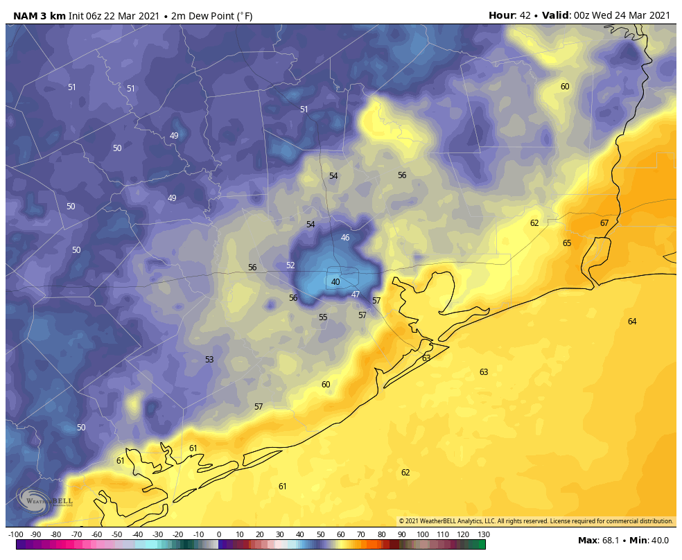
What is causing the NAM model phenomena that is resulting in the drier spot for Houston? Does the model know downtown Houston is there and all the pavement allows dew points to drop faster than surrounding areas? And does this actually happen in real life?