Good morning. A line of thunderstorms associated with a cool front is moving through the Houston region this morning, and these storms are strengthening a bit as they near the coast. For areas inland of Interstate 69/Highway 59, these showers are largely over, and they should clear the coast by mid-morning. These storms may produce briefly heavy rainfall, in addition to thunder and lightning. Please take care.
Tuesday
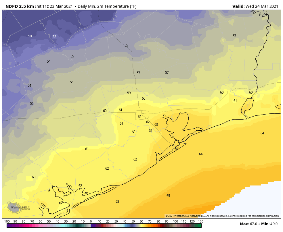
After the storms move through the area, we should see clearing skies. Drier air will follow, reaching northwest Houston this morning, the central city around noon and areas near the coast this afternoon. The question is whether the front itself makes it all the way to the coast, or lingers just onshore. This will have implications for whether places like Galveston Island and Chambers county see sunshine and drier air this evening, or not. Highs for most of the region will reach 80 degrees, and overnight temperatures will depend how far inland you live. The map below shows the forecast for lows Tuesday night.
Wednesday and Thursday
The front will return inland quickly, and as a result we’ll see increasing moisture levels on Wednesday in the atmosphere. This will basically make for gray, warm, and increasingly humid weather for Wednesday (highs near 80) degrees through Thursday morning. Some light scattered showers will be possible during this period. After that we’ll be on the watch for our next front, a bit stronger one. For now it looks like a capping inversion—warmer air aloft that prevents moist air at the surface from rising too far—should limit thunderstorms with this front. But it’s going to be a close call.
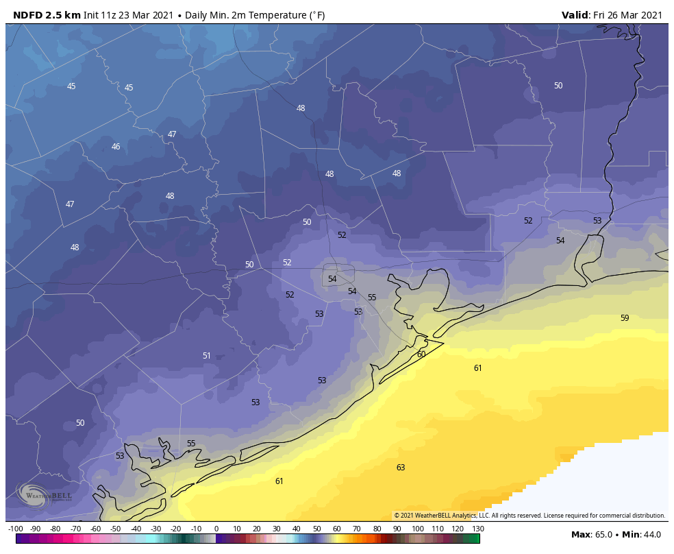
Regardless, it looks like the front will push through during the middle of the day Thursday, with showers ending by around Noon and clearing conditions afterward for most of the area. Winds from the north could be a bit breezy, gusting to around 20 mph. Lows Thursday night should drop into the 50s, with this being the coldest night for awhile.
Friday
Conditions looks quite pleasant for Friday, with sunny skies and highs in the upper 70s.
Saturday and Sunday
The weekend forecast remains somewhat in flux. Saturday now looks warmer and more humid, as the onshore flow resumes, with highs in the low 80s. Skies should be partly to mostly cloudy. Some scattered showers and possibly thunderstorms will be possible Saturday night before the passage of another front. This should set the stage for a sunnier Sunday, with highs near 80 degrees and drier air.
Next week should see a continuation of days with highs of around 80 degrees, and lows in the 50s or 60s.
Getting pretty heavy rain from a thunderstorm right now in the Freeport area.
Why is it so hazy around the area today??