In brief: We have an update on the situation west of Houston this morning. Additionally, we take a look at our lack of rain chances, the increasing heat, and the tropics today, all of which seem typical for late July.
Our thoughts remain with Hill Country and nearby areas impacted by flooding in recent days. While we are grateful at least that the human toll seems to be much less this time around, it’s still difficult to see unfold. This morning’s rains are to the west of the areas impacted yesterday, with numerous flood advisories and some flash flood warnings posted for places south of San Angelo.
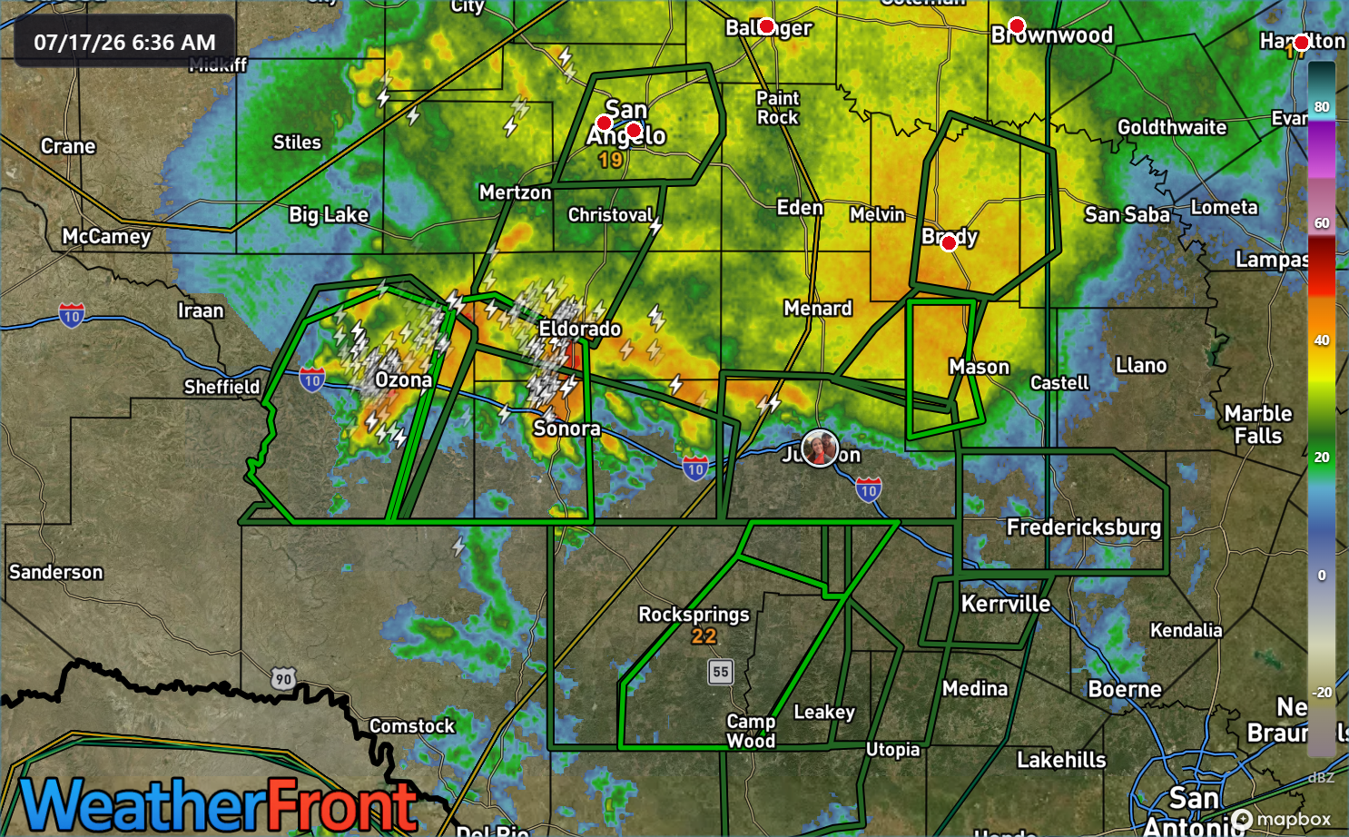
This includes Ozona and Sonora, where 3 inches or more of rain has fallen overnight. Another inch or two is possible in some of these areas, so flash flooding remains a distinct possibility through midday.
No more chasing waterfalls
The wet pattern that Texas has been dealing with will finally exit the state this weekend. Locally, this means that our rain chances will remain quite miniscule over the next several days.
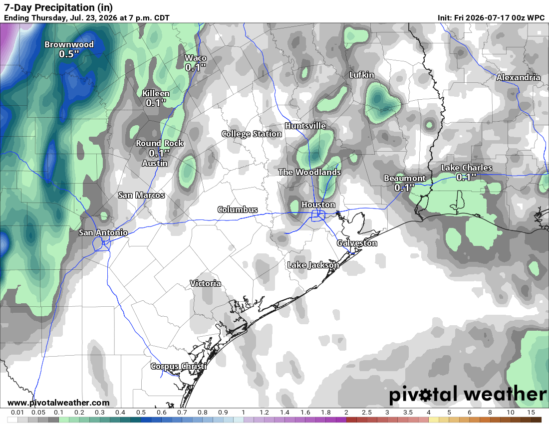
In fact, we may be lucky to see any rain at all over the next week. I don’t think we’ll hear a ton of complaints about this.
But the heat starts to creep creep
With rain chances in the proverbial gutter, this means that temperatures are going to begin to increase. On top of that, these temperatures will get a little bit of a boost as upper atmospheric high pressure flexes over Texas early to mid-week next week.
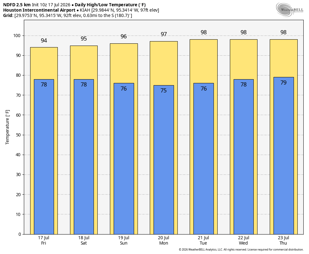
This means that temperatures, which jumped back into the mid-90s yesterday will probably stay there for a couple more days and then slowly trend toward the upper 90s. By the time we get to Tuesday or Wednesday, we could possibly be making a run closer to 100 degrees, but that’s still a bit of a longshot I think. Recent rains and wet soils will probably tamp down heat a little bit. Atmospheric moisture will be on the low side, but the humidity will still probably be elevated, as it typically is approaching August.
Somethin’ You Wanna Know
We’ll close with the topic of tropics.
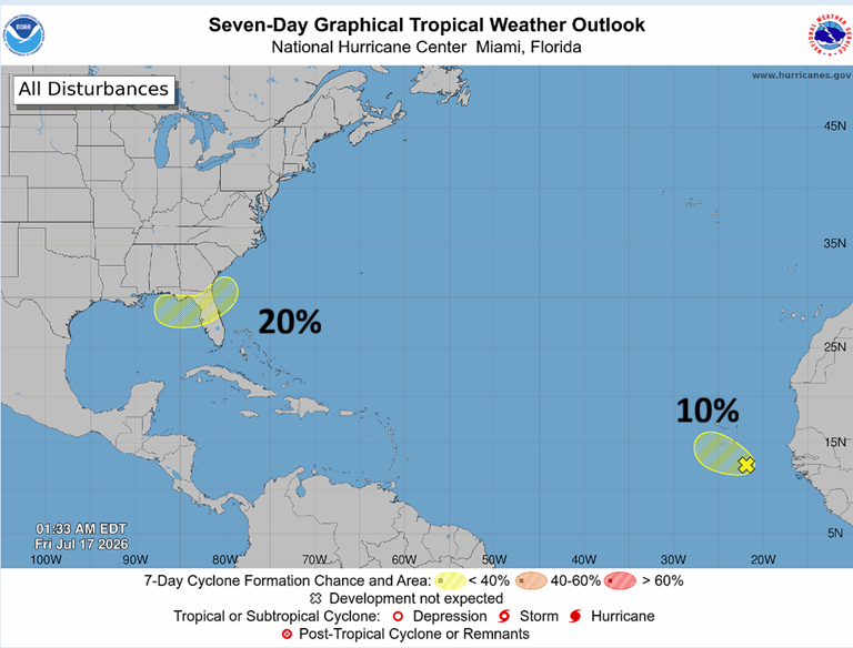
The NHC continues with a 20 percent area in the northeast Gulf. This area, if it did develop, would likely be a lower-end storm and either hug the Gulf Coast or push east into the Atlantic. The other area in the deep Atlantic with a 10 percent probability of development is likely to be torn apart by wind shear later this weekend. In other words, we’re in pretty good shape. Let’s keep it going.
