Good morning! I want to thank the teachers at Seabrook Intermediate, and the science program led by Rebecca Rolater, for letting me judge their annual science fair on Monday. It’s been an incredibly difficult year for teachers, so it’s great to see them persevere through the pandemic, and always uplifting to see the creative ideas kids have for projects. It gives one hope for the future. Now, on to the weather…

Tuesday
Temperatures have generally dropped into the upper 30s to low 40s across much of Houston this morning, and we’ll continue to see pleasant, sunny weather for a few more days as high pressure dominates. Expect high temperatures today to reach around 70 degrees, with light westerly winds. Temperatures Tuesday night will be a few degrees warmer for your location than Monday night.
Wednesday and Thursday
Expect more sunshine, and a modest warming trend, as we get deeper in the week, and our weather will begin to change further by early Thursday, as the onshore flow returns. This will begin to bump up our humidity levels. Otherwise, expect highs in the mid-70s both days, with mostly sunny skies. Overnight lows on Wednesday night will be about 50 degrees, and jump up to 60 by Friday morning.
Friday, Saturday, and Sunday
We’re still not all that confident about our forecast for this weekend. We can say that Friday should be mostly cloudy, with highs in the 70s, and some decent rain chances during the daytime and overnight hours—much of the area could see 0.25 to 0.75 inches of rain. However, we’re still not certain of what happens after that.
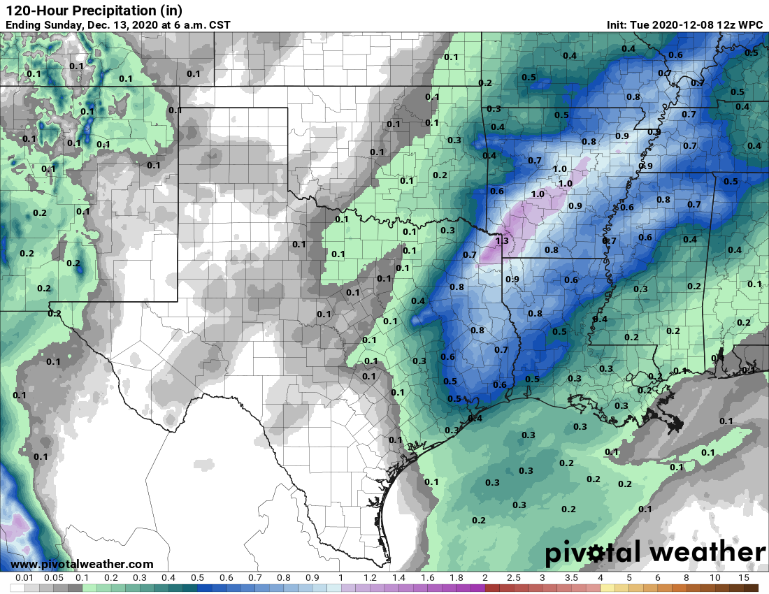
It’s possible that a front will barrel all the way into Houston, and off the coast, drying the region out by Saturday morning. Or the front could get hung up northwest of, or on top of Houston. This would lead to continuing moderate rain chances and warmer conditions on Saturday for much of the region. This front, or a secondary push of drier air, will eventually make it through and off the coast, so we expect a cooler and sunny day for Sunday, with highs perhaps struggling to reach 60 degrees.
Next week
There is a fair amount of discrepancy in the models about how cold things will get early next week in the wake of the front. For now, I think lows in the city itself will probably get down to around 40 degrees by Monday morning or so. Another front may push through on Tuesday night, to keep the region on the cooler side for a few more days.

I’m contemplating washing my car whether it needs or not on Thursday or Friday morning.
What is the weather predicted for Christmas?
Thank you for being a Science Fair Judge! My daughter goes to SIS and she worked so hard on her project this year! 🙂 We love the Seabrook Intermediate “shout out” in your column today.