The fog lifted and temperatures exploded yesterday afternoon. Houston managed to hit 79° officially, just a little shy of the record of 81° set back in 2012. This is our fifth day above 75° so far this month. We did eight of them last December, but most came in the final 10 days of the month. We should add at least one or two more warm days to the record this week before a pretty significant dose of winter cold brings us back to reality.
Today
Spectacular. We try not to editorialize the weather too much, but it’s tough to argue against today’s weather by almost any objective metric. I expect today to be a chamber of commerce special, with ample sunshine and just a few high clouds. Temperatures again should reach for the upper-70s. Dewpoints today will be 15 to 20 degrees lower than yesterday meaning drier air is in place. If we hit 79° again this afternoon, it will feel a whole lot nicer than the 79° we hit yesterday.
Thursday through Saturday morning
Our foray into near-ideal weather will end abruptly on Thursday. We could start the day with areas of fog back in the picture. If we don’t, they’ll return with force Thursday night I think. Humidity should skyrocket on Thursday as onshore flow returns. It might be cool and damp Thursday morning, but it will finish downright humid. There could be some showers around on Thursday, but I don’t really foresee anything too substantial and rainfall accumulations should be minor.
Temperatures will start Thursday in the mid-50s and warm into the mid or upper-70s on Thursday afternoon. We may not see temperatures drop very far on Thursday night. The best we’ll do is probably around 65-70° in much of the area, with some places perhaps not dropping below 70° Friday morning. Fog and some isolated showers will play games with temperatures on Friday, leading to perhaps mid-70s. With enough sunshine 80° can’t be ruled out however.
Our next cold front will approach Friday night — or Saturday morning. The timing has slowed down by at least six hours since yesterday and it now appears we won’t see much rain til after midnight Friday night into Saturday morning.
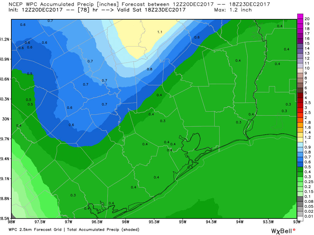
We could have some thunderstorms with the front as it passes also, but as of now severe weather is unlikely. Behind the front, somewhat cooler temperatures will pour into the region.
(Space City Weather is brought to you this month by the Law Office of Murray Newman)
Saturday afternoon through Sunday afternoon
It should start off cooler on Saturday, with lows in the mid-50s or so in much of the area. We should see slow, gradual clearing on Saturday afternoon which will allow temperatures to warm to the upper-50s or about 60° or so.
On Christmas Eve, expect partly to mostly sunny skies. There’s a pretty large spread in possible temperature outcomes for Sunday. AM lows could be between the lower 40s and lower 50s, while daytime high temperature possibilities range from the low or mid-50s to the low-60s. This has been a sticking point on the models for a couple days now, and we’re not a lot closer today. This likely has to do with cloud cover issues, as well as details with the cold air arriving. The good news is that the models all seem to agree on dry weather for Christmas Eve. I’d split the temperatures down the middle for now and go with mid or upper-40s for AM lows and upper-50s for daytime highs. We’ll hopefully have this pinned down better tomorrow.
Sunday night and Christmas Day
Our next cold front will reinforce and strengthen the cold air. It should be a dry front, but I’m guessing it will be ushered in with some fairly gusty north winds. As of now, it’s expected to arrive overnight Christmas Eve, basically with Santa Claus, so you’ll have to excuse him if he’s a bit vexed on arrival.
There are a lot of details that need to be ironed out still on how cold it gets. Yesterday, we were looking at temperatures on Christmas morning that should be in the low-30s. Overnight model runs are mixed, with the European model now backing off that and going with low-40s, while the GFS continues the idea of near-freezing temperatures.
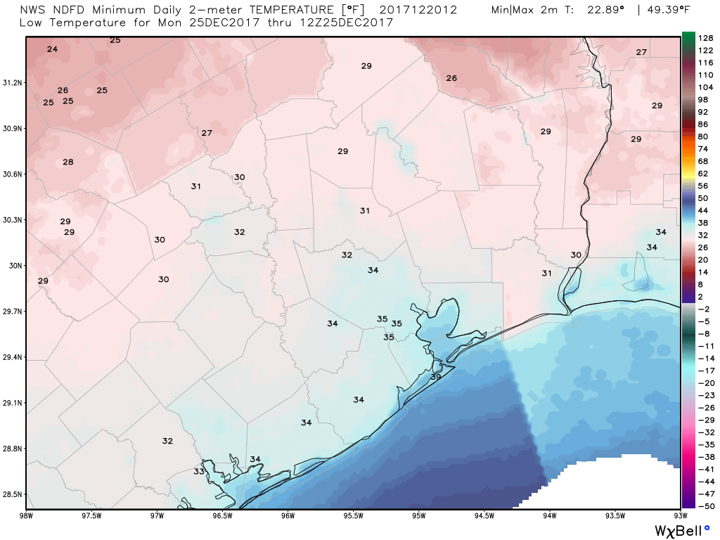
Officially, the forecast leans to the cold side. Let’s see if the overnight European model run shift was a blip or a trend.
The good news on Christmas Day? No travel worries, and all weather models agree with this. So unfortunately, no White Christmas for Houston. With the dry front, it should be mostly sunny, breezy, and chilly Christmas Day. Expect temperatures to top off in the mid or upper-40s for now.
Beyond Christmas, we run the risk of another cold morning Tuesday. I do think temperatures will warm up after Tuesday again, as another Central US storm develops. Once that moves away, it will likely turn cold once more heading into New Years weekend. We’ll have more on that for you in the coming days.
Love your forecast. My cousin linked me up with you during Harvey and I have come to use your forecast for my daily use. Very accurate and no hype. I have told others to give it a try. I live in Beaumont and find your forecast most useful. And I appreciate your sponsors for their support.
Don’t worry, Santa won’t be vexed. In fact, I’d bank on gusty north winds being partly his fault.
I’m actually super excited to have cold, blustery weather for Christmas. I have enough memories of having to run the A/C during Christmas, thank you. No one wants to be in the kitchen with a hot oven or hot dish water. And who wants hot chocolate when it’s 75 degrees and humid??
Btw, the fundraiser t-shirt arrived. Love it.