On Tuesday afternoon some strong storms developed over the central Houston area and then migrated to the northwest, causing temporary street flooding issues near downtown and over the Cypress area. This pattern of isolated to scattered showers and heavy thunderstorms will continue for the next couple of days, before more widespread rain is possible on Friday and through the weekend.

Wednesday and Thursday
Some modest high pressure should limit showers and thunderstorms on today and Thursday, allowing for partly sunny skies and highs around 90, or in the low 90s. Storms probably won’t develop inland until the afternoon hours when daytime heating nears its peak.
Friday through Monday
As pressure fall slightly, and access to moisture from the Gulf of Mexico increases, I expect more widespread showers and thunderstorms for this weekend, and early next week. As we’ve been seeing this week, heavy storms will develop in some areas of town, but not others, so it’s difficult to pinpoint exact rain chances. Still, most of the area should see about one inch, with isolated areas seeing double or triple that, and other areas less.
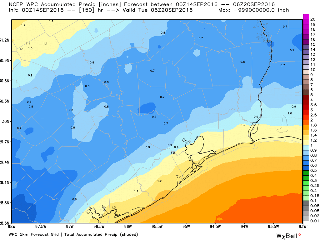
Temperatures will remain dependent upon storm coverage, but I think we can expect highs near 90 degrees, and lows in the mid-70s—basically a continuation of what we’ve had so far this week in Houston. If you’re planning outdoor activities this weekend my best advice is to have a contingency plan, but remain hopeful of getting at least some work or play done outside.
Tuesday and beyond
The Autumnal Equinox comes on Thursday, Sept. 22, but Mother Nature may not be inclined to cooperate. While fronts will begin to build over the middle United States, the upper atmosphere dynamics just don’t favor their ushering a front all the way through the Houston region during the next week or so. Knowing the importance of seeing some cooler air, I’m going to turn the long-rang forecast over to a new meteorologist we’ve brought over to Space City Weather. Please welcome Emo Geo, and his forecast for when Houston might expect its first strong fall cold front this year.
¯\_(ツ)_/¯
Thanks Emo Geo! So there you have it.
Ha ha, you’re funny! Love emo geo…
Great photo
I guess the benefit of being a Houston meteorologist is you don’t have to worry about being trapped by polar bears…
http://www.nbcnews.com/news/world/rescuers-reach-russian-meteorologists-trapped-polar-bears-n648021
Yikes!
You’re only talking about garden variety rain, right Eric? No redux of the Memorial Day floods, right?
Yes
Oil facilities located on the Beaufort coast in Alaska are equipped with barred enclosures (cages) around the entrances to allow an exiting worker to check if there are bears in the immediate area.
How does 2016 YTD rainfall compare to Houston’s wettest year? Is there any part of Texas still significantly lagging in precipitation?
Shelf cloud in the distance?