The good news is that if you enjoyed Monday’s weather we have plenty more days like that this week—warm, but not too warm, with lots of sunshine. Wednesday will be the only real exception to that. Our weekend weather also looks pretty fine if you’re looking for sunshine and drier air.
Tuesday
Any patchy fog this morning should burn off quickly, and like on Monday we should see a transition to partly to mostly sunny skies this afternoon. However, with winds turning to come from the southeast later today we expect clouds to return pretty quickly this evening to make for mostly cloudy skies. Highs today should reach the low 80s for most people, with low temperatures Tuesday night falling to around 70 in the city—lower inland, and warmer along the coast.
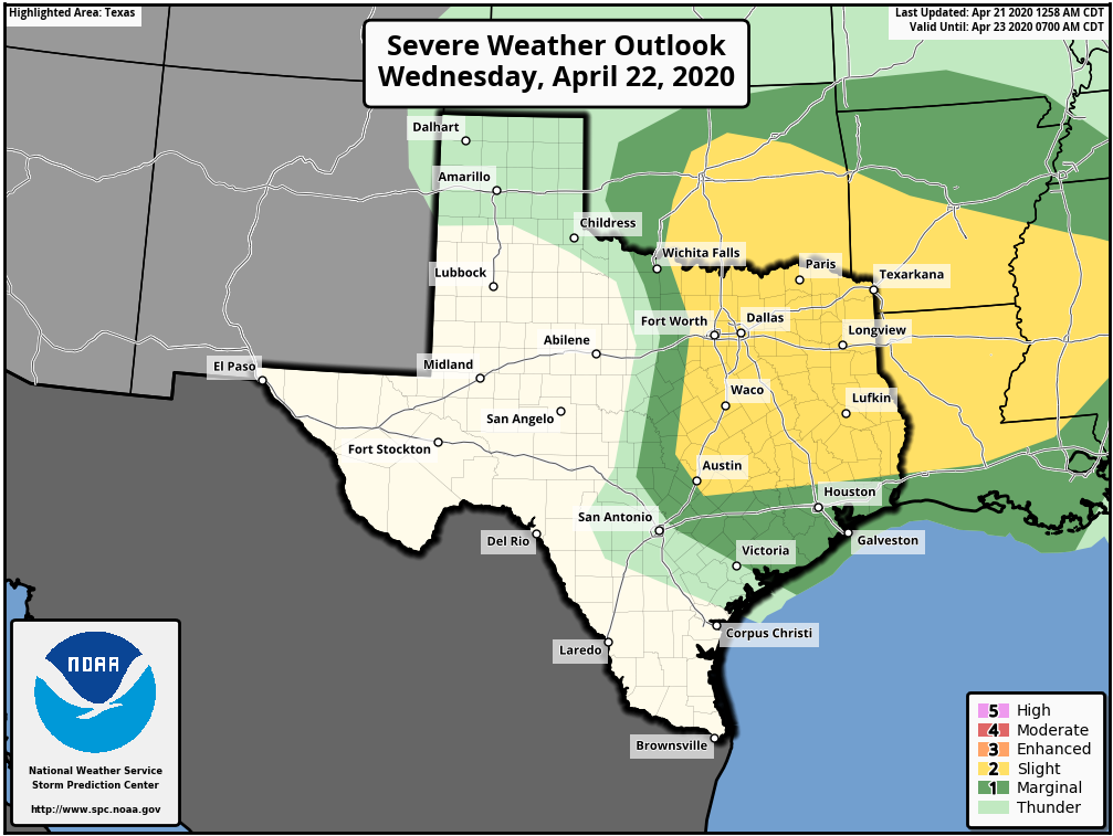
Wednesday
This is the one day this week the potential for some dynamic weather. An upper-level storm system will drop down toward Texas on Wednesday, but the effects look to be most pronounced for north and east Texas, with the Houston metro area on the southern periphery of the action. Models suggest that a mass of showers and thunderstorms will move through Houston during the afternoon or early evening hours on Wednesday, with the better organization north of Interstate 10. Areas such as Montgomery County and points north may see 0.5 to 1.5 inches of rain, while much of the rest of the region sees a few tenths of an inch or less. Highs Wednesday will be around 80 degrees with mostly cloudy skies.

Thursday
The storm system will drag a weak front through the region, but it will bring more dry air than cool air. As a result, expect highs in the mid-80s on Thursday with clearing skies, and lows dropping into the 60s Thursday night.
Friday
As high pressure continues to build we expect full sunshine on Friday, and this should allow highs to nudge up even higher, likely to around 90 degrees in some locations.
Saturday and Sunday
Another front arrives late Friday night or early Saturday morning, and this should set the stage for a pleasant weekend. Look for highs in the low 80s on both days with mostly sunny skies. Lows will also drop down to around 60 degrees on Saturday and Sunday mornings. There’s a slight chance of some showers Saturday night due to an upper-level disturbance, but most of us should stay dry.
Next week
After the cooler weather this weekend, Houston should jump back up into the upper 80s to 90 degrees for several days next week as a more summer-like pattern descends on the city. Spring isn’t over yet—as will be evidenced by this weekend’s weather—but summer isn’t too far away.
Thanks for your expertise! Looking at a very small family wedding on Saturday, 5/2 in La Grange. Anything to prevent an outdoor evening weather? Fingers crossed no rain!
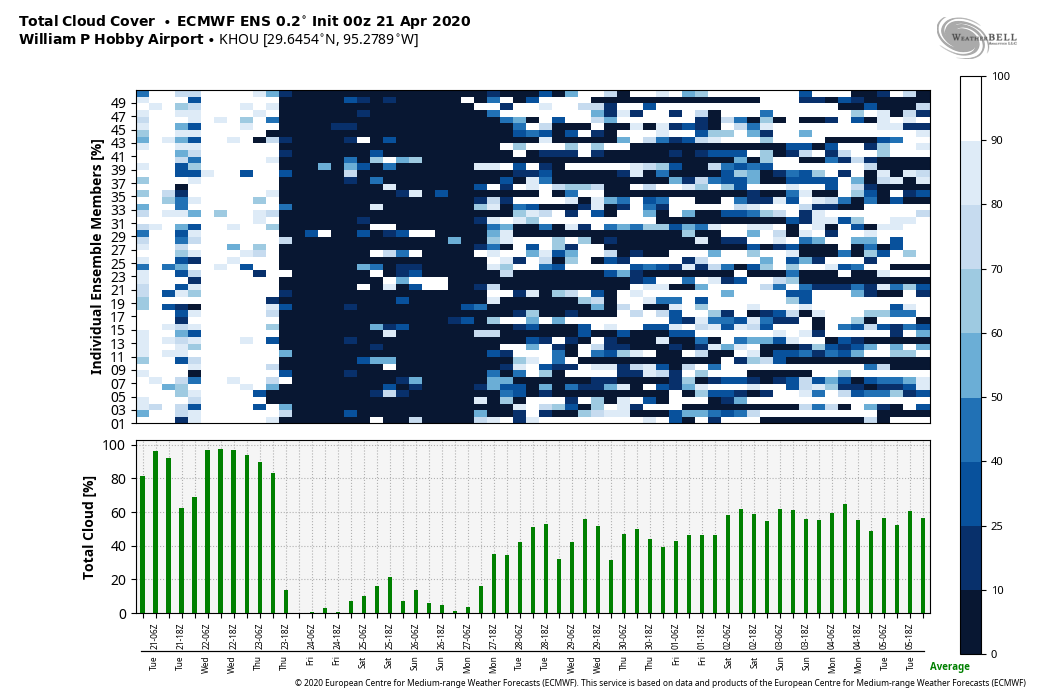
Hey Eric,,,question about that Hobby Total Cloud Cover graphic, the upper blue and white part that looks like spilled paint…dang, forgot my question…sorry for the noise…