Good morning, and welcome to my weekday morning update on conditions ahead for the greater Houston area.
TODAY
Houston will enjoy splendid weather for Election Day after any remaining fog burns off this morning, with a cool start to the day, highs in the upper 70s, and lots of sunshine. Nothing to complain about.
WEDNESDAY-THURSDAY
On Tuesday night and Wednesday we’ll see an increasing return flow off the Gulf of Mexico, and as atmospheric moisture levels rise we’ll see mostly sunny conditions on Wednesday transition to mostly cloudy skies on Thursday. Later on Thursday there will be a slight chance of showers or thunderstorms over Houston. However it appears the really dynamic weather will remain to the northwest of the Houston metro area. Here’s the outlook from NOAA’s Storm Prediction Center:

The light green area delineates areas with a 10 percent or greater chance of thunderstorms, and the darker green area to the northwest indicates a “marginal” risk of severe weather. Any major storms that do develop should be over the north Texas area for the most part.
I don’t anticipate significant rain accumulation in the Houston metro area, with the exception of areas far to the northwest, such as College Station.
FRIDAY-SATURDAY
A slow-moving cold front will approach Houston and probably stall near the upper Texas coast on Friday. This could be the driving force behind more widespread showers.
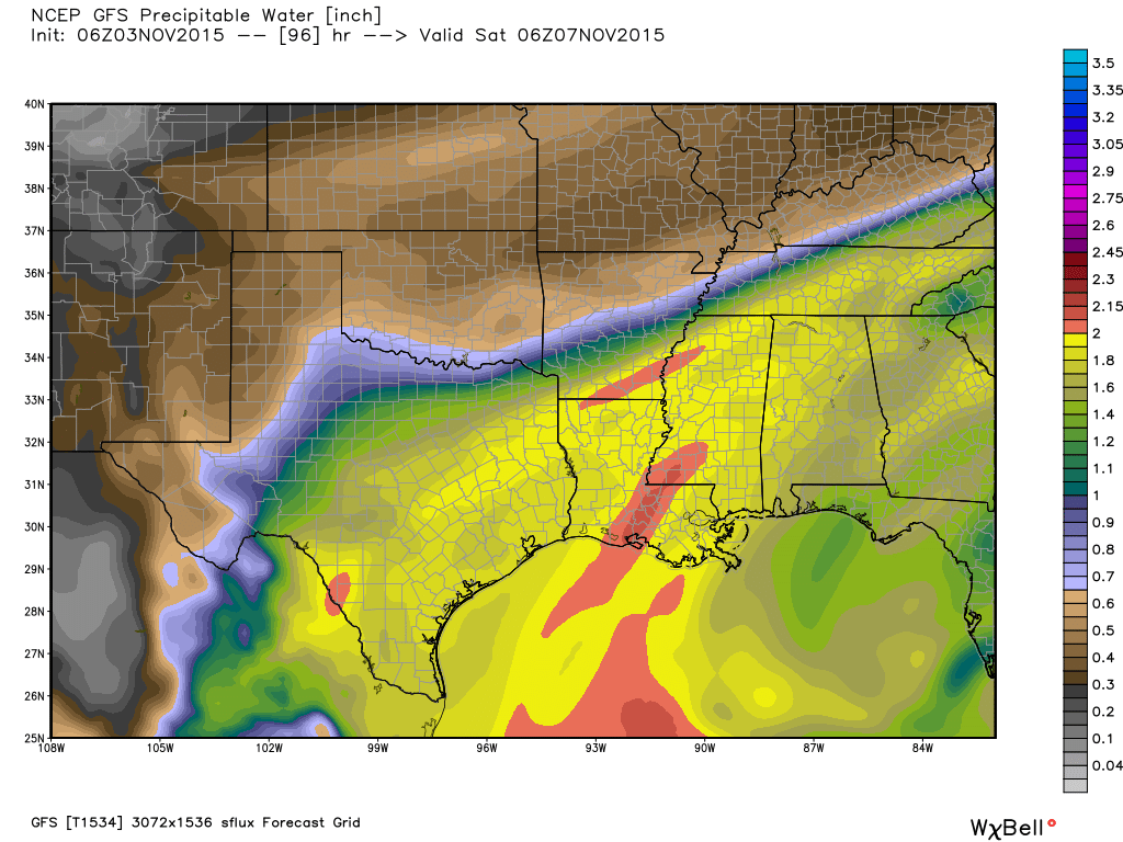
However, despite what you may have read or seen elsewhere, the chance of widespread, explosive rain this weekend is less than the previous two weekends. One reason is that precipitable water values — the amount of “fuel” available for rain — is less. Instead of 2.2+ inches, it is forecast to generally be below 2 inches for the upper Texas coast.
The bottom line is that I expect most of the Houston region to see 1 to 3 inches of rain, at most, during the Thursday through Saturday period. I cannot rule out heavier rain, especially over isolated areas, as slow-moving fronts with lots of moisture can produce significantly more rain than that. However right now this weekend does not look to me like a major flooding event. As I’ve been saying I expect it to be more of a nuisance rain than continual downpours.
SUNDAY
A secondary cold front will push through late on Saturday, so Sunday morning should be a bit cooler, and with drier air. We will hopefully see partly sunny skies later in the day.
Hopefully you’re right. I don’t think our creeks and streams can take much water right now. Aren’t we closing in on a record rainfall total for the year? I know we’re over 75 inches already this year in Fort Bend County.
When do you think we’ll see a significant cool front getting us to daytime highs in the low to mid 60’s and lows in the 40’s? This weather is just too warm for my liking (especially this time of the year). Thanks so much; love the new site.
Amen! All for 60s/40s!