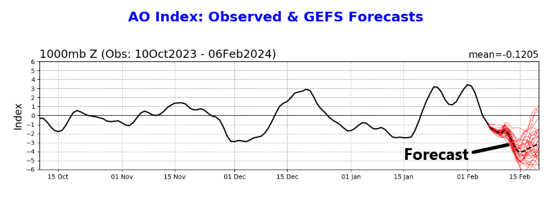
Summary: An area of heavy rain is expected to setup just northwest of Houston on Saturday, while the rest of the area sees mostly scattered showers. Exactly where this sets up will mean the difference between a washout and some nuisance showers. No serious flooding concerns are expected. Another wave of rain passes to our north on Sunday before cooler, drier weather builds in Monday. Most of next week looks quiet before we watch, sigh, more rain risk next weekend.
Today
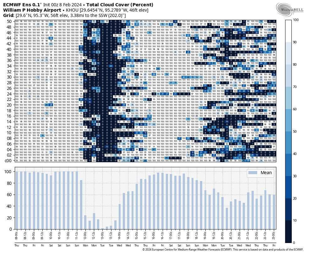
Expect a mix of clouds and maybe a touch of sun today. Some coastal fog may drift in and out through the day, so if you’re down in Galveston be aware of that. Otherwise, much like yesterday a few showers should float across the area today, so you may encounter a brief downpour or two through the day. This seems likeliest north of Houston. Highs should again be in the mid-70s.
Saturday
Time to plan around another wet weekend. At this point it appears that showers will begin to break out just before sunrise south of Houston and lift northward through the city in the early daylight hours. By mid to late morning, we will be watching for basically a conga line of rain and thunderstorms to establish somewhere in the area along a stalled frontal boundary.
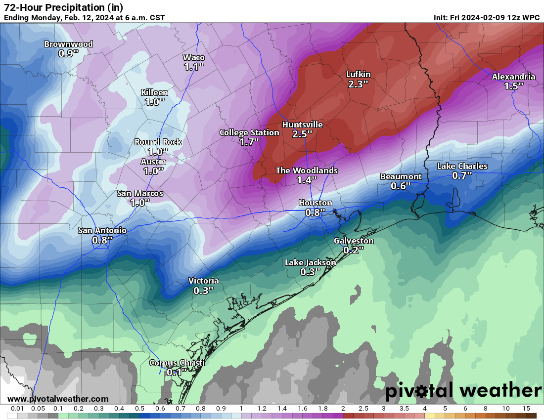
Admittedly, this is a little tricky. Stalled fronts can be a royal pain to try and pin down, but the best data we have at this point says that this line of rain and storms will predominantly focus north and west of downtown Houston. Where will that be? The axis from Sealy through Magnolia through Conroe through Lake Livingston is probably the most likely corridor to see this heavier rain. As of this moment. Could that shift south and east some? Absolutely. Could it shift further north and west away from the area? Absolutely. Under that axis it will be close to a washout. A few miles difference in location could change Saturday’s outcome for a few hundred thousand people. No biggie. So it’s a forecast to watch. But look for that to establish by late morning.
Outside of that somewhat narrow axis, there will be scattered showers or rumbles of thunder. But the day will not be a washout. Galveston for Mardi Gras? Mostly fine. Most areas south of Houston will just see a few passing showers.
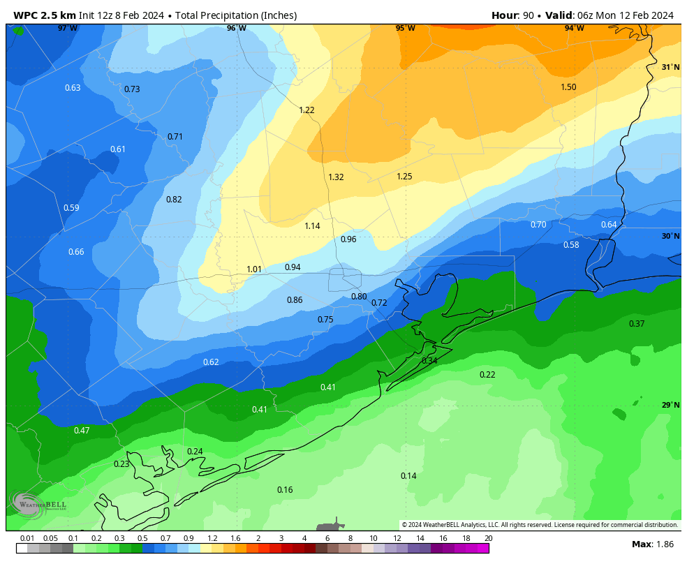
The areas that see the mostly stationary line of rainfall will probably see on the order of 1 to 3 inches. Those outside of that will see varying amounts from a quarter to half-inch or so. Look for a sharp gradient between the have-lots and have-nots. Flooding should be mostly just ponding and the usual trouble spots seeing water. Still, be careful if you are driving north and west of Downtown on Saturday.
Aside from rainfall, Saturday should be a mild day with temperatures in the 60s under the rain and low-70s away from the dreariness.
Sunday
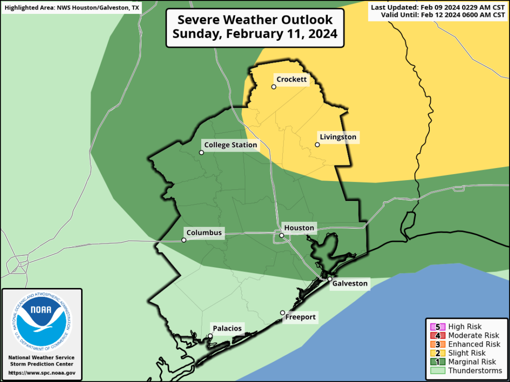
Additional rain or showers will skirt the area on Sunday. Most of this is expected to remain to the north of the Houston metro, so think like College Station through Huntsville or out toward Lufkin. Some thunderstorms embedded in that rain could be strong, and a slight risk (level 2/5) for severe weather exists for Huntsville, Lake Livingston, and Lufkin. Amounts of rain should be more modest Sunday with perhaps up to an inch or so under the heaviest rain and a half-inch or less in most other places. It’s possible that Houston and points south of I-10 see little to nothing on Sunday. Most places should start in the 60s and get one final day in the 70s before next week’s cooler weather.
Monday
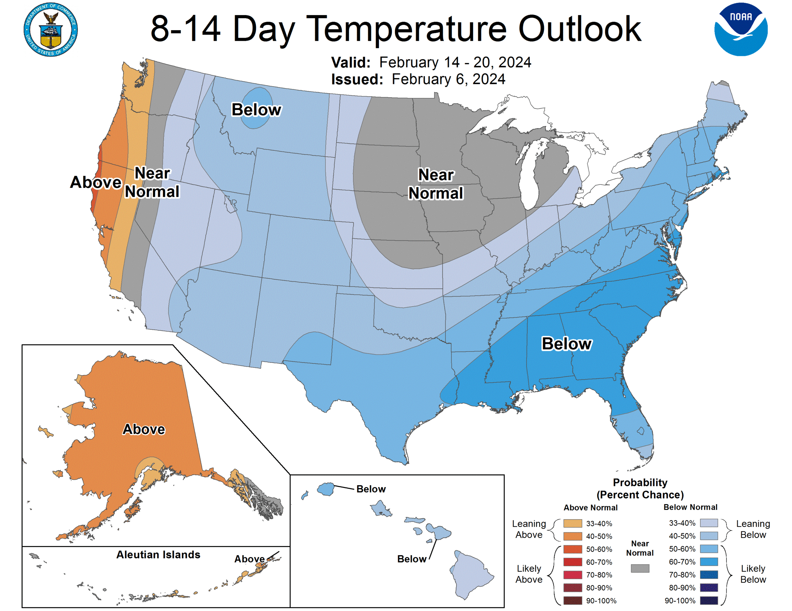
After several warmer days this week and weekend, Monday will be a bit of a stark change. We should see a good deal of sunshine Monday, but with a chilly, gusty northwest wind pulling down cooler air, we’ll only top off in the mid-50s after a morning in the 40s.
Tuesday through Thursday
Temperatures will bounce back into the 60s on Tuesday and perhaps upper 60s by Wednesday or Thursday. Morning lows will be in the 30s and 40s Tuesday, 40s Wednesday, and 50s Thursday. No meaningful weather is expected, and we’ll probably a mix of sun and clouds most days.
Beyond Thursday
At this point I think Friday will be quiet, but there is growing potential for another decent rainmaker next weekend. Yes, confidence in another wet weekend is increasing.
When we’re forecasting this far out, particularly with respect to rainfall, we’re just looking for signals, not specifics. But the signal for next weekend has been consistent for the last few days in suggesting rain. We’ll see how that evolves over the next few days. But if you have plans next Saturday or Sunday, I invite you to lodge a formal protest with Eric. We’ll have more on those chances Monday.