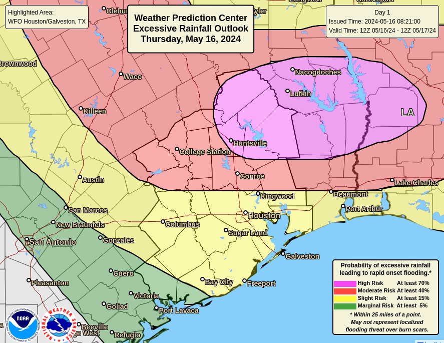
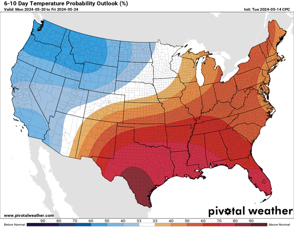
In brief: There will be some showers this morning south and east of US-59 to the coast. Some thunder is possible. No severe weather is expected. The rest of the forecast through Monday and Tuesday is quiet and turning hotter.
We have a few showers southwest of Houston that will push in this morning. The steadiest rain will be south and southeast of the city, areas that saw a bit less action yesterday. We then clear out and dry out for later and tomorrow, Sunday, and Monday. Highs will nudge into the 90s with lows slowly increasing through the 70s into next week.
Trying to make sense of Thursday
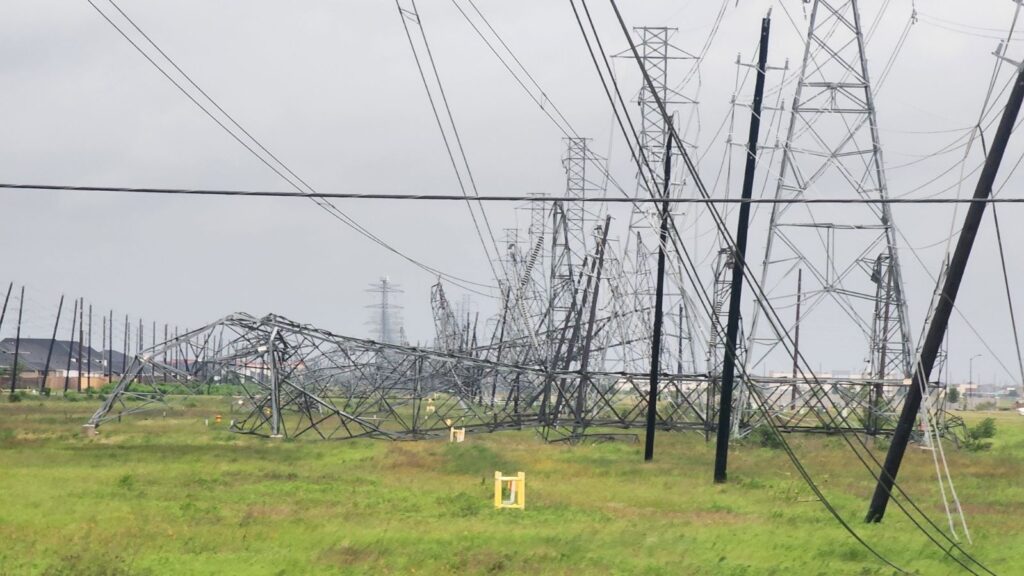
This will be a different post than typical. I want to walk through what happened yesterday from a forecaster’s perspective. About 750,000 customers remain without power this morning, and because of the extensive, widespread damage, this number will very slowly decrease today and tomorrow. Some may be without power until next week.
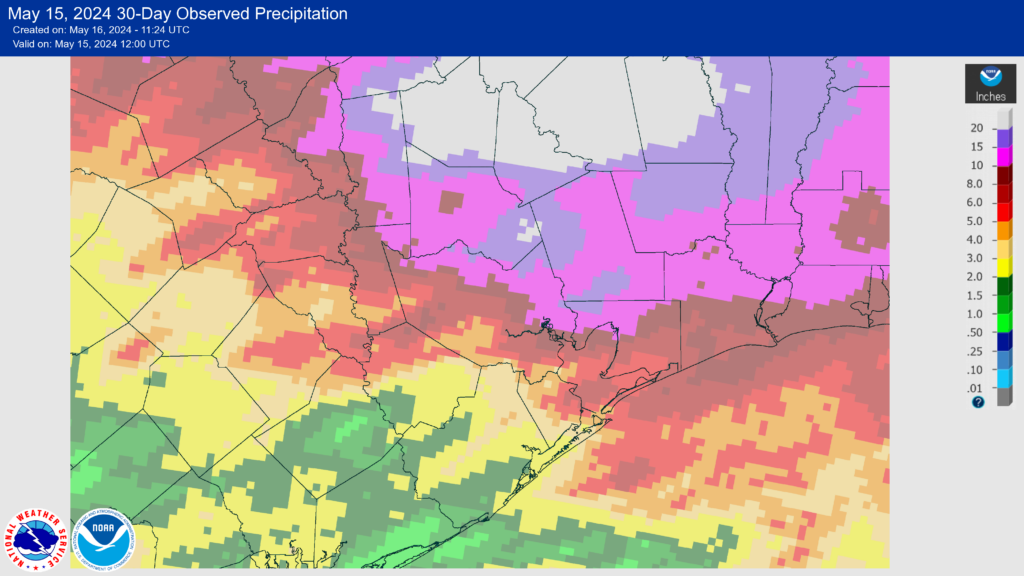
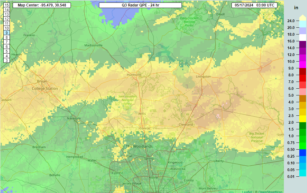
So how did we get here? As a refresh, here is Eric’s post from yesterday morning. We were all really focused on the threat for heavy rain, and with the high risk in place yesterday to our north, that shouldn’t be a surprise. In fact, 4 to 5 inches of rain did fall as expected, basically north of highway 105 through Conroe.
Eric did note the severe weather and correctly underscored the chances of wind and an isolated tornado. The Storm Prediction Center had the right idea on severe weather yesterday too. But again, I think most of us the significant messaging was heavily focused on the rain.
Through most of yesterday morning, not a whole lot seemed to change. Eric, Dwight, and I met up for lunch at a Pappas BBQ but not the one we originally planned on, which, thanks Apple Maps. Or Google Maps. Who’s to say? Anyway, we touched briefly on the day’s weather but were not particularly concerned about anything else happening. We checked radar while leaving and all looked good.
I got back to my desk and noticed a few people pinging me about a Reed Timmer tweet discussing rain-wrapped tornado potential in southeast Texas. Reed’s a good guy and a very smart meteorologist, but he also has tons of enthusiasm. His brand is to dominate and never stop chasing. My first reaction admittedly was to roll my eyes, but then I checked out the HRRR model, one of our hourly updating high-resolution weather models. Indeed, it lit up with supercells by 2 PM. But it was 2 PM. And there were no supercells.

So clearly it was overdoing it, and it would be necessary to watch subsequent runs to see what changes, as well as radar to observe the evolution of the storms. I decided to look at some other data, and I was surprised to see that despite clouds, haze, and mist (or even a heavy drizzle at times), the atmosphere was extremely unstable over the area.
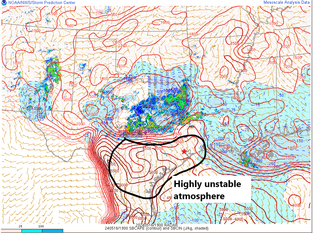
And when you would dig deeper into the models, everything pointed to severe potential. But we also just went through this a few days ago with a major hail threat that basically failed to materialize with any consequence in Houston. In that case, we had the same situation in theory: Impressive instability and an atmosphere primed to rock. As a meteorologist, you look at this two ways: We just came off a semi-bust and you need to make sure you are more confident in something than normal before pushing it, and secondly you also can’t deny that the ingredients were there. A tornado watch was issued, which was a little surprising, though given the parameters there was no good reason to argue much against it.
When I looked at model data, it appeared that any supercell risk would track from the southwest to northeast. I even highlighted a cell around Spring at about 4:25 that I thought was showing signs of trending toward something more meaningful. I went to pick up my oldest from school and came back intending to help him do some homework. Even by about 5:10 or so, it seemed pretty straightforward: A line of severe storms with gusty, maybe localized damaging winds was moving through Brenham and toward Waller County, and we’d probably get it through by 7 or 8 PM and that would be that.

Things began to change quickly about 15 minutes later. It was evident that rotation had begun to develop on the leading edge of the bowing line near Bellville. And it seems likely that a tornado may have been put down just east of there shortly thereafter. That is not necessarily uncommon. It’s often how we get our tornadoes locally, but it’s usually brief and disappears after 5 to 10 minutes. And indeed, the rotation weakened some, but at 5:35, it flared back up again, just west of FM 359 to the east of Bellville. Thereafter, it absolutely exploded near Pine Island and just south of 290 in Prairie View. By 5:40 to 5:45, we clearly had a problem.

I have been in Houston for about 12 years as of this week, and I cannot recall seeing this type of velocity signature (the right-hand panel) show up in this area. When you see this as a meteorologist, it either means a violent tornado is underway, or destructive winds are probable. At times, it looked like you could pick out a debris signature on radar that would essentially confirm a tornado, but it never took off, which led me to believe that this was becoming a major straight line wind event.
I had been texting a bit with Justin Ballard, the Houston Chronicle’s fine meteorologist earlier about the tornado watch. We both expressed some skepticism it would produce. He texted me at 6:07 in the middle of this saying, “Yeah, that doesn’t look like a bad decision after all.” Yes, many of us talk to one another. Yes, we occasionally have opinions on things.
Anyway, this continued to march east-southeast and slowly expand. At this point, it becomes straightforward: Monitor it and warn and clear. I had posted to Twitter in a tone I very, very rarely ever use. I don’t throw around language like “Treat this like a tornado” very often. We had gotten very few damage reports up to that point, but the radar was indicating 110 mph winds down to about 2,500 feet. By 6:23 PM, radar showed 120 mph winds down below 2,000 feet approaching Oak Forest. Does all that reach the ground? No. But a lot of it can. It also made me gravely concerned for the downtown high rises.

We’ll find out more today and tomorrow about specifics on damage and what was a tornado or straight line winds. Whatever the case, this was one of the most ferocious storms I’ve ever seen. This was a smaller scale version of what occurred in Iowa a few years back, when they had 140 mph winds down to about 1,000 feet but over a wider area. Whether or not this gets classified as a derecho will remain to be seen. I think it probably falls just short of that metric because of some discontinuity in the damage report path, but honestly, does it matter? It will take time to pick up from this one, and we hope our readers are safe. A major kudos goes out to the many media meteorologists and NWS meteorologists that assisted in keeping as many people safe and informed as possible. Saving lives is rarely a literal thing for a meteorologist. I am thinking that it was for many last night.
I’ll close with a bit of a sobering note: Hurricane season begins in about 2 weeks. What many of you witnessed last night would be experienced not over a few minutes but over several hours over a large area if a truly potent hurricane found its way into the Houston area. By living in this region, you have to accept the risks associated with that. We know a lot about flooding. Most of us know about surge. Very few knew about wind and what it’s really like. Many do now. Use this experience to inform your preparation for hurricane season just in case. Houston has been through an absolute meat grinder of weather disasters in the last 10 years. Candidly, it sucks, but we should know enough now to prepare for the next one.