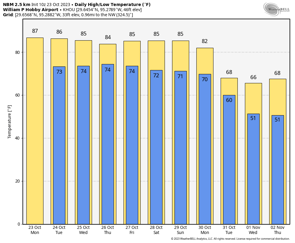
Good morning. Houston faces another six warm days, with some healthy rain chances on Wednesday and Thursday, before a sweeping front drives us truly into fall-like weather. And with the potential for nights in the 40s, it may feel almost winter-like for a few days next week. The timing of all this lines up with Halloween, so I’m still not particularly confident in that forecast yet. But I’ll discuss some of the uncertainties below.
Tuesday
Today should be a sunny and warm day, with a fairly robust southerly flow. Winds probably will gust as high as 25 mph from the south. For most of us, highs will top out in the mid-80s, although a few inland locations may briefly pop into the upper-80s. With a slightly drier flow it won’t be quite as humid as Monday, and rain chances should be essentially zero. Lows tonight drop into the mid-70s for most.
Wednesday and Thursday
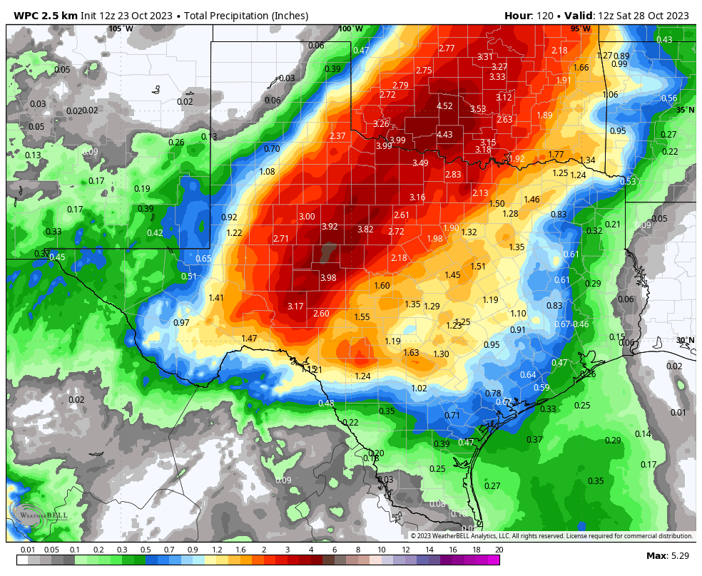
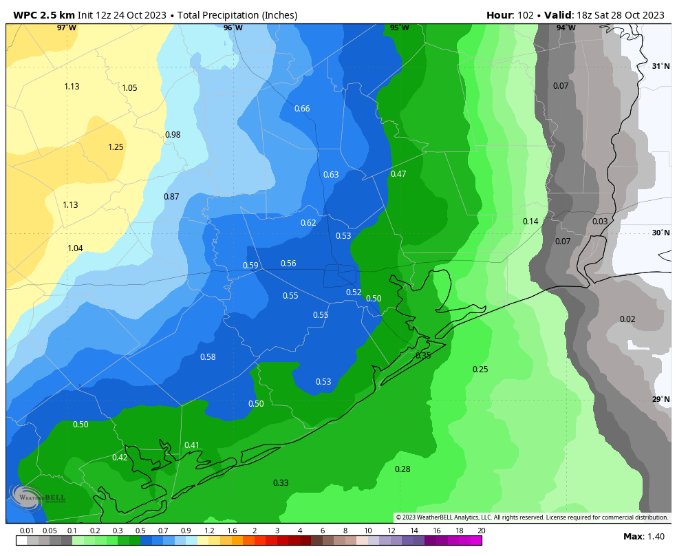
As high pressure eases away from the area we’re going to see a surge in atmospheric moisture levels during the middle of the week. This is a tricky forecast, because this much moisture will tend to support heavy rainfall. At the same time, the most favorable atmospheric dynamics—primarily a forcing mechanism to lift this surface moisture—will lie over Central and West Texas. The bottom line is that I think most of our area will probably get between 0.25 and 0.75 inch of rain this week. However, there is a risk for some areas to receive 2 inches or more, particularly the further inland one lives. Skies, otherwise, will be partly sunny with highs in the mid-80s.
Friday
Rain chances will start to diminish by the end of the week, but not go away entirely. We’re still looking at a warm-ish day, with highs in the mid-80s and partly sunny skies.
Saturday and Sunday
Expect mostly sunny skies this weekend, with highs in the mid-80s. If you’re like me and you’re looking for a time to get in a long training run for the Houston Marathon with low humidity, I’m afraid there are no good options. Dewpoints look fairly high throughout the weekend, so expect humid days and nights, with lows of around 70 degrees.
Next week
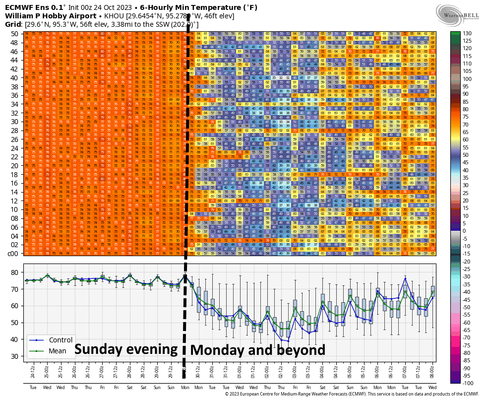
We still have lots of questions about the timing of the cold front, and the amount of Canadian air it will usher into the region. So from here out you’re going to get my best guess. I think the front probably will push into Houston sometime on Monday, possibly during the morning hours. There will be some initial showers with the front. And then it’s possible some light showers will linger into the Monday night and Tuesday morning. However, I do think this will probably end before it’s time to trick-or-treat on Halloween (next Tuesday). We’ll see. At this point I think much of the area will see highs drop into the 60s next week, with lows possibly in the 40s. It’s still a week or more out, so the usual caveats apply.