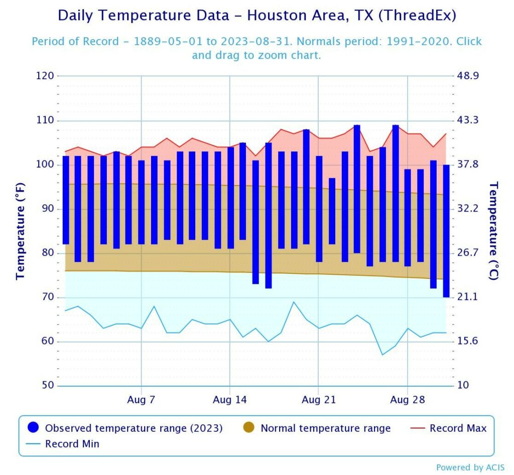
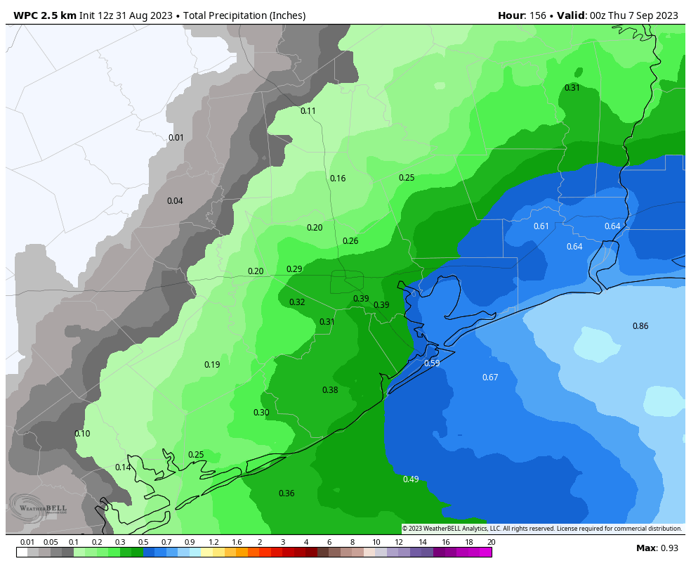
Good morning. After parts of the Houston region received a decent soaking on Labor Day, the region has one more passable chance of rainfall today before the high heat returns through the weekend. And after that? Well, after that I think we’re done with 100-degree temperatures for awhile, and perhaps even for the entirety of 2023, although I’m not ready to stipulate that yet.
Tuesday
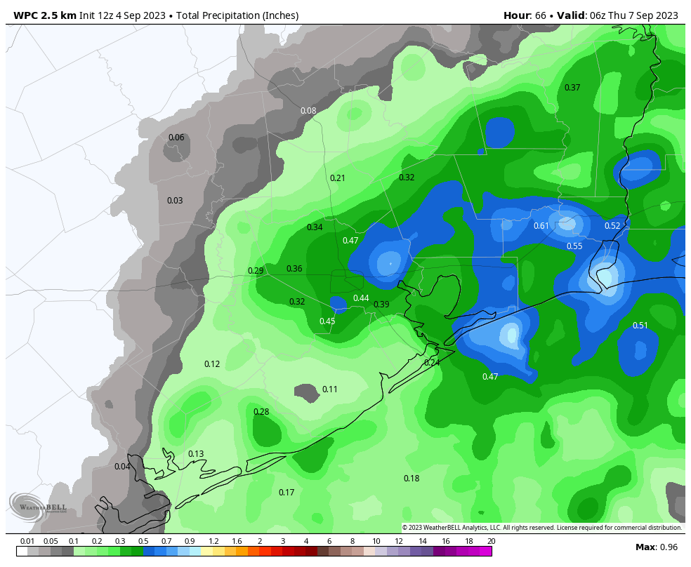
The overall setup today, in terms of rainfall, is similar to Monday. There is plenty of moisture and a decent amount of lift to promote showers and thunderstorms. However, a capping inversion should be a little more pronounced today, and that may limit coverage. The bottom line, I think, is that areas along and east of Interstate 45 probably have about a 50 percent chance of rainfall, and areas to the west about 30 percent.
For the most part these will be quickly passing storms, so don’t expect significant accumulations. Temperatures will depend on the extent of rainfall coverage, but generally we can expect highs to reach the upper 90s with partly to mostly sunny skies. Winds will be light, out of the south. Lows tonight will drop to around 80 degrees.
Wednesday
Skies will be sunny, and most of the area will see temperatures of around 100 degrees. Rain chances aren’t going away entirely, but we’re looking at chances probably on the order of 10 to 20 percent. Winds will be light, out of the southeast.
Thursday and Friday
Who is ready for the return of the ridge? The answer, I realize, is almost no one. But high pressure will indeed build back over the are during the end of the week. This will produce highs of around 100 to the low 100s. This won’t quit be the stultifying heat we saw earlier this summer, but it’s still going to be really, really hot.

Saturday and Sunday
The heat continues, with highs of around 100 degrees each day. However as the high pressure system eases westward it will introduce some slight rain chances, perhaps 20 percent, each day. Skies, for the most part, should be sunny however.
Next week
Hey Eric, didn’t you mention the “end of the worst summer ever” in the post’s title? Well, yes I did. And it wasn’t clickbait, I promise. The reality is that after the surge of heat to end this week, our pattern should shift to a slightly more moderate one that will feel a bit more like late summer. That is to say, for most of next week, we probably will see highs top out in the mid-90s—or even lower if we see the development of some afternoon showers. Which will be possible. The bottom line is that we’re probably looking at a little bit less sunshine, a little bit less heat, and possibly a little bit more rainfall. It’s not fall, but after this week, I think we can close the door on extreme heat for the summer of 2023. Small victories, right?
Hurricane season
Check back on the site around 10 am for a post on what to expect for the remainder of the Atlantic hurricane season, with a focus on Texas.