In brief: The current storms across the region are behaving more or less as expected, and much of the Houston region is getting a good soaking with no major problems. We see one more wave of storms this afternoon before the front moves offshore.
Houston weather status: It’s raining. And it will continue to do so for several more hours.
We have seen a couple of waves of showers and thunderstorms today, with a pulsing up of intensity followed by a break. This has brought some healthy rain totals, with up to 4 inches over the last 24 hours northwest of Houston, near locations such as Cypress. Most other areas have picked up 1 to 3 inches. Pretty much all of the region’s major bayous and waterways remain within banks, so the issue has primarily been one of brief street flooding.
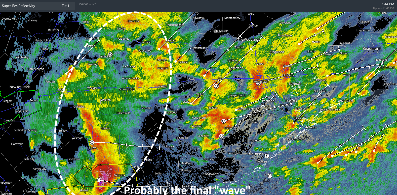
Based upon radar trends and our most recent high-resolution modeling, it appears likely that one final wave will push through the metro area between 3 and 5 pm, from west to east. This could bring an additional 1 to 2 inches of rainfall for some locations, and we cannot rule out some severe impacts such as damaging winds and possibly hail. As this wave should cross our region during the evening commute, please take a little extra care. After this, from approximately 5 to 9 pm, we likely will see some additional light to moderate showers before the mess moves off to our east.
That will be the end of the rain, but it will be replaced by gusty winds from the north-northeast, up to 30 mph in Houston, and perhaps a bit higher along the coast. These gusts should start to subside on Saturday morning, before dying off during the afternoon hours. The weekend still looks splendid and sunny, with chilly mornings and pleasant afternoons in the 70s. Enjoy!
