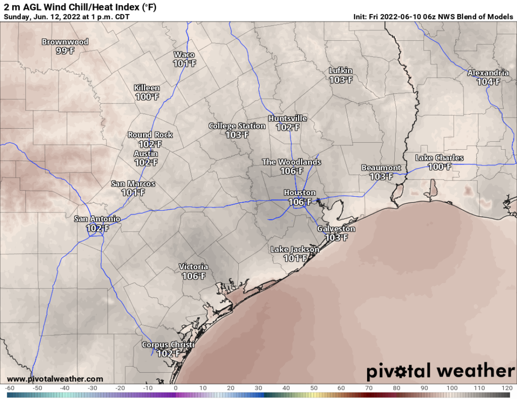
Well, we failed to officially hit 100 degrees in Houston this weekend, instead topping out with a pair of 99s on Friday and Sunday, sandwiching a 98 in there on Saturday. The heat will continue this week, though we’ll likely shave at least a couple degrees off things. That makes your author happy because, conveniently, the Lanza household is dealing with a partial AC outage this morning. Yay.
Monday and Tuesday
More of the same, really. Sun, some clouds, and highs in the mid to upper 90s. Rain chances aren’t zero, but they’re awfully close.
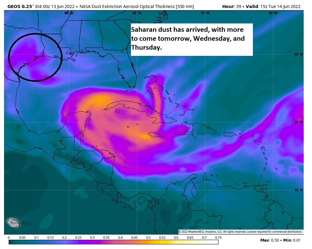
We are already seeing some Saharan dust in the area, and as we move into Tuesday, it will become a bit thicker as another surge of dust arrives in Texas. That may subside a bit on Wednesday morning before additional dust later Wednesday and on Thursday. Look for haze, less blue sky, and maybe some more interesting sunrises and sunsets. Those of you that have respiratory ailments that flare up when these hit should be ready for a couple unpleasant days.
Wednesday
Our next reasonable chance of at least some rainfall comes on Wednesday. If you’re choosing cities for your fantasy rainfall battles on Wednesday, I would probably still skip Houston, but the chance is closer to 10 percent than zero. Look for mid-90s. Southerly winds will continue around 10 to 15 mph, gusting 20 to 25 mph at times.
Thursday and Friday
We have a bit of a mixed bag to close the week. For now, I’d expect temperatures to bounce back a degree or two, with highs in the upper 90s for the most part. Rain chances remain at a paltry 10 to maybe 20 percent on Friday.
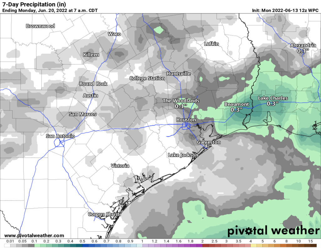
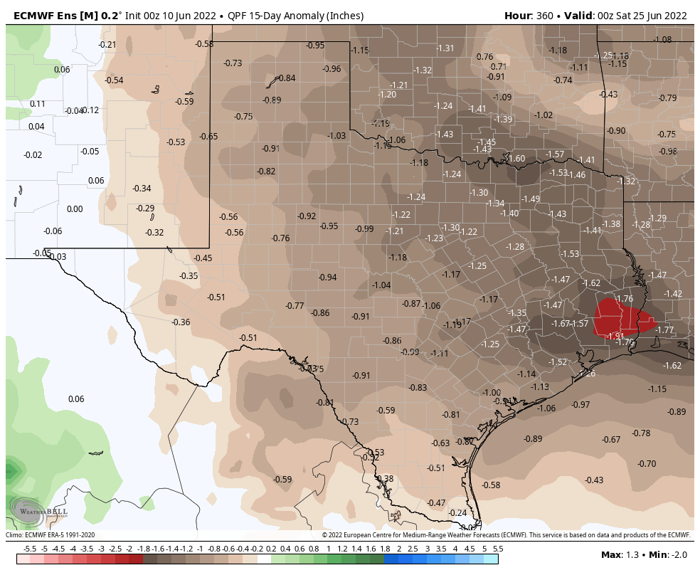
You can see that expected rainfall over the next 7 days continues to look abysmal. That said, I do think a couple locations may do better than what is shown here, so we’ll hold out hope that some of us get lucky.
Beyond Friday
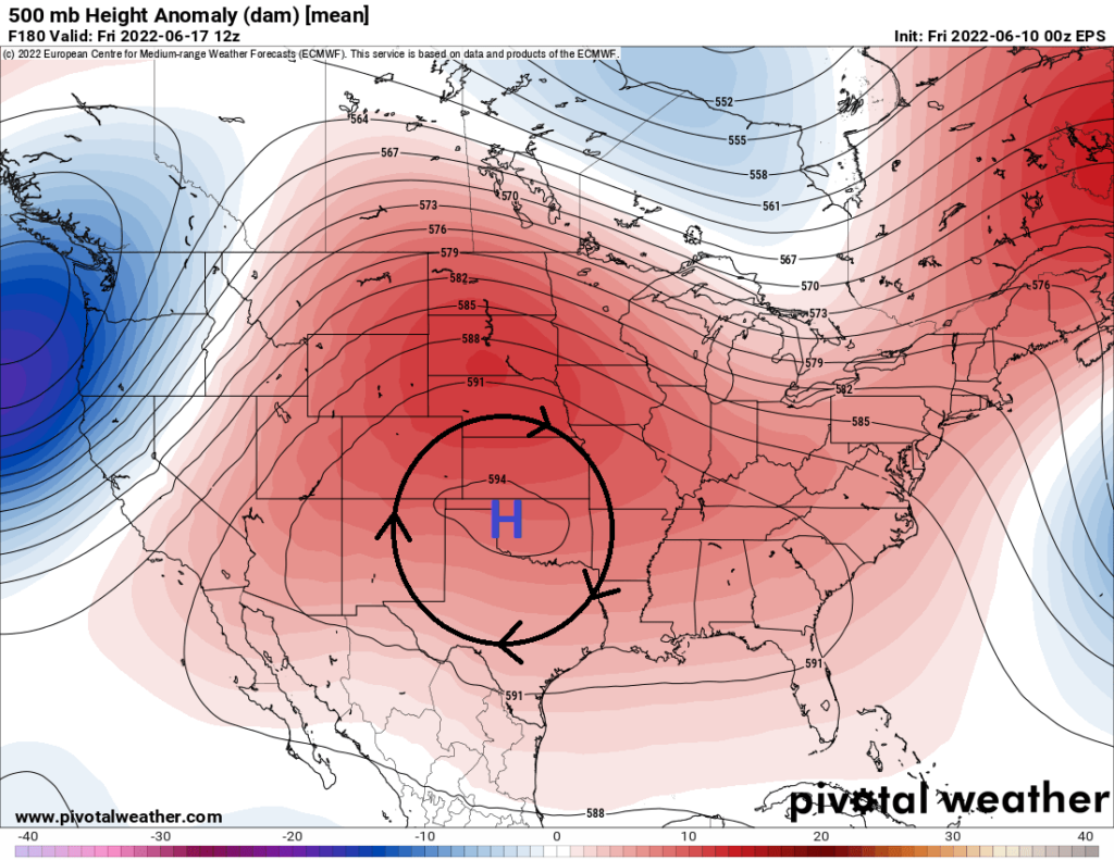
The weekend gets a little more interesting at least. We will have strong high pressure anchored over Kansas, which is a bit farther north than what we dealt with this weekend. This will allow for continued hot weather, yes, but there may be some “noise” that can sneak in underneath the high.
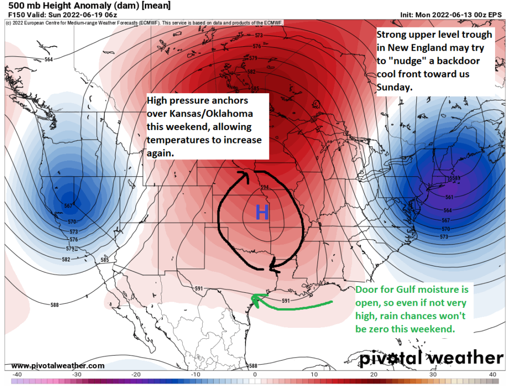
So I would say that rain chances may actually improve a bit this weekend into early next week. There are some signs of a weak “backdoor” cold front trying to slide in from Louisiana on Sunday or Monday thanks to a pretty strong trough in the atmosphere along the East Coast. Whether that gets here or not is TBD, but just having that in the neighborhood may be enough to trigger some scattered downpours at least.
Bottom line: Rain chances look better this weekend, though still not especially high, and it will remain quite hot.
Tropics
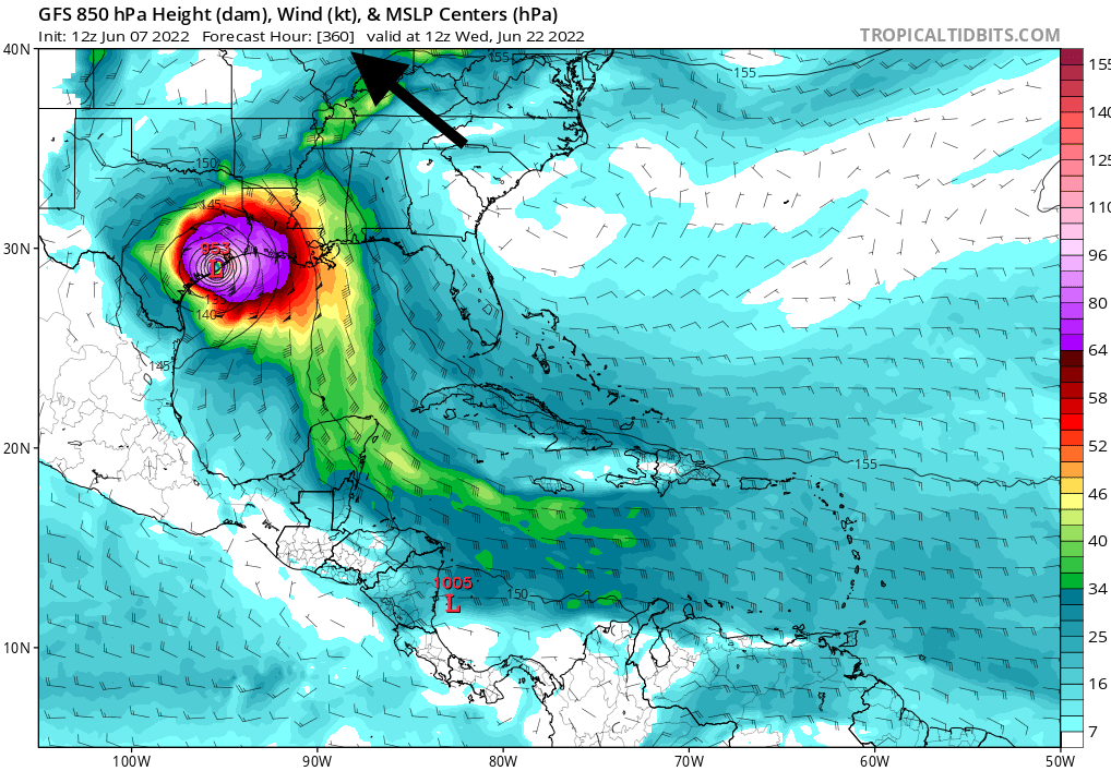
The National Hurricane Center is outlining an area in the western Caribbean for possible development this week.
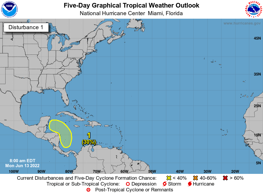
While this probably is something to at least monitor, I don’t think there is a lot of concern about this here. With that very strong ridge over the Central U.S., that argues that whatever happens there will likely stay suppressed to our south. Still, we will keep an eye on things just in case.