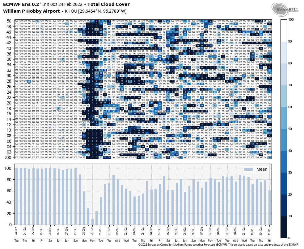
Good morning. Cold, gray weather has descended upon the Houston metro area, and this will be our new normal until at least Sunday. To the northwest of the metro area, in Washington, Brazos, and Grimes counties, there is a winter weather advisory due to light freezing rain. These areas should warm sufficiently above freeze by around 9 am this morning for the threat to lift. For the rest of us the region should simply see cold and cloudy conditions, with intermittent light rain or drizzle for the next few days.
Thursday
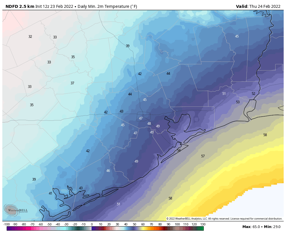
Today will not see significant warming due to thick clouds, so expect highs in the upper 30s for far inland areas to the northwest, the low 40s for places like Katy and The Woodlands, upper 40s for central Houston, and lower 50s for the coast. Some light showers are possible this morning, but overall rain chances are probably less than 30 percent for most of the region today. The potential for some light rain increases a little bit tonight, so there may again be the threat of some light, freezing rain in places like Washington, Brazos, and Grimes counties to the northwest of the metro area. Lows in Harris County, and counties immediately surrounding it, should remain above freezing.
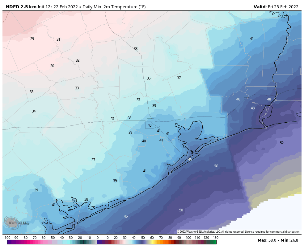
Friday
Expect another cold and gray day. Highs will generally reach the upper 40s for most of the area, with the further potential for some light rain, although for most of us there probably will just be clouds. Friday night will be cold again, but temperatures should be a few degrees warmer than Thursday night, with lesser rain chances.
Saturday
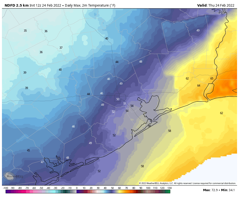
We should see more of the same, with leaden skies and highs perhaps around 50 degrees in Houston, with cooler weather for inland areas. One more system will push through the area later on Saturday and Saturday night, bringing yet another decent chance of light rain overnight, as lows drop into the 40s.
Sunday
As high pressure starts to assert some control over our weather we should see partially clearing skies at some point on Sunday, with highs perhaps pushing into the upper 50s to 60 degrees. Rain chances should end during the morning hours. Lows on Sunday night should drop into the low 40s, give or take, with the clearing skies.
Next week
We’ll see a progression of warmer days next week, with highs probably somewhere in the 60s on Monday rising to around 80 degrees by next weekend. Skies look to be partly sunny, with no major issues to look out for at this point. This could be the transition from winter into spring.