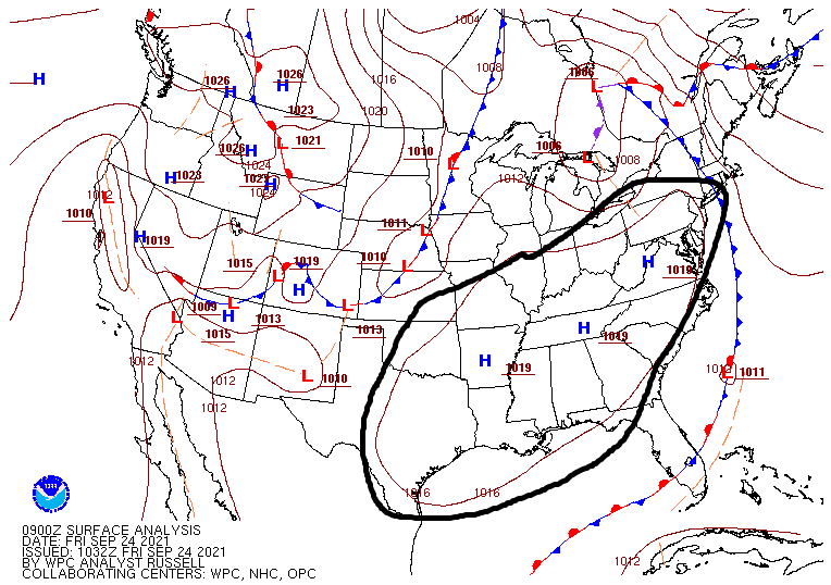
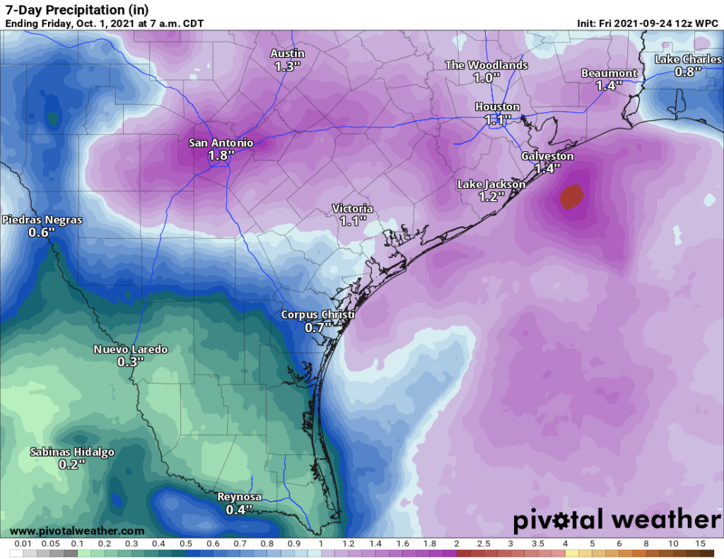
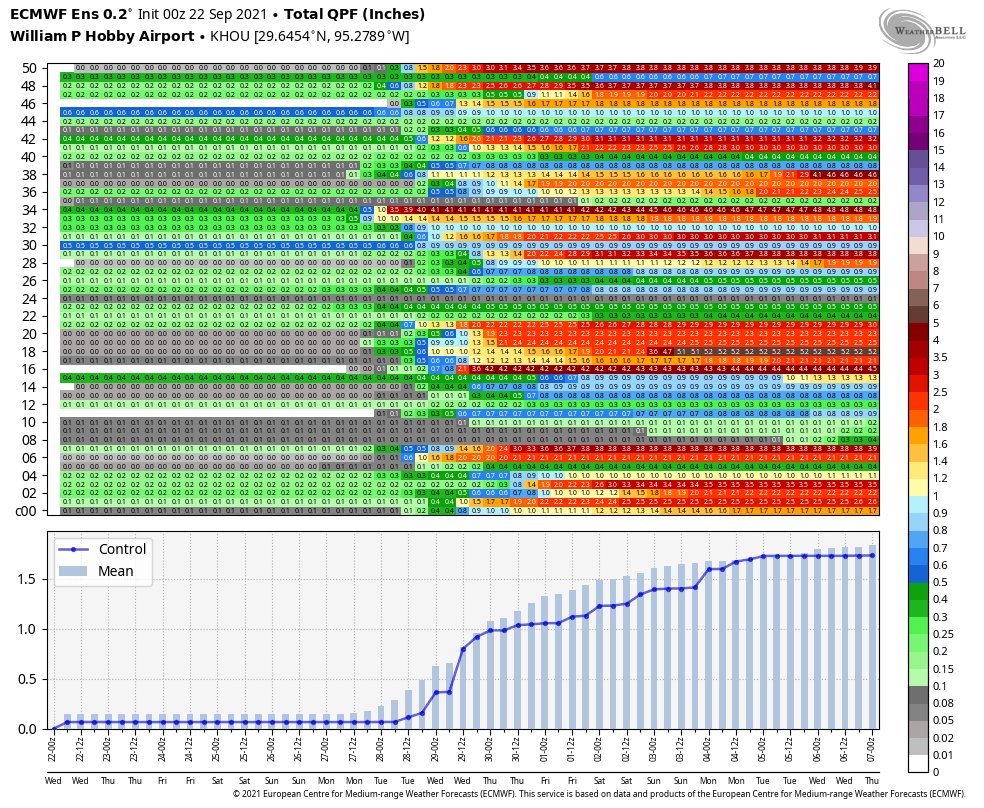
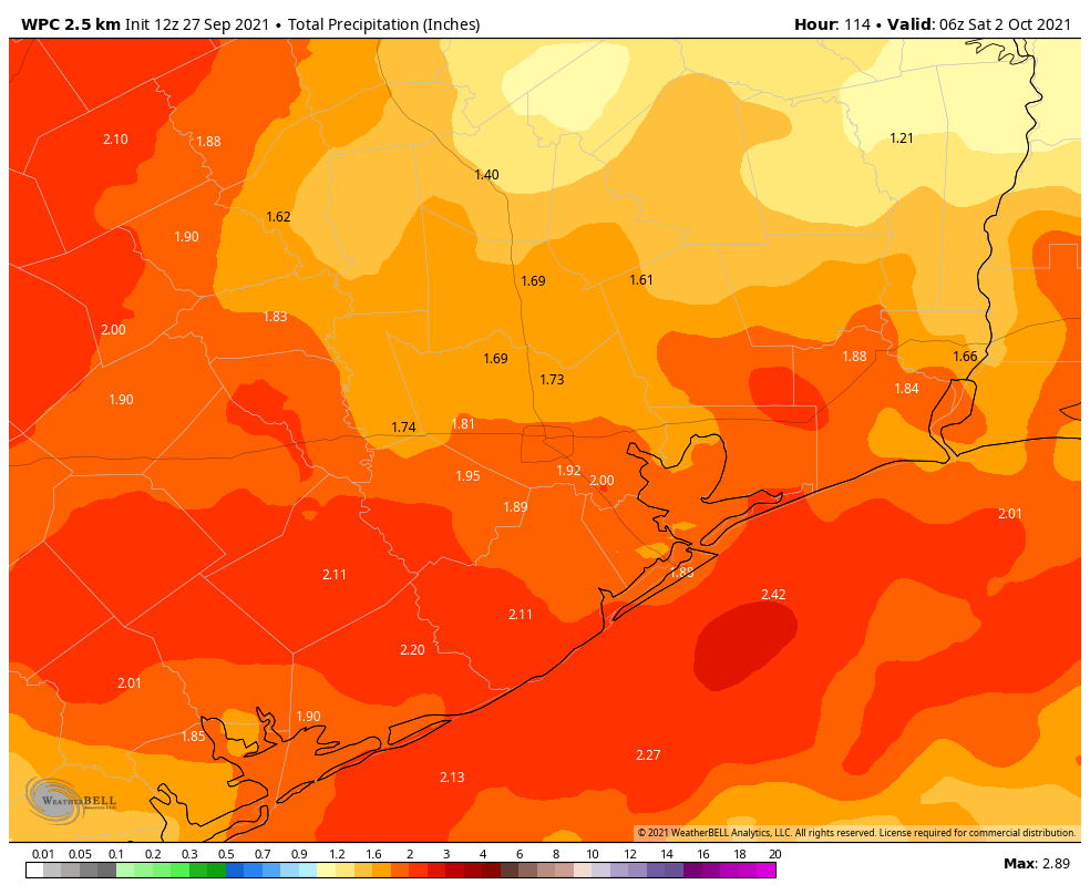
After five sunny and splendid days, Houston’s weather will turn warmer and muggier in the days ahead, with increasing rain chances by Tuesday running through the end of the week. Much of the area should see 1 to 3 inches of rainfall this week, which is fine as it has now been nearly two weeks since Hurricane Nicholas made landfall.
Monday
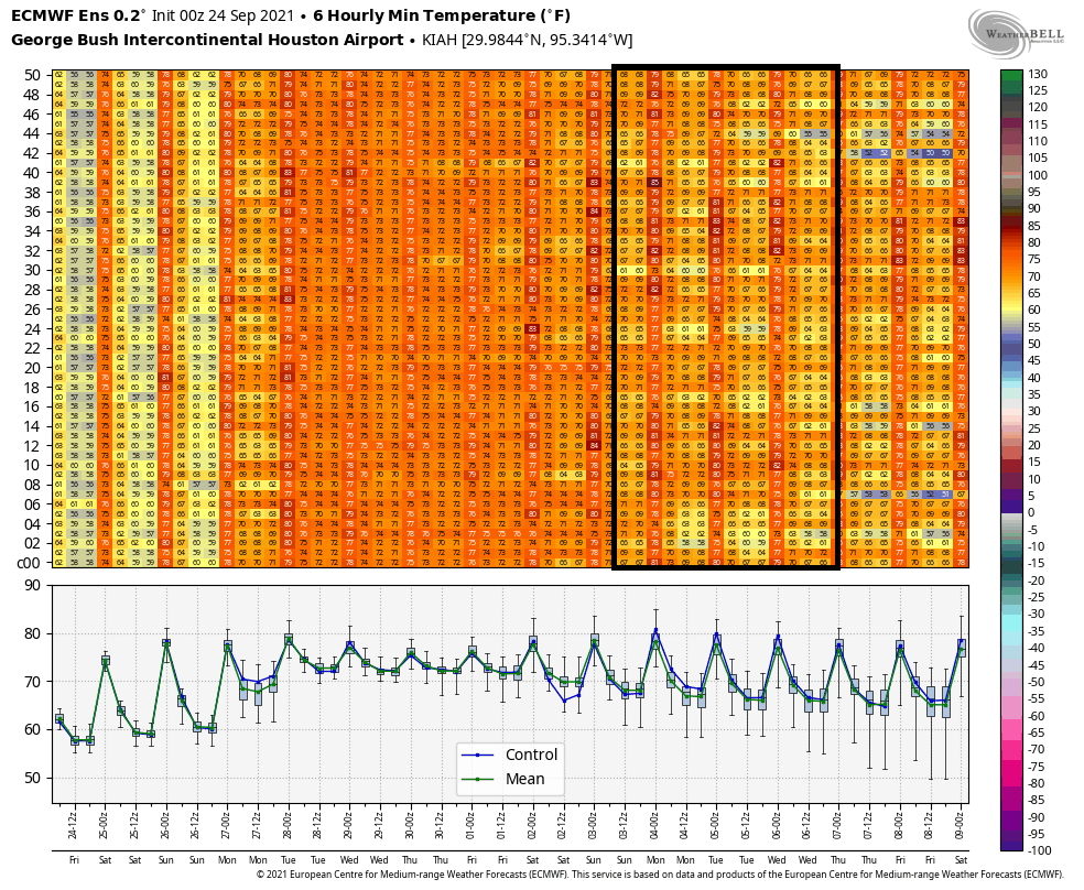
Today will be somewhat of a transition day after high pressure has departed the region. Yes, atmospheric moisture is returning, but levels should not be high enough to generate much in the way of shower activity. Area-wide, rain chances will be only about 10 percent. There should be enough afternoon sunshine to allow temperatures to approach 90 degrees for much of the region, and lows will only drop into the mid-70s.
Tuesday
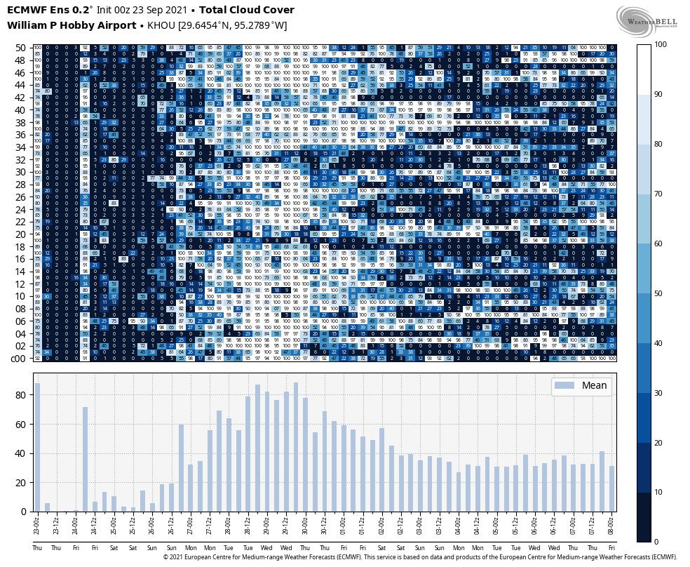
Conditions turn more favorable for showers on Tuesday, with rain chances increasing to about 40 percent. Additional cloud cover should shave a degree or two off peak temperatures during the afternoon. Storms will be scattered, and should move fairly quickly from south to north.
Wednesday and Thursday
Rain chances will peak on these days, as an energetic atmospheric feature known as a “jet streak” moves overhead and helps air at the surface to rise. As a result, both of these days should be mostly cloudy, with on and off shower activity. Highs will be in the mid- to upper 80s. Rain will be possible during the overnight hours as well.
Friday
Models suggest rain chances will start to diminish on Friday, perhaps to around 50 percent, but this should still be a mostly cloudy day, with highs slotting somewhere in the mid-80s.
Saturday, Sunday, and beyond
The forecast for next weekend remains fairly fuzzy. It now seems unlikely that a front will make it through the area, but we may fall further under the influence of high pressure by Saturday or so, and this should bring sunnier weather back to the region. For now, I’d predict partly sunny skies this weekend, with highs in the upper 80s. But the forecast is written in pencil, rather than pen. The arrival of our next front now looks to be delayed until Tuesday or Wednesday of next week.
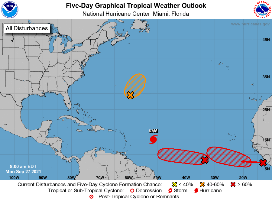
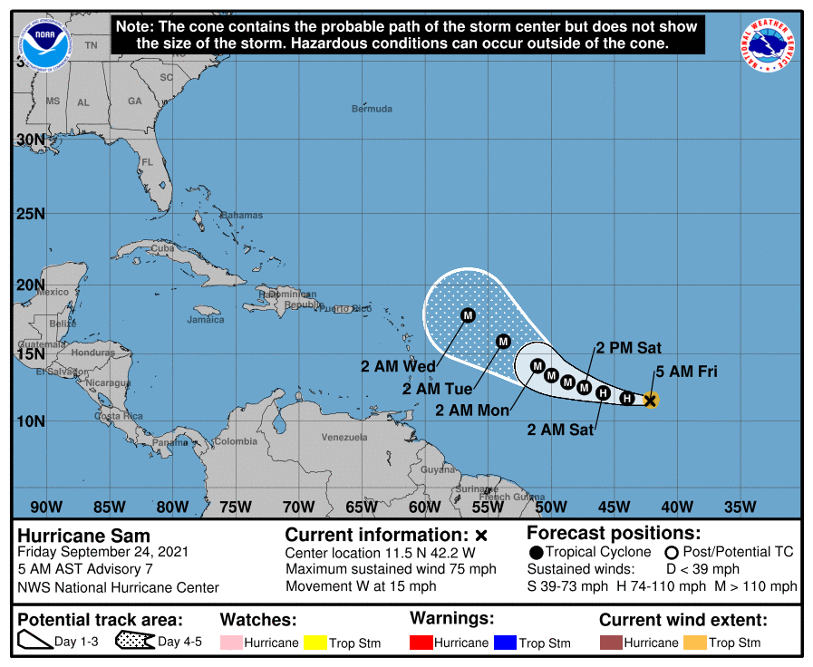
Tropics
The Atlantic tropics remain active, with major hurricane Sam and a couple of more areas likely to develop later this week. However, Sam will probably steer east of Bermuda and avoid any landmasses, and there is no reason to believe any of the other storms in the Atlantic will track far enough west to reach the Gulf of Mexico.