Apologies for the late (or early) post, but given the situation across the area tonight, I felt we needed to update.
We’ve got two main issues of concern: Tornadoes and flooding.
The tornado threat has flared up and down since this afternoon. None have looked especially menacing, but at a couple points we did observe tornadic debris signatures; once this afternoon just northeast of IAH Airport, the other with the late evening storms near the Beltway and I-10 west of Houston.
The tornado threat has lulled now, but just be aware that another storm or two could produce isolated, brief tornadoes. I believe that threat has peaked, but still have a way to get warnings if possible overnight.
A possible tornadic debris signature (TDS), indicating lofted debris from a tornado was noted on radar this evening (upper panel) just inside the Beltway north of I-10. (RadarScope)
As far as flooding goes, there is serious street flooding west of Houston, particularly from around Westpark & Highway 6 through I-10 and the Beltway northeast to near Greenspoint. Rainfall was at one point coming down at over 4 inches in an hour between Briarforest and Spring Branch. Please stay off the roads west of Houston, as that will take time to drain.
Rain totals have been widely variable, but 4-6″ has fallen west of Houston and also well northeast toward Liberty County since Saturday. (Harris County Flood Control)
The Spring Branch area may also see creeks and drainage out of banks for a time before it subsides.
From here, we should see support for storms begin to fade. The rain will become more sporadic and intermittent, easier for drainage to keep up with. Through about 3 AM, however is when things will be the most dicey. Look for deteriorating road conditions up north between Aldine and IAH into Kingwood as well, but the hope would be that rain rates would be less than what we observed in Spring Branch.
Most of this will be done by morning, and while there is a continued chance of showers or storms tomorrow, they should not be this significant or severe. We’ll update you later tomorrow morning. Hope you’re able to get some sleep tonight.
While we’ve been discussing periodic cold fronts, record warm Decembers, and everything else over the last month or so, we have been quietly amassing a rainfall deficit in the Houston area. Since November 1st, Houston has officially seen just under 6 inches of rainfall, about 5.96″ to be exact. Normally over that span we would have received roughly 8.5 inches of rain. The last 30 days in particular have been pretty rough all across Texas with a handful of localized exceptions.
Rainfall in the 30 previous days (as of Wednesday) was running about 50 percent of normal in Houston but worse over much of Texas. (High Plains Regional Climate Center)
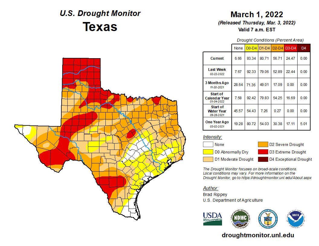
We’ve received about half our normal rainfall over the last month, and other parts of Texas are seeing it even worse. Yesterday’s Drought Monitor placed parts of the Houston region into drought for the first time in quite some time. That’s why this weekend may seem a little out of place with our recent stretch of weather, as there will be bonafide rain chances for most of the area. However, because of the scattered nature of the rain this weekend, many of you seeking some water will be left thirsty once more. There are more rain chances in the forecast after this weekend, however.
Today
There shall be no rain for today, however. Most areas should see sun to start today, but look for clouds to try and build in from the south this morning and afternoon. The chilly morning and some clouds will limit how warm we get today, with highs likely only in the mid or upper-50s.
Saturday
For those of you trying to make outdoor plans for this weekend, basically, you’re going to have live with at least the chance of showers and storms all weekend. It’s unlikely to rain more than a few hours at a time in any given location, but trying to time exactly where and when it rains will be somewhat difficult in this setup.
For Saturday, I would expect to see showers and storms develop around sunrise southwest of Houston, toward Matagorda Bay or out along US-59 toward Victoria and Wharton. Those storms would spread north and east through the morning and into the afternoon. Not everyone will see rain all day on Saturday, and there’s a chance some folks may not see much rain at all. But for those that do see rain, it could be heavy, as the amount of moisture in the atmosphere this weekend will be near record levels for early January.
Anywhere you see blue or green on the map above indicates above normal to much above normal amounts of moisture in the atmosphere. Localized heavy downpours will be possible Saturday into Sunday. (Pivotal Weather)
So, localized street flooding is a definite possibility for those that see more persistent showers on Saturday.
In addition to the rain, severe weather is a possibility. While we are not expecting a significant severe weather outbreak, the atmosphere will be capable of allowing storms to briefly rotate on Saturday, which could lead to a couple tornado warnings in the area.
There will be a marginal (1/5) risk of severe weather tomorrow, primarily due to a brief, lower-end tornado threat from a few storms. Widespread severe weather is not expected. (NOAA)
The Storm Prediction Center has us in a “marginal” risk for severe weather, or level 1 of 5 on Saturday. I don’t want you to worry too much about this, but just be aware of the chance and stay plugged in this weekend.
Outside of the rain, look for lots of clouds and skyrocketing humidity. It will feel quite warm and humid by Saturday afternoon, with highs well into the 70s and overnight lows barely budging just under 70 degrees.
There is a definite signal in the models that we could see showers and storms persist or even expand on Saturday night into early Sunday morning, so that’s something to be aware of as well.
Sunday
Modeling is all over the place on details for Sunday’s outlook but the story should be: A healthy chance of storms in the morning, followed by a cold front sometime Sunday afternoon or evening. Once again, heavy rain is possible in spots before this all slides to our east in the afternoon. In general, expect decreasing rain chances from about midday onward.
Expect a half-inch to an inch on average across the region, meaning some places will see more than that, while others could see a good bit less. The best odds of higher rain totals are along and south or east of US-59. (Pivotal Weather)
Once all is said and done, we should expect some places to see as much as 2 to 3 inches of rain or even a bit more, an average of about a half-inch to inch across the area, and, yes, certainly some folks that see less than that. It will be quite variable.
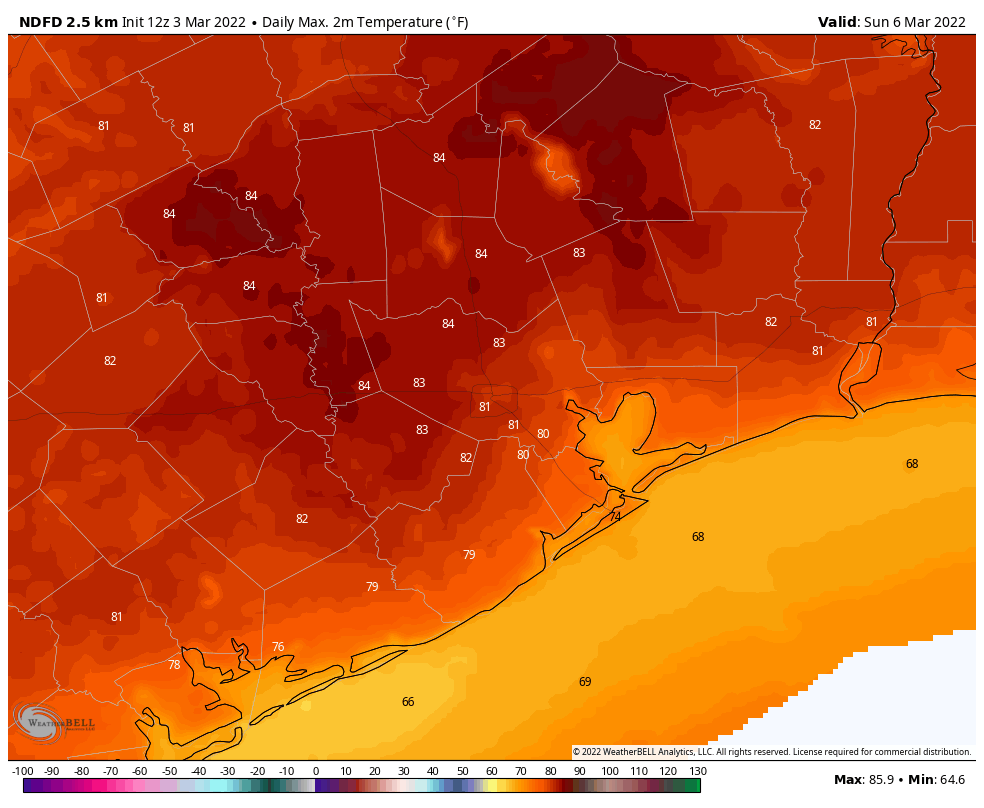
Sunday’s high temperatures could approach 80 degrees depending on how exactly things play out. This would be our first shot at 80 since way back on New Year’s Day.
Next week
Behind Sunday’s front, look for a return to more “Houston-winter” type weather. Morning lows on Monday should be in the 40s and low-50s, warm to near 60, and then drop into the 40s and 30s on Monday night. Expect another cool day Tuesday with highs only in the 50s and nighttime temperatures back into the 40s again. We will likely see another warming trend with more moisture back in the picture later next week. With that comes rain chances, but details are uncertain this far out.
As Eric has alluded to this week, I too am fairly optimistic that the next front should pass before next Sunday’s Houston Marathon. A lot can change between now and then, but if you’re looking for minimal humidity, you are setup nicely right now. I would anticipate race temperatures mostly in the 40s based on the current model scenarios, but again, it’s still a bit too soon to get too specific. Stay tuned!
One year ago, after a warm spell in early January, several readers asked if the 2020-2021 winter was effectively over for the Houston region. Our response at the time was, “It is decidedly not, but we are having quite mild conditions during what is normally the ‘dead’ of winter.” Of course, a little more than one month later, temperatures plunged as part of the Valentine’s deep freeze that prompted widespread, prolonged power outages, deaths, and significant home damage due to burst pipes.
A similar question might be asked this year, especially after record warmth in December, and a high temperature of 77 degrees on Wednesday. However, our answer remains the same. Houston can have pretty strong cold outbreaks through the middle of March, so “winter” will likely last for about two more months. With that said, the window for a terribly cold freeze, on par with what occurred last year, is closing. We probably have about six or seven weeks during which we really need to worry about seeing a really hard freeze. At present there are no indications of such happening.
Thursday
It will certainly feel like winter later today and tonight as a front moves through the region this morning. Drier air will move into the region from the northwest today, and winds will gust up to about 20 mph from the north-northwest. Although high temperatures will get into the 60s this afternoon beneath sunny skies, they’ll drop off pretty quickly this evening, and bottom out at about 40 degrees overnight in Houston. A few outlying areas may see a light freeze.
Friday will be mostly sunny, and after a chilly start temperatures will warm to about 60 degrees. As winds shift to come from the east and then southeast, our air mass will modify pretty quickly. As a result we should see clouds returning by Friday evening, and temperatures won’t drop much, if at all, during the overnight hours.
Saturday and Sunday
The weekend still looks wet, gray, and warm. The combination of moist air and a low pressure system will yield our first real rain chances since mid-December. The ingredients are there for showers and thunderstorms, and even some heavy rainfall. Right now, models are pegging area-wide accumulations at about 1 inch, but I could certainly see some areas picking up 2 to 3 inches from Saturday morning through Sunday. Rains will likely end by late Sunday morning, so there’s a chance of some sunshine later in the day. Both days look warm, with highs in the mid- to upper-70s. A front will arrive on Sunday afternoon, or evening, to drive the moist air away.
There is a marginal chance for severe weather in our region on Saturday and Saturday night. (NOAA)
Next week
Accordingly, most of next week should see highs somewhere in the 60s, with overnight lows in the 40s and 50s. Some rain chances return mid-week, and some kind of front should arrive by Friday or Saturday to cool us down for the weekend. Start line temperatures for the Houston marathon still look pretty cold, probably about 40 degrees, give or take.
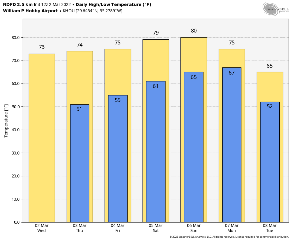
Up and down, up and down—so will go our temperatures over the next 10 days as Mother Nature vacillates on whether it should feel like winter or spring outside. This is good thing for those who believe variety is the spice of life. We’re also continuing to track the likelihood of rain this weekend, which would be the region’s first meaningful precipitation in about three weeks.
There will be more temperature swings this week before a prolonged cooler spell next week. (Weather Bell)
Wednesday
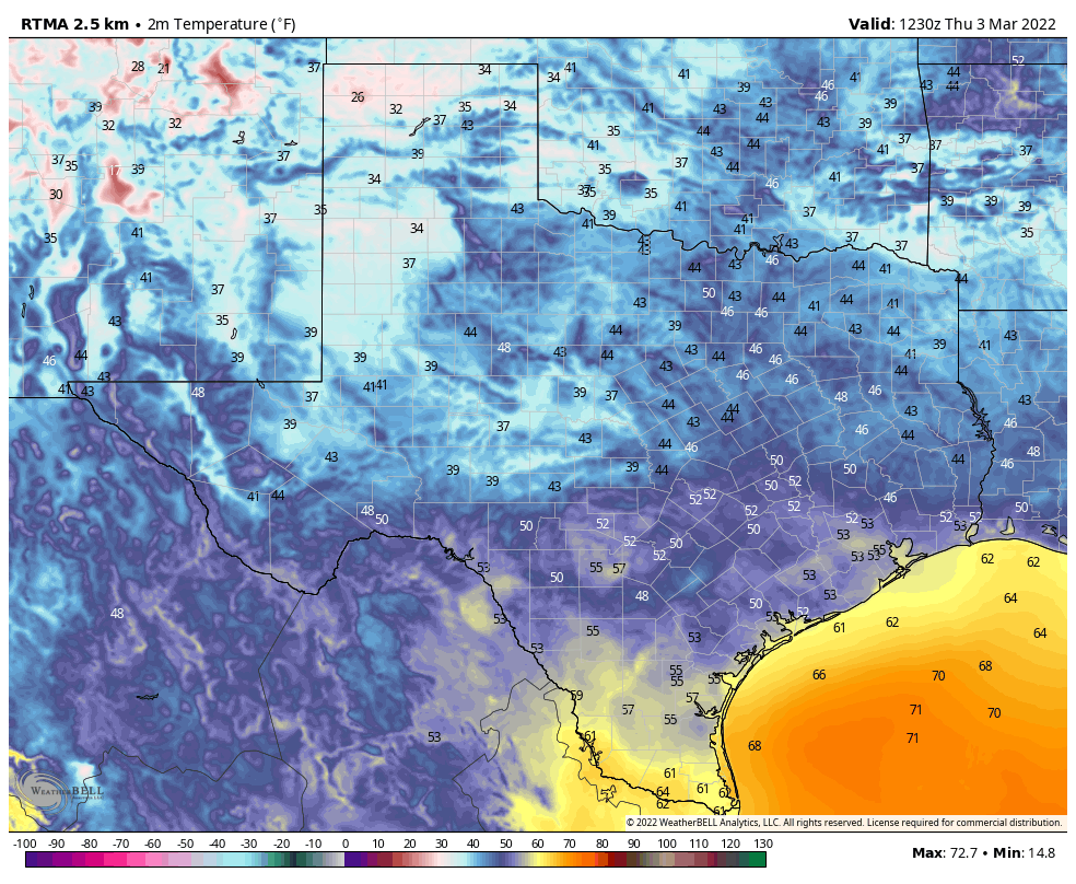
Temperatures are generally starting out in the 50s this morning, and with light winds a few areas of patchy fog have developed. This should not last, and skies will be mostly sunny later today, allowing for temperatures to warm nicely into the mid-70s. Winds will be modest, out of the south and southwest, at 5 to 10 mph. Temperatures tonight will start out moderate, but a cold front will arrive to cool things down. It looks like the front will reach the Interstate 69/Highway 59 corridor around midnight, and push down to the coast between 3 and 6 am. As a result, Houston will be generally in the 40s (inland) to low 50s (near the coast) when you wake up on Thursday. No rain is likely to accompany the front.
Thursday
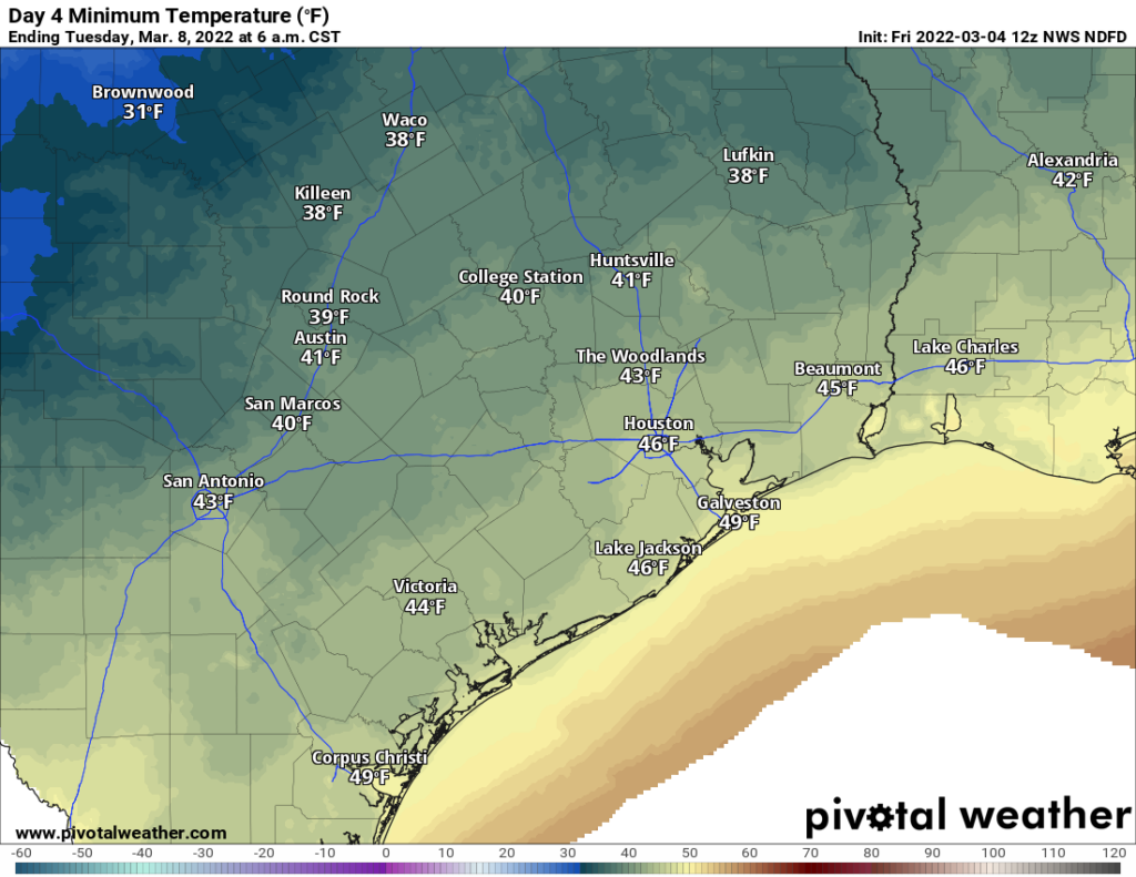
Conditions will be breezy on Thursday, as northerly air follows the frontal passage. Look for winds gusting up to about 20 mph to go along with sunny skies, and highs likely topping out in the upper 60s. As winds die down overnight, this will set the stage for cold temperatures. I think the urban core of Houston will remain at about 40 degrees, but outlying areas should fall into the 30s. A light freeze is possible for far inland areas, such as College Station.
Friday morning will be cold before temperatures quickly rebound this weekend. (Weather Bell)
Friday
This will be a sunny and cool day, with highs around 60 degrees. However as high pressure moves off and winds shift easterly, this will set the stage for warmer weather ahead. Lows Friday night will probably be about 15 degrees warmer than Thursday night.
Saturday and Sunday
Conditions will be quite warm and muggy this weekend, especially for early January. Look for highs in the mid-70s with partly to mostly cloudy skies and plenty of humidity. The onshore flow will also ramp up moisture levels, and this will lead to increased rain chances beginning as early as Saturday morning. This pattern will hold sway until about Sunday afternoon or evening, when the next front arrives. This front may bring additional rainfall with it, and all told I think most areas will average 1 inch or so this weekend, with less for some areas, and more for locations that see some briefly heavy rainfall. Rains will end with the front’s passage, and lows on Sunday night should drop into the upper 40s.
Next week
We’ll see fairly cold conditions next week, with highs in the 50s and 60s, and lows in the 40s and 50s. Another front arrives by the weekend, perhaps Saturday the 14th, to keep things on the cooler side. If you’re running the Houston marathon, my best guess remains chilly start line temperatures of about 40 degrees.