Cool, dry, and sunny weather expected in Houston for awhile

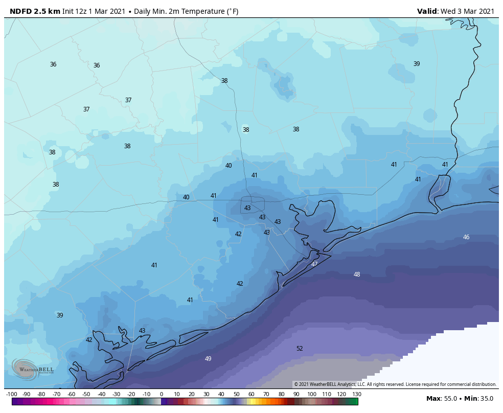
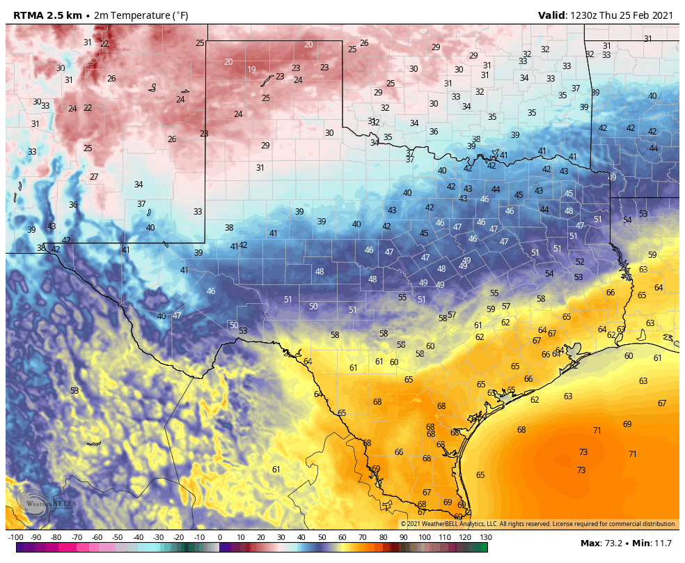
It’s quite cold across the region this morning, ranging from a few readings in the upper 30s in some parts of Montgomery County down to around 50 degrees right along the coast. It looks like Houston’s official station, at Bush Intercontinental Airport, probably will bottom out at about 42 degrees. This is chilly, but still 7 degrees warmer than the all-time record set in 2017. Incidentally, the earliest freeze ever recorded in Houston came on October 31, 1993.

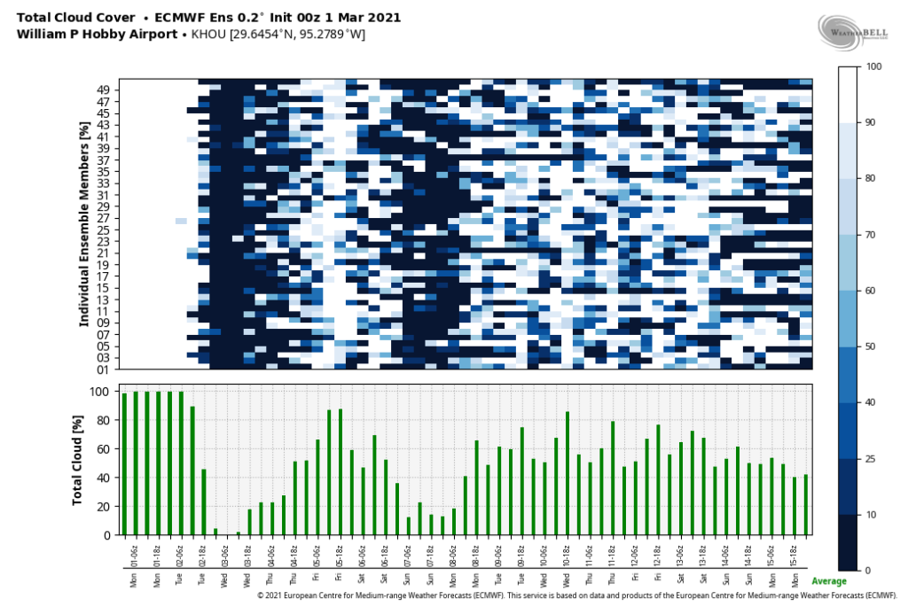
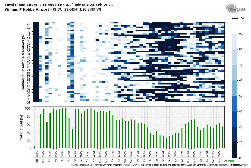
Our forecast ahead is pretty straightforward. We should see generally cooler than normal weather through the middle of next week, and our next real chance of rain is unlikely for quite some time. Enjoy fall, y’all!

It is a chilly, almost winter-like morning across the upper Texas coast on Thursday. (Weather Bell)

Thursday

Today will not be so nice. Although sunshine will predominate, strong northerly winds will keep things on the unpleasant side Thursday. Highs will recover into the low 60s for most of the area, but northwest winds should gust today as high as 25 mph. Winds will back off slightly this evening, but it will still be a cold, clear, breezy night with lows falling into the 40s again for most of the region.

Friday

A damn near perfect day. Highs in the low 70s. A light wind. Ample sunshine. Lows Friday night will probably be a couple of degrees warmer.

Saturday and Sunday

By late Friday we should see winds swing around to come from the east, and then southeast, but the region won’t warm up too appreciably. Under sunny skies, highs should climb into the mid-70s for most, possibly touching 80 degrees by Sunday for some locations near the coast. Lows will remain solidly in the 50s. A reinforcing shot of cooler and drier air arrives Sunday evening or during the overnight hours.

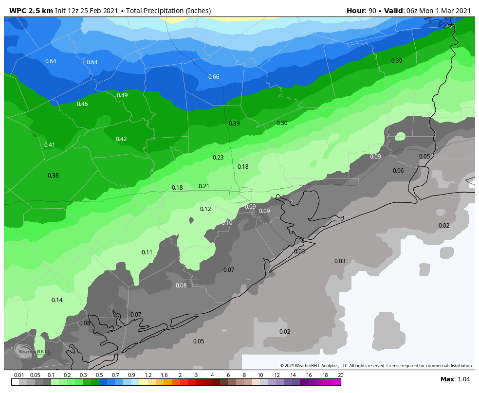
Here is the seven-day rainfall forecast for Texas from NOAA. It looks … dry. (Pivotal Weather)

Next week

Expect highs in the 70s and lows in the 50s through Wednesday. After that a warming trend is likely heading into the weekend, with highs rising to perhaps 80 degrees, and lows to around 60. As for rain chances, they’re going to remain low for awhile, at least until the end of the next work week.

Matt will have you covered tomorrow, when he’ll discuss all the records set by Hurricane Zeta as it strengthened Wednesday before making landfall in southeastern Louisiana—such a nasty, late season storm.

Cold front crosses Houston as Zeta strengthens, aims toward New Orleans

The cold front has finally pushed all the way into Houston and Galveston this morning, and it is going to be a cold day for the region. Yes, I said cold—as in temperatures this afternoon will likely remain in the 50s for much of the area. And the big change with this front is that it will have sticking power, as we anticipate cool, dry air hanging around into early next week. In today’s post we also discuss Hurricane Zeta, which is intensifying as it moves toward southeastern Louisiana and Mississippi.

Wednesday

The front has moved to the coast, but it still will require another shove to completely pass through. Essentially, as Hurricane Zeta moves into the Norther Gulf Coast today, and toward the northeast, this front will follow. In the meantime, we’re likely to see on-and-off light showers today, with northwest winds of 10 to 15 mph. Rains should end this afternoon, from west-to-east. As the front gets pulled away, we will see some clearing skies tonight, and lows should drop into the 40s for much of the area.

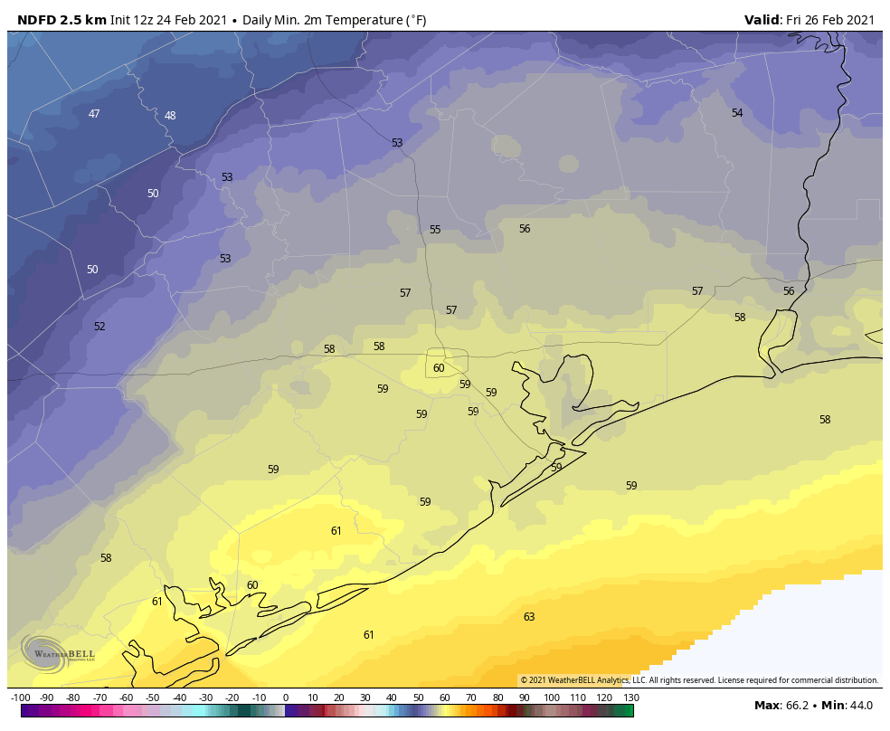
Here are the temperatures you’re going to wake up to on Thursday morning. (Pivotal Weather)

Thursday

Skies should be clear Thursday, but we’ll see fairly pronounced northwesterly winds as the front moves well clear of the area, perhaps gusting to 25 mph. Despite sunny skies high temperatures will probably crest in the mid-60s for most. It will be another cool, clear night with blowing winds.

Friday

Sunny, highs near 70. Damn near perfect.

Saturday and Sunday

This weekend will see fine weather too, with highs in the 70s, and lows in the 50s. A reinforcing front should reach the region by Sunday night or so, but with a dry atmosphere we don’t expect any rainfall.

Next week

The front should keep Monday and Tuesday of next week on the cool side, before we warm back up toward the 80s by Wednesday or Thursday. Rain chances likely won’t return until the end of next week, at the earliest.

Tropics

Zeta has strengthened into a hurricane overnight with 90-mph winds, and is moving rapidly toward the Mississippi River delta where it will likely make landfall this afternoon as a Category 2 hurricane. This will produce a greater than anticipated storm surge, particularly from the mouth of the Pearl River to Dauphin Island, Alabama.

Updated track forecast for Hurricane Zeta. (National Hurricane Center)

The storm is moving quickly enough that, although it will generate heavy rainfall, accumulations should generally be less than 5 inches for most areas as storms move through. The other big concern is wind, with hurricane-force wind gusts likely in New Orleans this afternoon.

Forecast for maximum wind GUSTS from Hurricane Zeta. (Weather Bell)

Conditions should rapidly improve in Louisiana and Mississippi after the storm passes, and this cold front follows through, with a sunny, placid weekend ahead for the northern Gulf of Mexico coast.

Front moves into Houston, and stops. Stronger push coming Wednesday

Houston’s weather this morning is something akin to the opening of Charles Dickens’ A Tale of Two Cities: It was the best of times, it was the worst of times. It was the coolest of times, it was the warmest of times. By this I mean that a cool front has sagged into the Houston region, and pretty much stalled right on top of our heads. To the west, it is cool and dry, to the east, much warmer and humid. Conditions will remain this way until the front bulls all the way through on Wednesday.

Tuesday

Temperatures are generally in the 50s this morning on the west side of town, in places such as Sugar Land and Katy. They are in the mid-60s in the central part of the city, and mid-70s along the coast and to the east. The line demarcating cooler and warmer air should waffle back and forth some today, and it’s impossible to predict precisely where with the front stalling overhead. So highs will vary from the 60s to 80s across Houston. Pretty remarkable. Skies should be mostly cloudy, with a few light showers possible.

That’s quite a temperature gradient as of 6:45am CT across Houston. (Weather Bell)

Wednesday

A reinforcing push of colder air arrives on Wednesday, probably during the middle of the day, and this will bring fall-like weather to the entire area. We should see some better rain chances during the day on Thursday as the front slogs through, primarily from shortly before sunrise into the late afternoon hours. I think most areas will see 0.25 to 1.5 inches of rain, and I don’t have high confidence in pinning down where. Temperatures will drop to around 50 degrees Wednesday night in the wake of the front—cooler inland, and warmer along the coast.

Thursday

This should be a breezy day due to a strong pressure gradient in the wake of the front, with gusts possibly as high as 30 mph. Please take note of this if you have outdoor activities planned. Skies will otherwise be clearing out, and highs likely will only get into the upper 60s in most locations as colder air moves in. Winds should back off some toward evening.

Friday, Saturday, and Sunday

This weekend’s weather looks splendid, with sunny skies, highs in the upper 60s to low 70s, and overnight lows in the 50s. For those wondering about Halloween rainfall, there will be none this year. Enjoy!

This is what Thursday, Friday, and Saturday mornings will feel like. (Pivotal Weather)

Next week

The models are suggesting another front may arrive by around Monday to keep the cooler, drier pattern going. However, overall confidence in this is not yet high.

Tropics

Tropical Storm Zeta crossed the Yucatan Peninsula during the overnight hours and is now emerging into the Gulf of Mexico as a strong tropical storm, with 70 mph winds. Confidence in a track toward the northern Gulf Coast is high, with the storm likely making landfall in southeastern Louisiana on Wednesday afternoon or evening. It should be a Category 1 hurricane at this time and its center may pass near, or directly over New Orleans.

European model forecast for wind GUSTS due to Zeta. (Weather Bell)

The storm will be moving quite rapidly to the northeast at this time, so while it won’t linger on Wednesday night, it could produce briefly very heavy rainfall and wind gusts above 90 mph over southeastern Louisiana. This is a nasty, late-season storm no one wants.

Zeta bound for Louisiana, Houston to see its first sustained stretch of fall

Good morning. There’s a lot to discuss this morning, including some uncertainty in the near-term forecast, a bonafide fall-like weekend ahead, and a strengthening Tropical Storm Zeta. So let’s jump right in.

Monday

Skies are generally partly cloudy across the region and will likely remain so during the daytime. High temperatures for most areas should reach around 80 degrees. The big question remains the timing and impact of a front moving in from the northwest. It should reach areas west and north of Houston by roughly around sunset, plus or minus an hour or two. Some scattered showers and gusty winds are possible, but we’re not anticipating any strong storms with this front. The front should keep on moving, but it’s difficult to say how far it will get—the Interstate 69 corridor? All the way to the coast? The bottom line is that if you live in the western half of Houston, you’re waking up to cooler, drier air on Tuesday morning. If you’re southeast of I-69? We’re making no promises.

HRRR model forecast for front’s position (by wind direction) at 10pm CT Monday. (Weather Bell)

Tuesday

High temperatures on Tuesday will likely fall somewhere in the 70s for most people, with partly to mostly cloudy skies. Dewpoints will depend on how far east the front makes it. This frontal boundary should linger nearby, so we may see some additional, mostly light rain.

Wednesday

Conditions may be a bit warmer and muggier on Wednesday morning, but during the afternoon and evening hours we expect a stronger front to push through. Unlike several recent cool fronts, we expect this one will have sticking power, bringing cooler weather and lower dewpoints into the region through much of the weekend. I have some hope that most areas will also see some precipitation with this front, and as a guess I’ll go with 0.25 to 1.0 inch of rain through Wednesday night. The front should drop Wednesday night’s temperatures into the 50s.

Thursday through Sunday

We still have some questions about the strength of the front, but generally I think we’ll see highs in the low- to mid-70s through the weekend. As for low temperatures, they’re likely to vary from 40s for areas well inland (i.e. Conroe) to 50s for the city of Houston generally. This will be some of the coolest air of the season, and it will be sustained for several days. We also should see mostly sunny skies through the weekend. Cannot wait!

Forecast low temperatures for Thursday morning. (Pivotal Weather)

Next week

A gradual warm-up should begin by Monday or so, but temperatures should remain mild.

Tropical Storm Zeta

As anticipated, Tropical Storm Zeta formed this weekend, and after meandering around the Caribbean Sea it has begun a motion to the northwest. For much of the weekend, the track models were widely divergent in terms of where Zeta will go along the northern Gulf of Mexico coast. However, with better data, the models are now tightening in their solutions, showing a landfall somewhere along the central or southeastern Louisiana coast on Wednesday evening or Thursday morning. The track forecast from the National Hurricane Center captures this well:

Confidence is increasing in Zeta’s track. (National Hurricane Center)

Unfortunately, Zeta has found low shear in the northwestern Caribbean Sea during the last 24 hours, and has now strengthened to near hurricane status, with 70 mph winds. Tonight the storm will make landfall—likely as a Category 1 hurricane—in almost the same location struck by Hurricane Delta only three weeks ago. Then the storm will move into the Gulf of Mexico. Zeta is likely to remain a Category 1 hurricane over the southern Gulf of Mexico before reaching cooler seas and increasing shear in the northern Gulf. It likely will make landfall in Louisiana as a strong tropical storm, although some uncertainty remains—more misery the state does not need.