Houston will see a front bull through the area this afternoon and evening, and this could briefly bring strong showers and thunderstorms into the region. The front will move from west to east, clearing quickly. We’ll then see calm and cool weather until another front arrives Sunday. This second front will bring near freezing conditions to the metro area and a slight chance of snow north and west of the city.
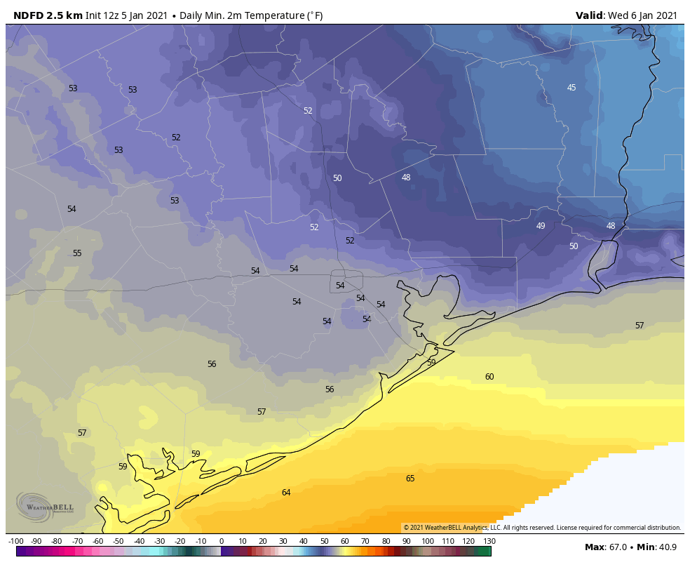
Wednesday
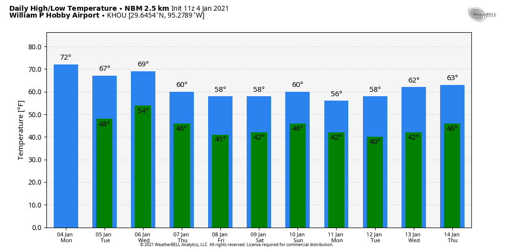
Lows across much of Houston have only fallen to around 60 degrees, with a southeasterly wind providing a moderating flow of air. Skies are cloudy, and will remain so throughout the day due to elevated moisture levels in the atmosphere. Highs will get into the low 70s for most. We may see some scattered showers during the daytime hours, but the big event—the front—will come later. In terms of timing, I expect it to reach a line from Katy to Conroe between 3 and 6 pm today, central Houston an hour later, and to be off the coast between 6 and 9 pm tonight. The main threats are brief, heavy rainfall, and strong wind gusts. There is a very slight chance of an isolated tornado. Total rainfall amounts will likely average 1 to 1.5 inches north of interstate 10, and 0.5 to 1 inch closer to the coast.
Thursday and Friday
Thursday morning will see gusty winds, perhaps as high as 30 mph, as colder and drier air moves into the region. However, winds should subside somewhat during the afternoon hours. Expect mostly sunny skies and temperatures in the mid- to upper-50s on Thursday and Friday, with lows dropping to around 40 degrees in the city—colder north, and warmer near the coast.
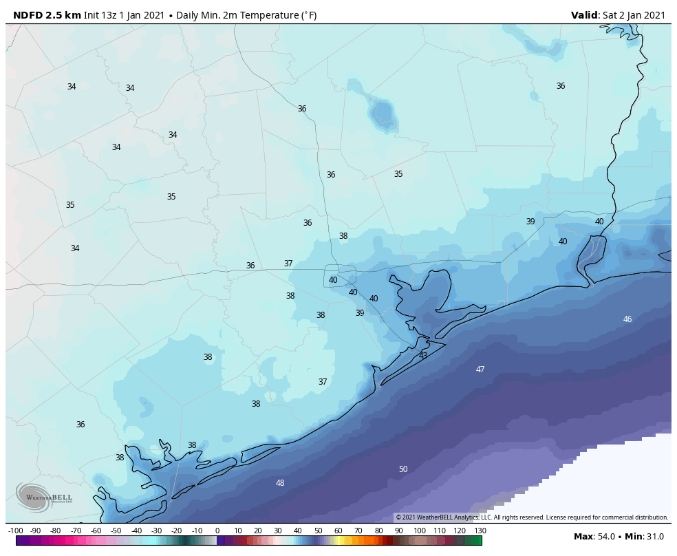
Saturday
This should be another winter-like day for Houston, with highs in the 50s and a chilly night down around 40, with mostly sunny skies.

Sunday and beyond
The forecast for our second front this week remains uncertain. However, at this point we can probably pencil in cold, gray, and wet conditions for the second half of the weekend. This front could bring an additional 0.5 to 1 inch of rain to the Houston area on Sunday, but that is not set in stone. Nor can we entirely rule out the possibility of snow or sleet. However, right now it appears the track of air cold enough to allow for wintry precipitation will pass just north of Houston. Bottom line, we’re going to have to watch and see how the forecast evolves.
Anyway, Sunday will be chilly, with highs perhaps in the 50s, depending on the timing of the front. After it passes, much of next week looks cold and sunny, with highs in the 50s, and lows in the 30s and 40s.