We certainly have not been in a true “drought” this summer, but at times, we’ve flirted with some extended dry periods. We seem to be in one of those now. Over the last 60 days, we have seen mixed results in the rainfall department in our area.
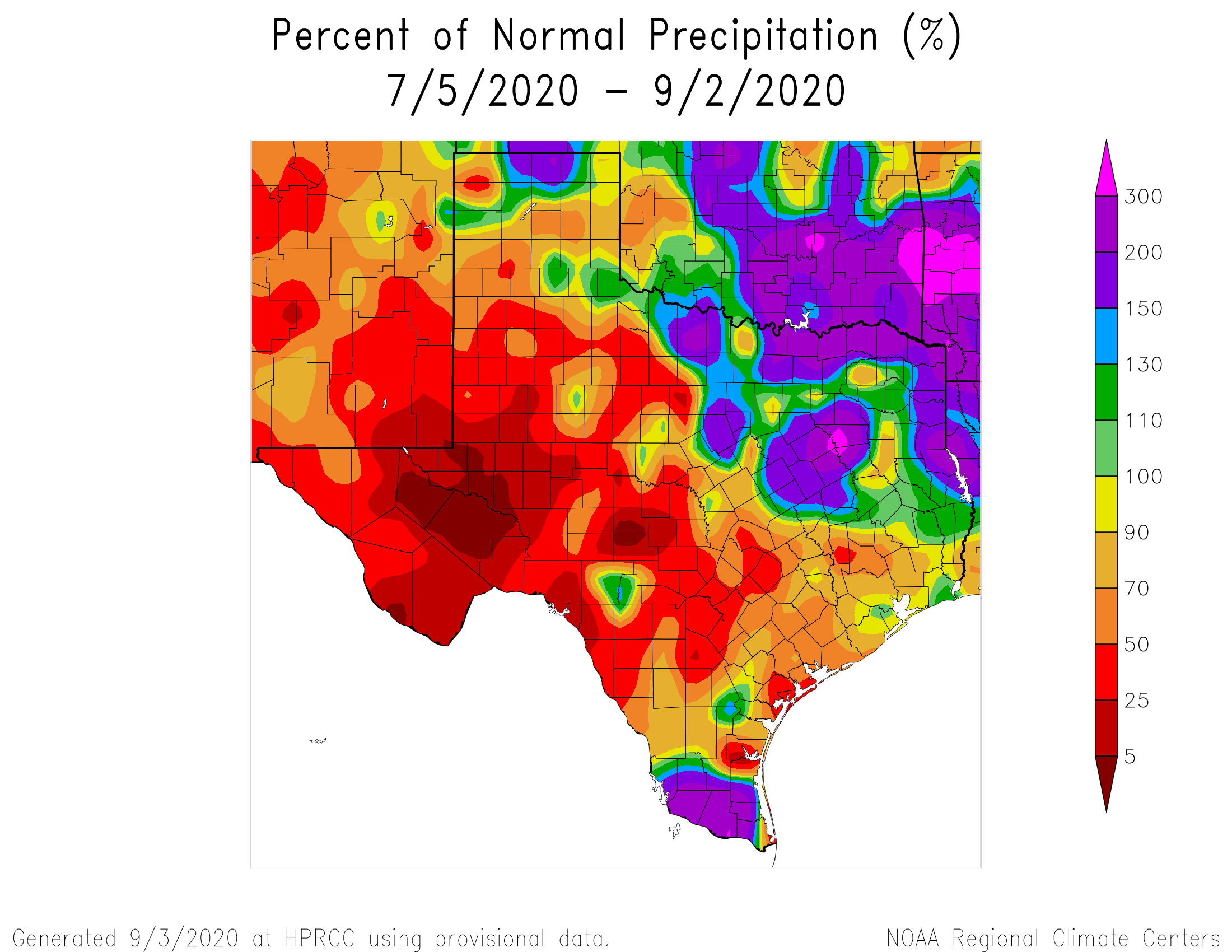
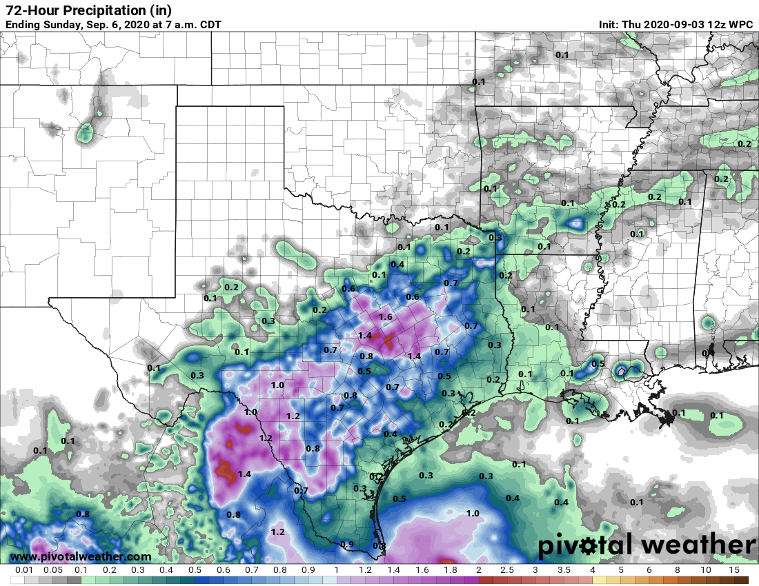
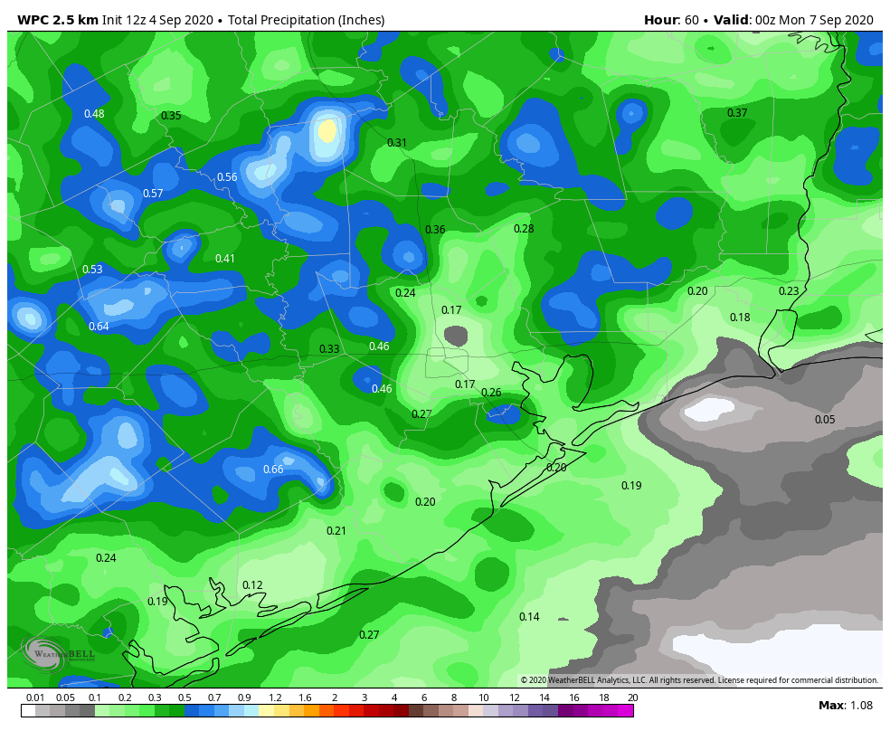
Parts of the Houston area, particularly down toward Hobby and Clear Lake have seen near average rainfall over the last two months. But, if you go up into western Montgomery County, some places have seen less the 50-percent of normal rainfall. Most of the Houston area is running drier than normal, and while parts of Texas have seen decent rainfall this week, most of Greater Houston has not. At least many of us will see a little rain in the next couple days, as we try to decipher the potential cold front riddle for next week.
Today
If you’re like me, perhaps you were woken up by thunder at 4:15 or so this morning. There have been a few storms focused mainly on the east and north sides of the city so far today. Places like Baytown, Pasadena, and Galena Park have seen around or above a half-inch of rain from those showers.
The rest of today will be characterized by scattered showers and storms. In trying to pinpoint any sort of rhyme or reason to how they’ll behave today, it would seem that they may try to focus in the Highway 59/I-69 corridor or just south this morning before slowly focusing more north and west as the day wears on.
Some of you won’t see any rain. Others could pick up an inch or two with some heavier downpours possible. Most of us will see slightly cooler weather today. Humidity will remain quite high, however, so don’t expect any sort of comfort in the Houston area. But, hey, at least Galveston finally dropped below 87 degrees this morning. Look for highs in the lower 90s and heat index values again jumping above 100 degrees, albeit somewhat less oppressive than earlier this week.
Weekend
Both weekend days will carry at least a chance of showers or a thunderstorm. As low pressure in the upper atmosphere gradually weakens and slips away, we’ll see a little less support for storms than perhaps we see today. Look for scattered showers both days, but with gradually less coverage. Many areas may not see much rain at all this weekend. Right now, places away from the coast look to have higher odds of rain, with a gradual shift south and west on Sunday.
Total rainfall when all is said and done will likely average around a quarter to half-inch of rain for most of the area. Again, some will see less, some a bit more. That’s just the nature of these types of setups. High temperatures will be in the low- to mid-90s this weekend, with our uncomfortably warm overnights continuing.