It feels like it has been eons, but the last time it rained in the Houston area with any meaning was back on July 7th, or only about 10 days ago. Today will be our best chance since then at seeing some showers. Fortunately, we don’t foresee rain chances truly dropping to zero again anytime soon, but they will wax and wane as some features shuffle around the Gulf Coast. Let’s take a look.
Today
We have a weak disturbance coming at us today from Louisiana, and that will provide the impetus for scattered showers and thunderstorms, especially south and east of Houston. Radar is already lighting up this morning off the coast.
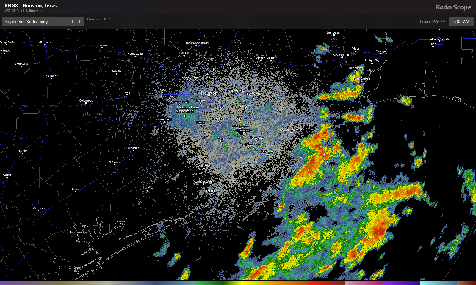
Look for these offshore showers and storms to move onshore through mid-morning. Numerous showers and storms are likely south and east of Houston this morning. They will gradually advance farther inland this afternoon, but we think they’ll probably stay primarily focused south of I-10. If we’re talking about inland rainfall chances today, Sugar Land or Wharton probably have a better chance at seeing some than The Woodlands or Hempstead. Whatever the case, some of the rain is bound to be locally heavy wherever it falls, and a few locations could easily see 2 or 3 inches, while others will see absolutely nothing today.
That disturbance shifts away from our area later today and tonight, leaving us just warm and humid for tonight. Depending on the coverage of clouds and storms today, we could see highs only top off in the low-90s briefly. Some coastal areas may not get much past the mid-80s. Houston again hit 100° yesterday, so it certainly may feel a little better today.
Weekend
It does not appear that we will have another disturbance this weekend like we have moving through today. This means we should probably expect fairly standard summer fare for southeast Texas. Look for highs in the mid-90s, lows in the upper 70s to near 80, and a standard 20-ish percent chance of a passing shower or storm with each day’s sea breeze off the Gulf. In general, you’ll be lucky if you see rain this weekend, but there will be showers around on both days.
Monday and Tuesday
It would seem another weak disturbance may pass through on Monday, coinciding with an increase in Gulf moisture, which could bump our rain chances up a notch or two relative to the weekend. We’ve thrown precipitable water (how much moisture is available in the atmosphere) on the map below, and you can see that by late Sunday and especially Monday, we see an influx of Gulf moisture, with PWATs over 2 inches again.
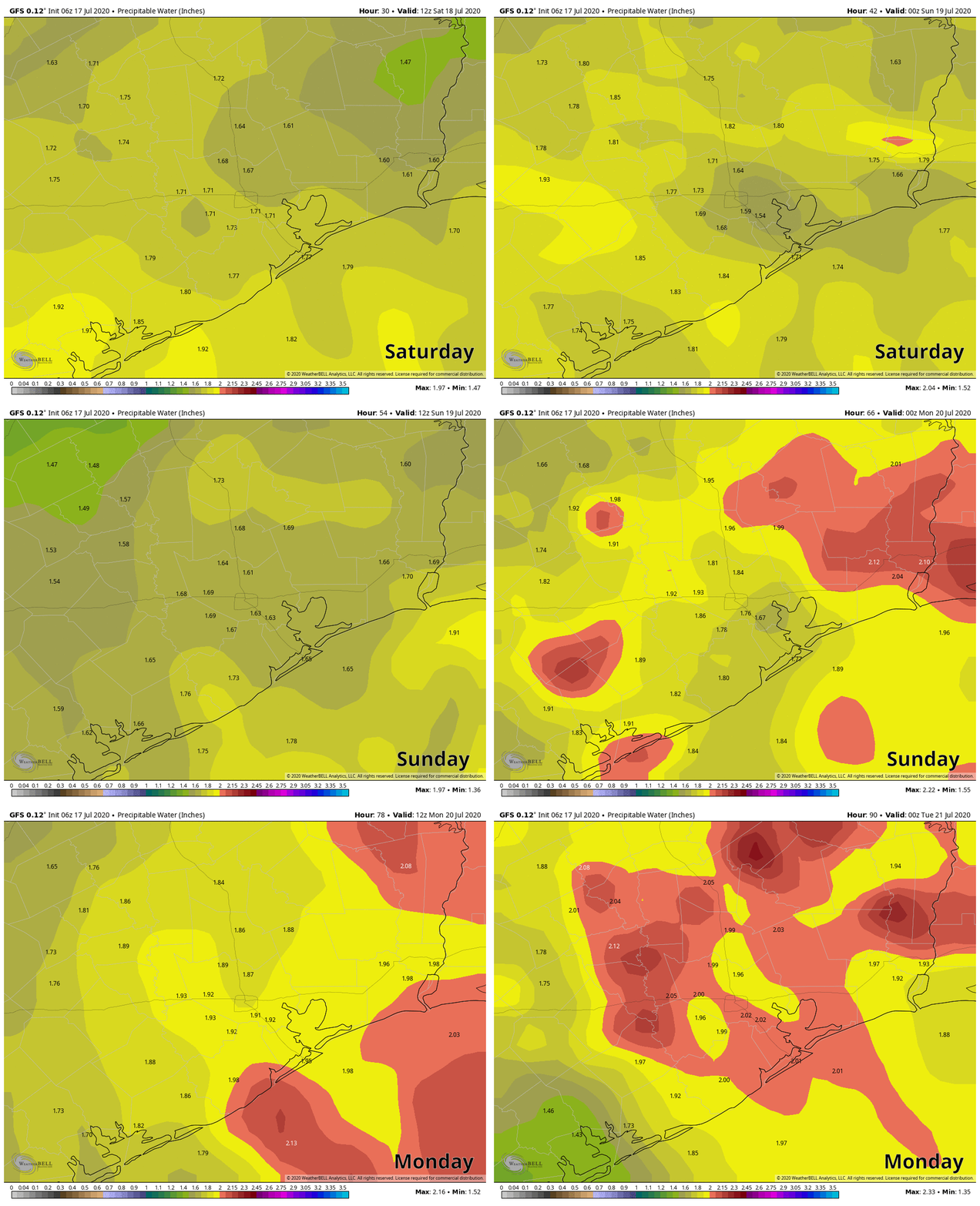
It still doesn’t appear that everyone will see a dousing here, but coverage of rain will be noticeably greater on Monday than it will be Saturday or Sunday. Tuesday should similarly see scattered showers or storms as well. Daytime highs will come off a couple degrees, so mainly lower 90s, maybe a few upper-80s in spots, with lows generally in the 70s, except perhaps at the coast.
Rest of next week
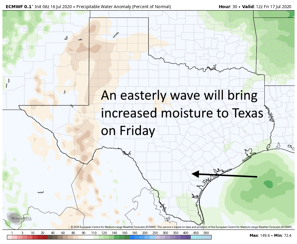
We will probably see a continued pattern of typical summer: Hot, humid, sunny for the most part, and days with one or two showers punctuated by a day or two of higher rain chances as some easterly waves move in off the Gulf. Friday may be one of the more active days as it stands right now. Settle in for a more standard Houston summer.

