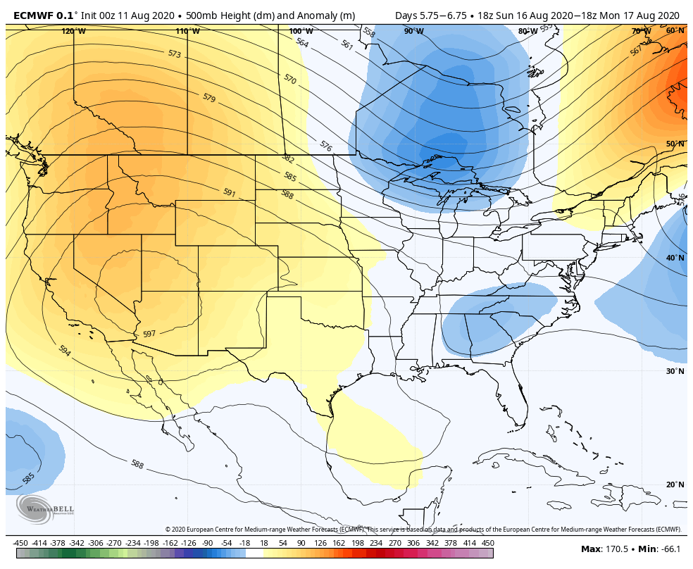
Good morning. Temperatures will be hot enough today that the National Weather Service has issued a heat advisory for now through 7pm CT. This means the hot temperatures and humidity will combine to create a heat index of up to 110 degrees later today. We can probably expect more of the same for the remainder of the week as high pressure influences the region’s weather through the weekend. Some relief should come next week.
Wednesday
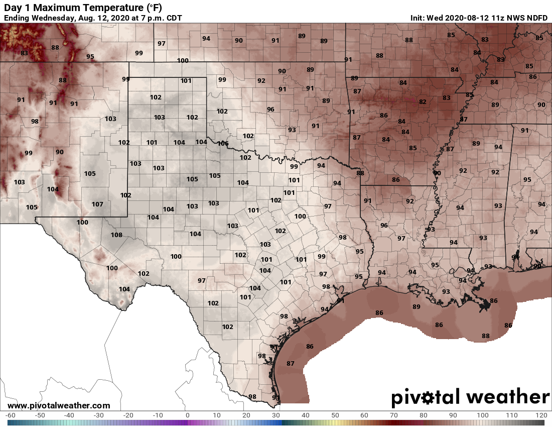
High temperatures today will likely reach near 100 degrees for inland areas, with lower-to-mid 90s along the coast. Expect mostly sunny skies, although there will be a slight chance of showers and thunderstorms later this afternoon. Winds will be light, at 5 to 10 mph out of the southwest. Our trend of warm nights will continue, with many areas south of Interstate 10 not falling below 80 degrees tonight.
Thursday and Friday
With conditions more or less the same for the remainder of the work week, I’d anticipate the National Weather Service extending heat advisories for both of these days.
Saturday and Sunday
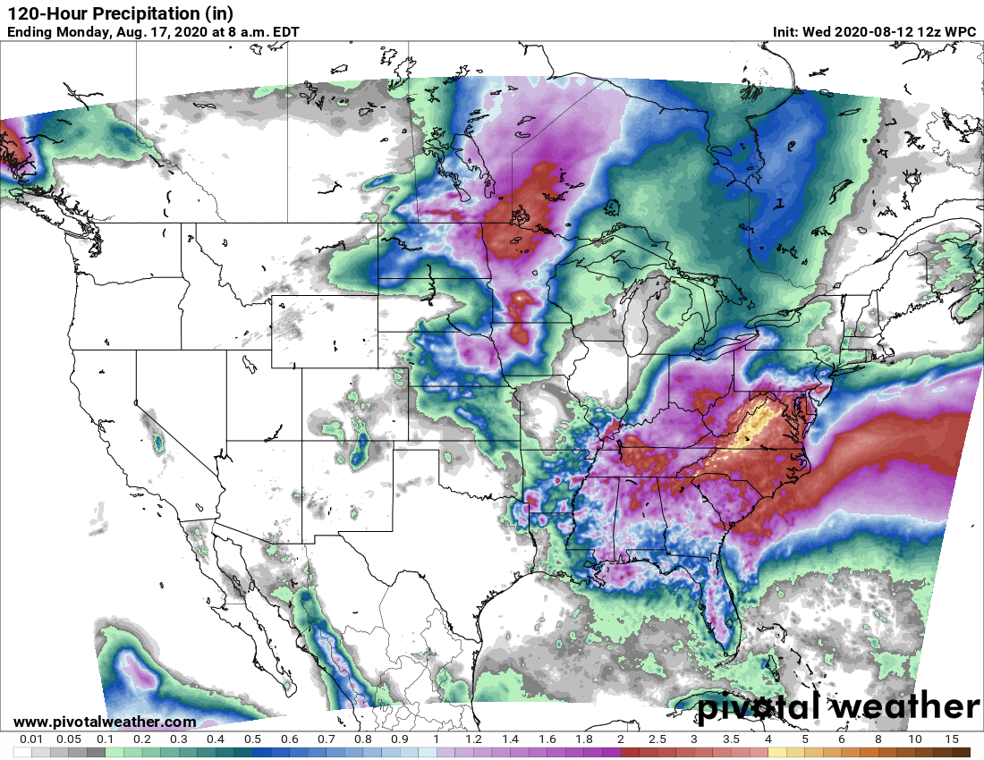
We don’t really anticipate much change this weekend, either, with only slight—roughly 20 percent—rain chances both days. Otherwise skies should be partly to mostly sunny, with highs in the upper 90s to possible 100 degrees for inland areas. Overnight lows will provide scant relief.
Next week
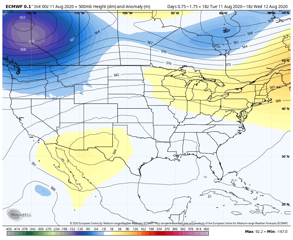
Things may get a little more interesting next week as high pressure backs off some. Rain chances may increase by Monday or so, perhaps into the 30 to 40 percent range. And I’m not ready to fully buy into this yet, but the models bring a front into Texas and push it toward Houston on Tuesday or Wednesday of next week. The jury is out on how far the front will push into Houston, and whether it will make it all the way to the coast. Typically this does not happen in August, but if it does we’ll see some pleasantly drier air. We’re not going to get crazy here, but instead of nighttime temperatures of around 80 degrees, they may drop into the lower 70s in the city. We’ll see.