Good evening. Today started out as a spotty day, before thunderstorms really revved up over the northern and western halves of the metro area, including some hail in The Woodlands and eventually a tornado warning for northwest Harris, Waller, and parts of southern Montgomery Counties. As I write this, those storms have reorganized and are making one final push south and east across the area. Carpenter’s Bayou at I-10 near Channelview has received over 1.5 inches of rain in the last 15 minutes. Scattered heavy rains will slowly slide south and east and dissipate over the next few hours.
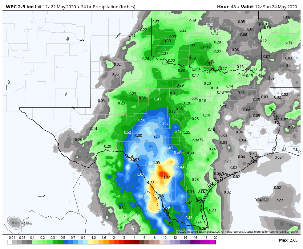
Rain totals today have been widely, widely variable.
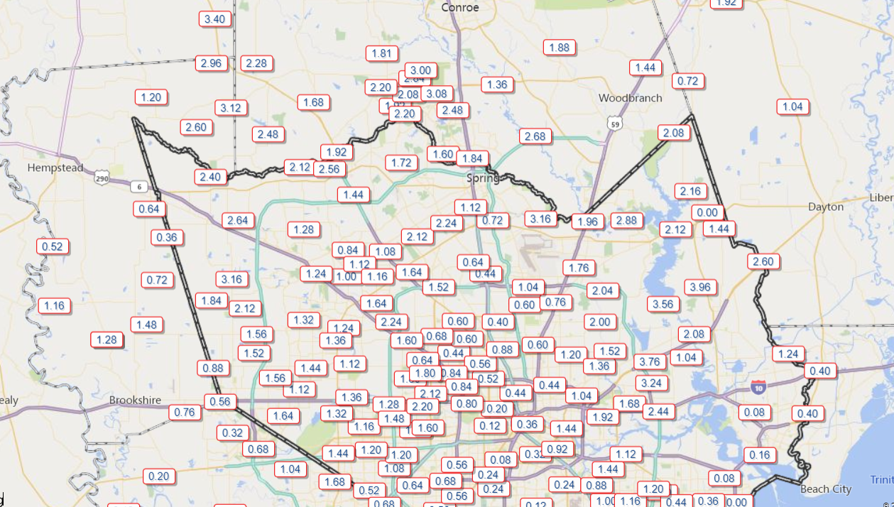
The map above is intentionally skewed to show the north side of the metro area, as there’s been far less rain to the south today. Rain totals on the east side will increase markedly in spots before the night’s up, as this map is only through 7:45 or so. You can view more rain totals and more time scales at Harris County’s outstanding rainfall page. Rain totals were paltry to non-existent southeast of Houston and toward most of Fort Bend County.
Overnight
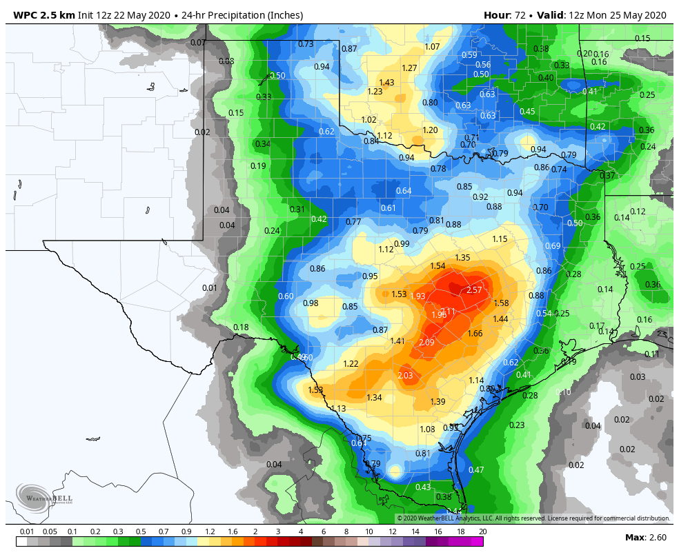
Looking at radar across Texas this evening, it’s pretty evident that we are not done tonight.
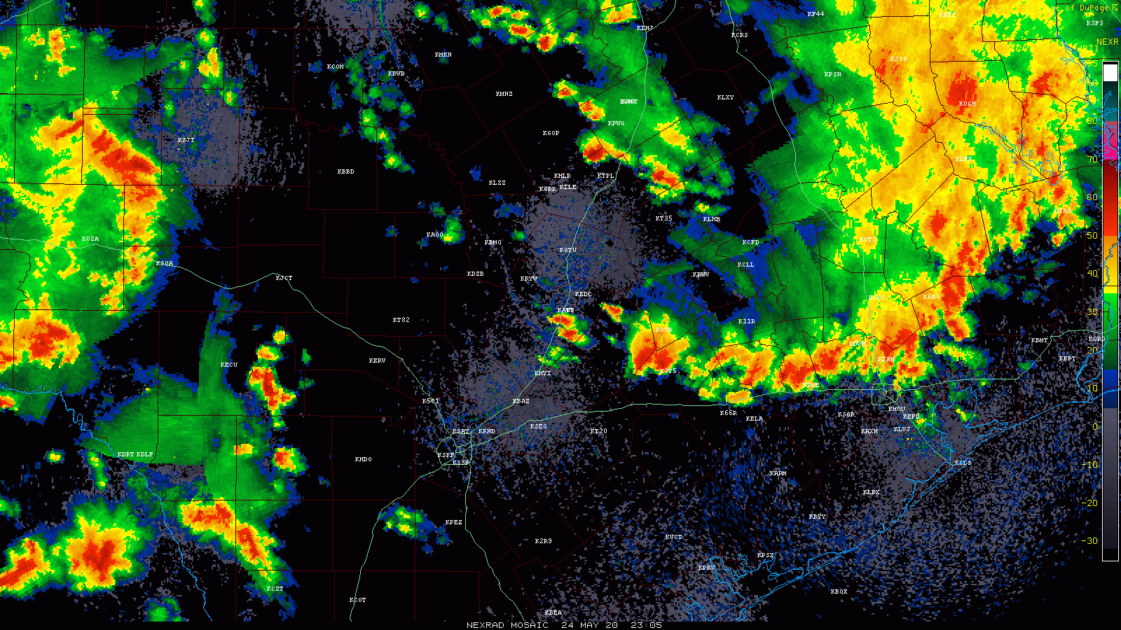
Storms are pooling west of I-35 this evening, which is something that had been well telegraphed on weather models the last couple days. Those will move through the area overnight.
So expect conditions to improve between now and midnight, though rain may continue at times. Weather models have been suggesting the next round of storms would arrive in Houston around 3 AM or so. I would not be shocked if that occurs a little sooner based on radar. When that happens, we’ll probably have some loud, wake your dogs up thunder, heavy rain, and potentially some strong gusty winds. The good news is that storms should be moving, so although some brief street flooding may occur, things should not last too terribly long. New rainfall should range from a half-inch to perhaps 2 inches over most of the area.
Memorial Day
Storms will exit after the morning, and we’ll probably be left with clouds and a few showers. The atmosphere will likely need time to recover, so the majority of Monday morning and early afternoon we think will be fine right now. In the late afternoon and evening, we may see conditions become more conducive for storms to redevelop. Exactly where and when? TBD. But those would probably be similar in nature to what we see occurring this evening: Slow movers, occasionally strong, and capable of putting down 2 inches in an hour, meaning a few unlucky spots may receive another few inches of rainfall with those. So yes, street flooding will again be possible under any storms.
Temperatures will be held down in the low- to maybe mid-80s.
Beyond Monday afternoon
With a low pressure system in the upper atmosphere placed just to our north and west for Monday night, Tuesday, and Wednesday, you can expect additional rounds of thunderstorms across the area, with varying degrees of intensity each time. We will likely need to watch for areas of flooding risk over more of the area through that period, details TBD. By Thursday, that upper low should begin to migrate toward Louisiana. That should mean improving weather heading into next weekend, but I don’t want to get your hopes too high just yet. We’ll keep you posted.