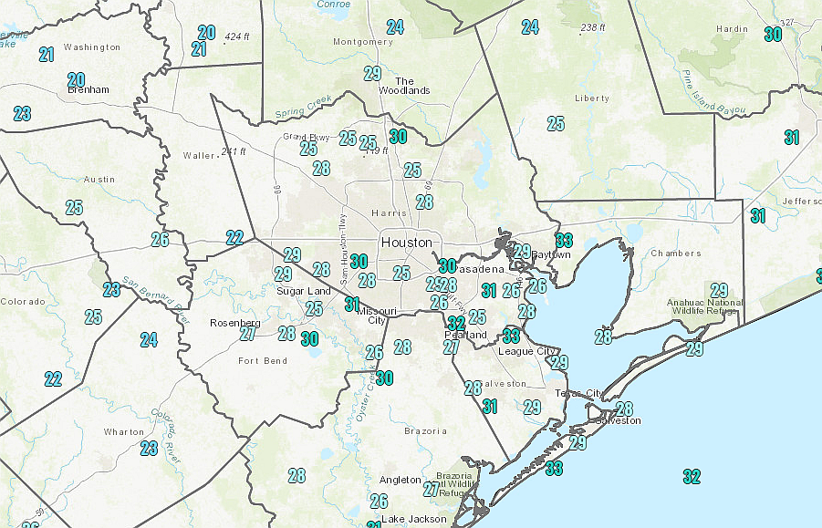
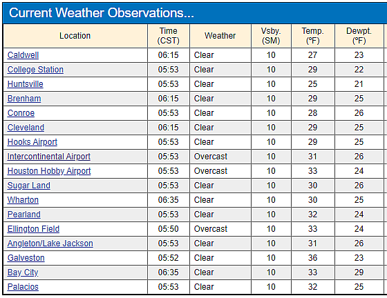
An Arctic front has brought a widespread freeze to Houston, with temperatures generally in the mid-20s to mid-30s this morning across the region. This will be the last of the freezing weather for us, for now, but we’re going to remain in what passes for “winter-like” conditions in Houston through Saturday. Next week looks to be warmer, on the whole.
Wednesday
As the next front approaches from the west, it will begin to push rain chances up later today. A relatively dry atmosphere should keep Houston mostly dry into this afternoon, but by this evening or the overnight hours we can probably expect to see the development of light showers across much of the region moving in from the southwest. Highs today will struggle to reach 50 degrees as clouds build across the area, with lows tonight falling to around 40.
Thursday
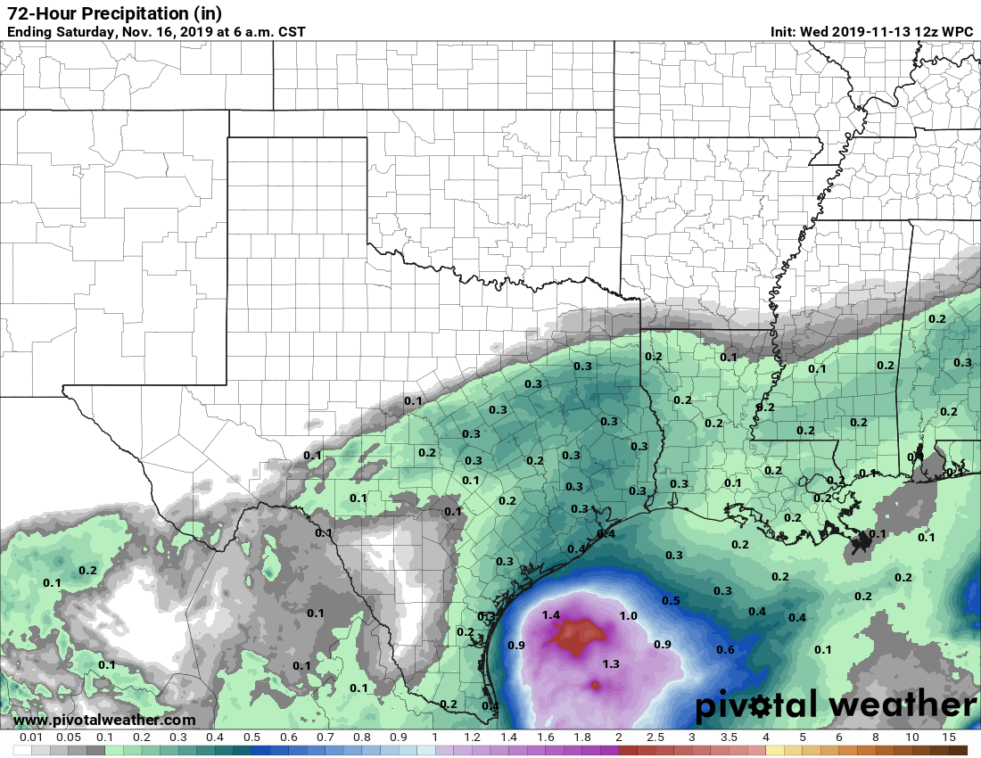
This will be a gloomy day, with cloudy skies, and on-and-off light to moderate rain showers. In terms of accumulation, most of the region will probably see on the order of 0.25 to 0.5 inches of rain from Wednesday evening through Thursday, so this is not something to be concerned about in terms of flooding. The absence of any sunshine should limit temperatures to the upper 40s for most. The rains should end some time Thursday evening for most as the front pushes through and dries out the atmosphere.