Note: We’re big fans of the Capital Weather Gang site in Washington D.C. So to mark the beginning of the World Series between the Astros and Nationals, we have agreed to publish their best attempt to trash talk Houston’s weather. In turn, Matt and I got to set the record straight on their site about catastrophe that is Washington’s bullpen, err, weather. Here, then, is why Houston’s weather allegedly sucks.
Houston: You have a weather problem. From hurricanes, to 500-year floods, and the relentless heat, I am not sure how you stand it. Washington’s weather is clearly superior.
We Washingtonians like to whine about our hellish heat and humidity, which occupies about two months of summer here, from roughly mid-June to mid-August. In your city, it starts to feel gross outside starting in April or May and doesn’t abate until around now.
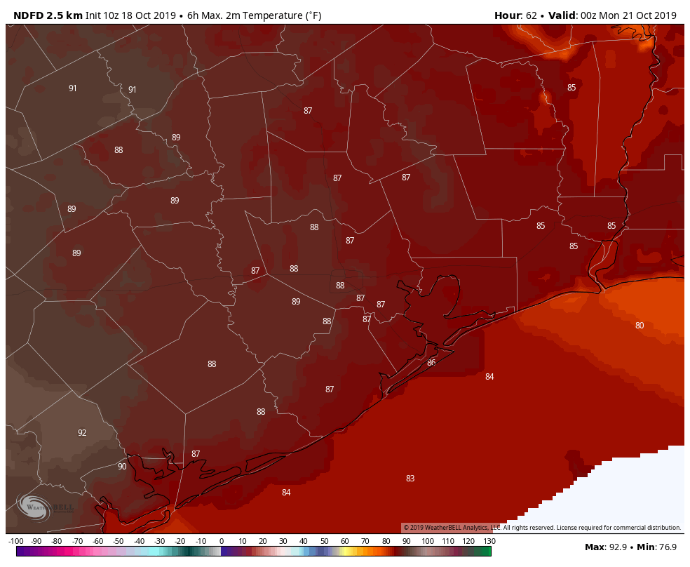
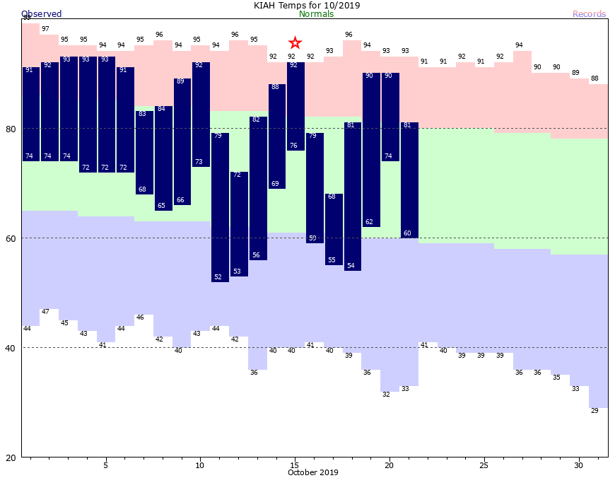
Let’s examine this year, for example. You’ve already posted 10 days with highs in the 90s and lows in the 70s in October. You’re running your air conditioners full blast when you should be outside in the crisp autumn air picking apples and pumpkins while watching the leaves change.
Seasons are something you know little about. You have six months of summer and six months of “meh.” Fortunately, you’re about to enter “meh” when you’ll finally be able to step outside again without sweating through your clothes.
As your average high temperatures fall through the 70s and 60s, you’ll be able to boast about some nice days between November and April. But, frankly, these days have little to offer. It will neither be warm enough to be out at the pool nor cold enough to enjoy winter activities like skiing and sledding, sadly foreign to you.
For anyone who likes snow, your city is a nightmare. It’s cute in a pathetic sort of way that a local news organization writes “Snow in Houston happens more than you think” when measurable snow has fallen at Houston Hobby airport just 10 times in the last 89 years, the most being 4.4 inches on Feb. 12, 1960.
Washington isn’t exactly a snow town, but it averages about as much of the white stuff in one winter as you’ve seen since 1930. (Yes, we are aware that 20 inches fell in your city in 1895 during a single storm and, props, that was impressive.)
Now let’s talk about rain. I need to be sensitive here because I feel for the folks who have been flooded repeatedly over the past few years. But the deluges you’ve dealt with are perhaps the most challenging and unsettling aspect of Houston’s climate.
You’re probably painfully aware that five exceptional rain events have inundated your region in the last five years, some of them, like Harvey and Imelda, considered 500-year rainstorms.
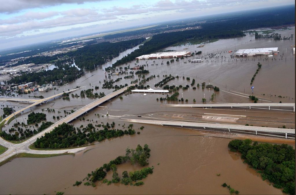
Likely fueled by climate change and exacerbated by land-use decisions, the situation is getting worse. Since 1970, your average yearly rainfall has climbed between four and eight inches.
It is true that Washington can be rather soggy, and 2018 was our wettest year on record. But the rain we see is but a sprinkle compared to the tropical torrents in your city. Unlike Houston, which can get hit by hurricanes head-on, the tropical storms affecting Washington are typically weaker since they first pass over tens of miles of land.
For having four real seasons and for our tamer breed of heat and rain storms, we’ve got you beat in the weather department, Houston. Trust that our winning ways will carry over to this week’s World Series.
Jason Samenow is The Washington Post’s weather editor.