We’re warmer for a bit, then a blustery front will reach Houston

Parts of the Houston region, particularly the western half of the area, are seeing dense fog this morning. Sunrise, and later increasing winds, should help break up the fog by mid-morning but until then please take caution on roadways.

Wednesday

Even after the fog clears skies should remain gray today, with winds picking up out of the southeast as the onshore flow gets a bit stronger. Expect highs in the low- to mid-60s, with not much of a temperature drop off tonight.

Thursday

These somewhat stronger winds during the overnight hours should help to limit the development of fog on Thursday morning, although it’s still possible given warmer air and moisture in the atmosphere. Highs Thursday should reach up to near 70 degrees before a front moves through, probably sometime during the early afternoon hours. It appears as though some line of showers and thunderstorms will accompany the front, but this system should move through fairly briskly on its way toward the Gulf of Mexico. I wouldn’t anticipate accumulations of more than a few tenths of an inch of rain.

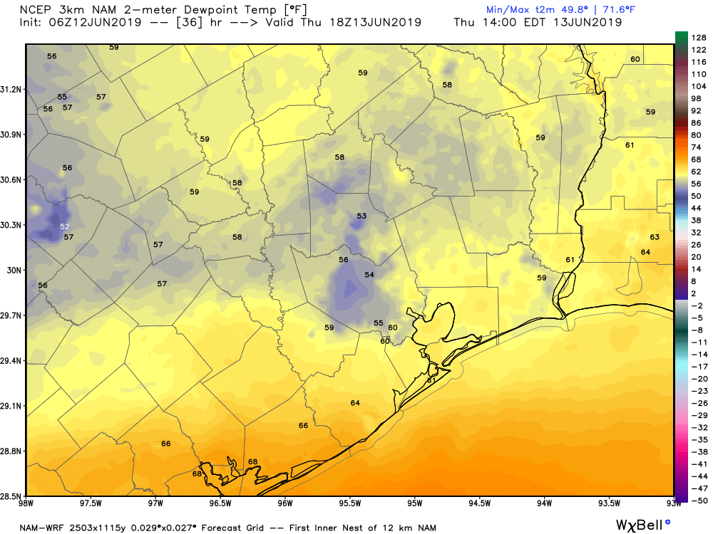
Wind gusts could be in the 30s for parts of Houston on Thursday evening and Friday morning due to the front’s passage. (Weather Bell)

Winds should really kick up behind the front, and the National Weather Service has issued a gale watch for waters off the coast with rough seas anticipated Thursday night into Friday morning.

See full post

Parts of Houston could return to the 20s this weekend

Officially, the mercury in Houston has yet to hit 70 degrees in 2018. In fact, we haven’t gotten that warm since Dec. 22. (This is, like, a real winter). Anyway, we have a chance to get close to 70 degrees this week before the region gets quite cold again this weekend.

Tuesday

Not much to say about today, as we’ll see partly sunny skies and high temperatures in the low 60s. Winds won’t be appreciable today and lows tonight will probably only fall to around 50 degrees. Should be very nice for January.

Wednesday

As the onshore flow returns Tuesday night, the region should see a partly to mostly cloudy day on Wednesday, with the potential for some fog during the morning hours. Highs should climb into the mid- to upper-60s, and we could hit 70 degrees if the Sun breaks through for long enough.

Thursday

We’ll start the day out warm before a cold front moves through the area during the daytime hours. I’m not expecting anything severe, but the front’s push through the area could be accompanied by some brief, heavy rain showers.

Rain accumulation forecast for Thursday. (NOAA)

Still, because the system should move steadily from northwest to southeast, I don’t expect accumulations above a few tenths of an inch of rain for most areas. Areas far inland on Thursday night could see a light freeze, but I expect most of the city to remain above freezing on Friday morning.

See full post

Normal winter weather this week in Houston, with a cold weekend ahead

The region’s latest cold front made a dramatic entrance on Sunday night, dropping anywhere from 0.25 to 1.5 inches of rain across the region as it pushed through. The rain was largely welcome, as Houston had yet to see much precipitation in 2018, and little is expected for much of the rest of this week. Instead, we can expect a steady diet of mostly clear, mostly cool winter-like weather. The weekend weather turns colder.

Harris County rainfall totals from Sunday night. (HCOEM)

Monday and Tuesday

High pressure should assert control over Houston’s weather, allowing skies to clear later this morning. Although high temperatures should rise into the low 60s, brisk, northerly winds will make it feel chilly outside. Winds should begin to subside later this evening, and overnight lows will dip into the mid-40s—near normal for this time of year. Tuesday should be a nice day, with less wind and similar temperatures (highs in the 60s, lows in the 40s) beneath mostly sunny skies.

See full post

One week to the Houston Marathon: Likely quite cold and dry

We are now just one week away from the Houston marathon. And as the event comes closer, the forecast continues to become clearer. At this time we can have relatively high confidence in a cold and probably dry day for the run, which we’ve been suggesting for some time would be most likely. But how cold?

Ensemble forecasting (looking at the various ensemble members of the global models) remains a better practice until about five days out, so it still makes sense to look at the range of possibilities rather than a specific, point forecast. And generally, the global models are in agreement that a cold front will move through the region next Friday, with some reinforcing colder air on Saturday at some point. Because the timing of this colder air remains uncertain, we still cannot have total confidence in the forecast. But I think it’s safe to say the temperature will fall within the following ranges:

Run start, 7am CT

European model forecast: 25 to 45 degrees

GFS model forecast: 27 to 42 degrees

Run finish, noon CT

European model forecast: 40 to 60 degrees

GFS model forecast: 40 to 55 degrees

GFS model forecast for highs and lows on Sunday. Green bar indicates most probably range. (Weather Bell)

As for precipitation, rain chances appear low if non-existent. Most likely we’ll have clear skies, which would lead to quite cold temperatures to start the day.